MyTopo
Classic USGS Kielberg Canyon Arizona 7.5'x7.5' Topo Map
Regular price
$16.95
Regular price
Sale price
$16.95
Unit price
per
Couldn't load pickup availability
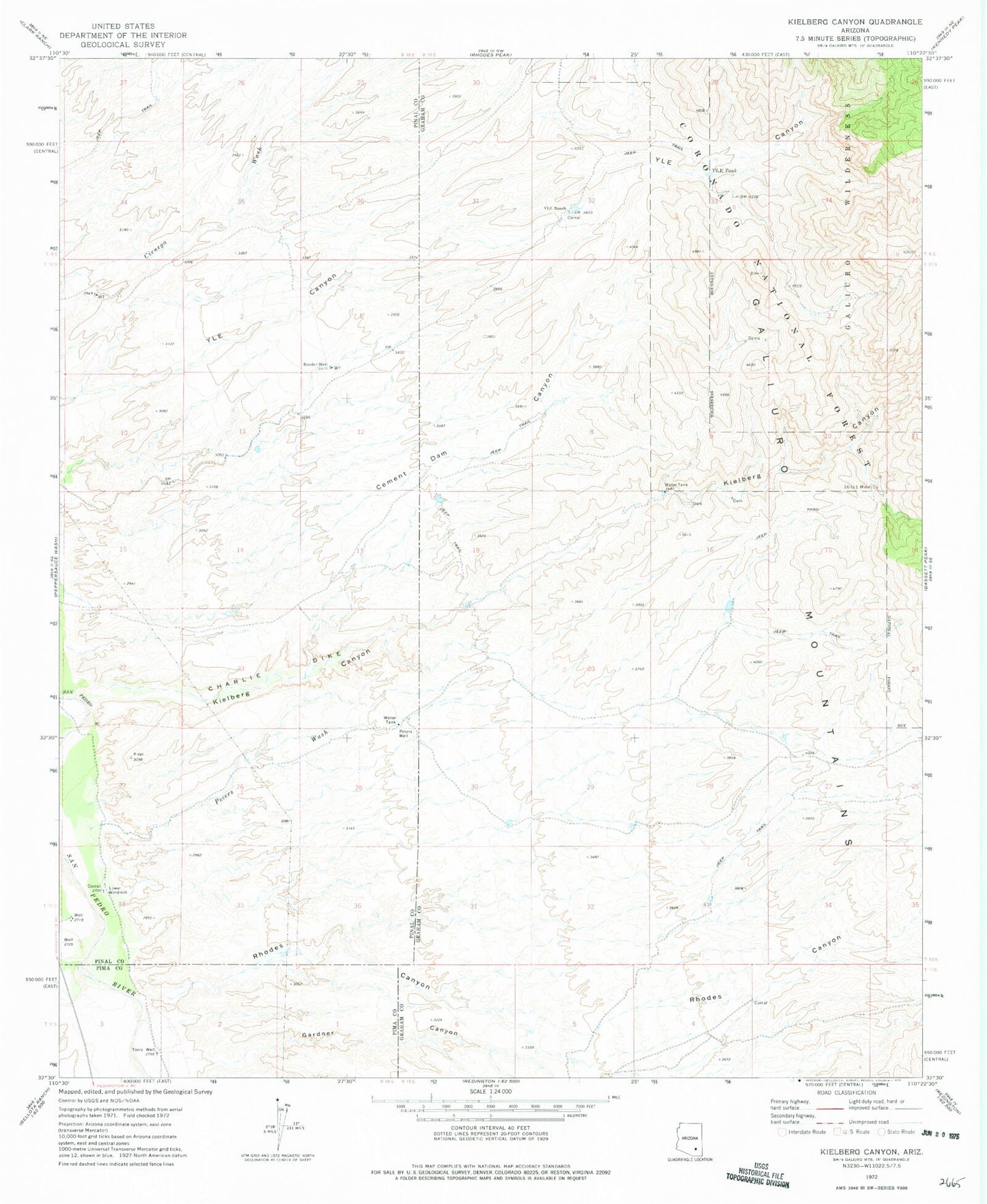
Historical USGS topographic quad map of Kielberg Canyon in the state of Arizona. Map scale may vary for some years, but is generally around 1:24,000. Print size is approximately 24" x 27"
This quadrangle is in the following counties: Graham, Pima, Pinal.
The map contains contour lines, roads, rivers, towns, and lakes. Printed on high-quality waterproof paper with UV fade-resistant inks, and shipped rolled.
Contains the following named places: Border Well, Cement Dam Canyon, Charlie Dike, Gardner Canyon, Kielberg Canyon, Lower Windmill, Peters Wash, Peters Well, Rhodes Canyon, Sixteen to One Mine, Torro Well, Y L E Ranch, YLE Tank