MyTopo
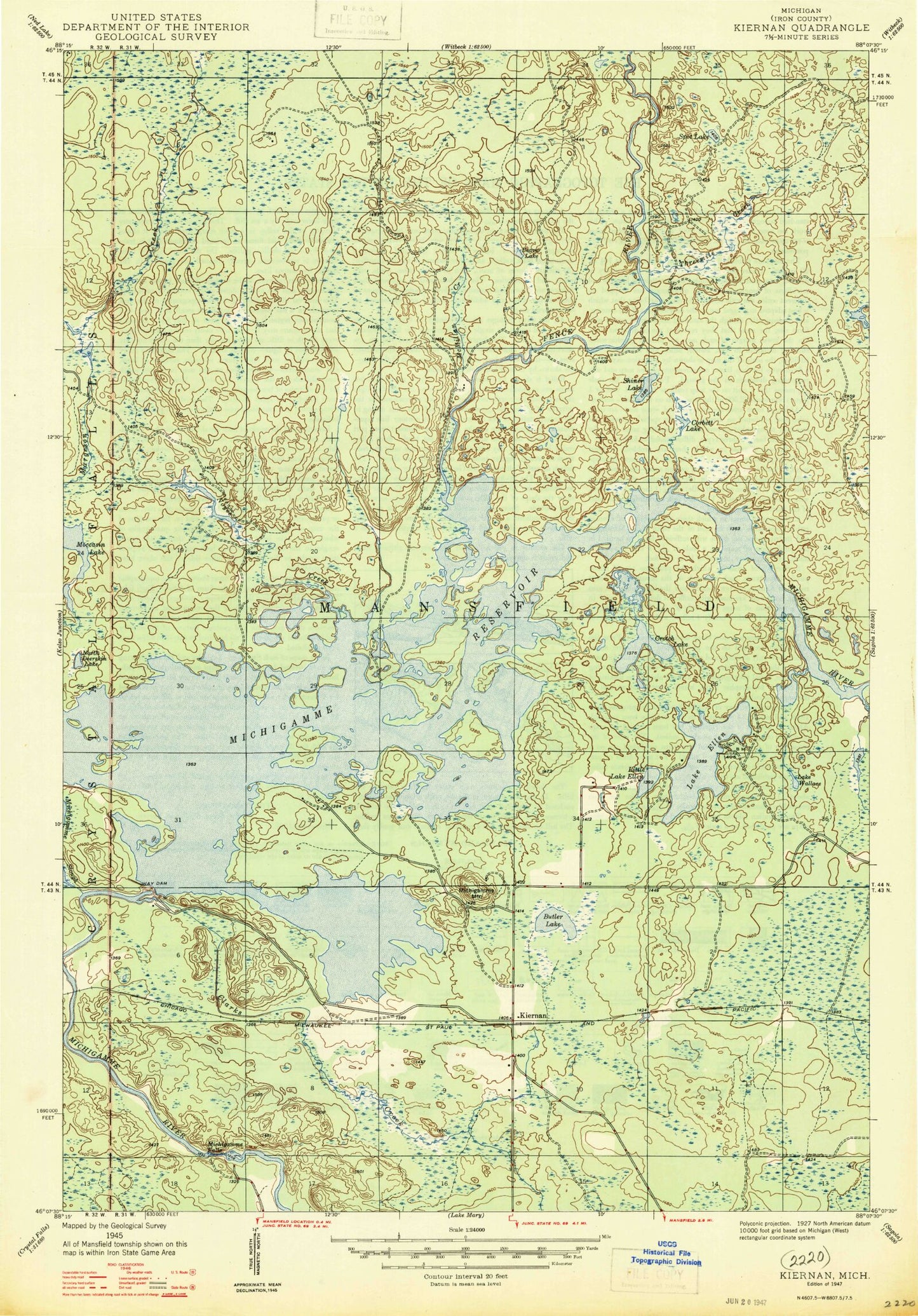
Classic USGS Kiernan Michigan 7.5'x7.5' Topo Map
Couldn't load pickup availability
Historical USGS topographic quad map of Kiernan in the state of Michigan. Typical map scale is 1:24,000, but may vary for certain years, if available. Print size: 24" x 27"
This quadrangle is in the following counties: Iron.
The map contains contour lines, roads, rivers, towns, and lakes. Printed on high-quality waterproof paper with UV fade-resistant inks, and shipped rolled.
Contains the following named places: Beaver Lake, Butler Lake, Clarks Creek, Corbett Lake, Crotch Lake, Lake Ellen, Fence River, Hemlock Falls Dam, Little Lake Ellen, Margeson Creek, McMillan Camp, McMillan Creek, Michigamme Mountain, Michigamme Reservoir, Michigamme Slough, Moccasin Lake, North Deerskin Lake, Noyes Creek, Shiner Lake, Spot Lake, Threemile Creek, Lake Wallace, Way Dam, Kiernan, Huber Airport, Township of Mansfield, Maywood Post Office (historical), Lake Ellen Campground, Margeson Falls, Michigamme Falls (historical)