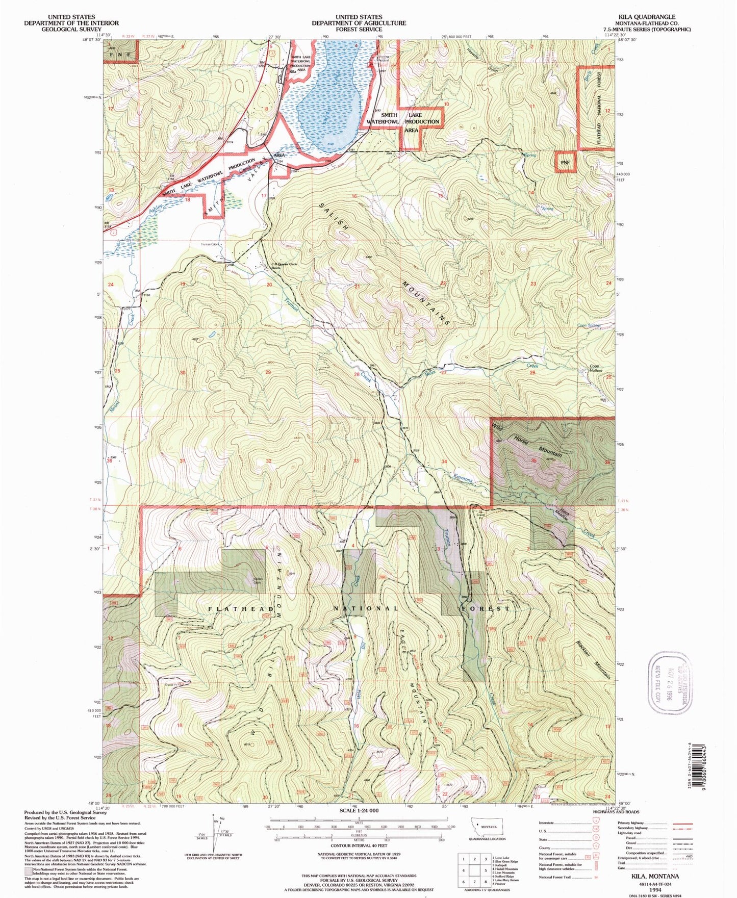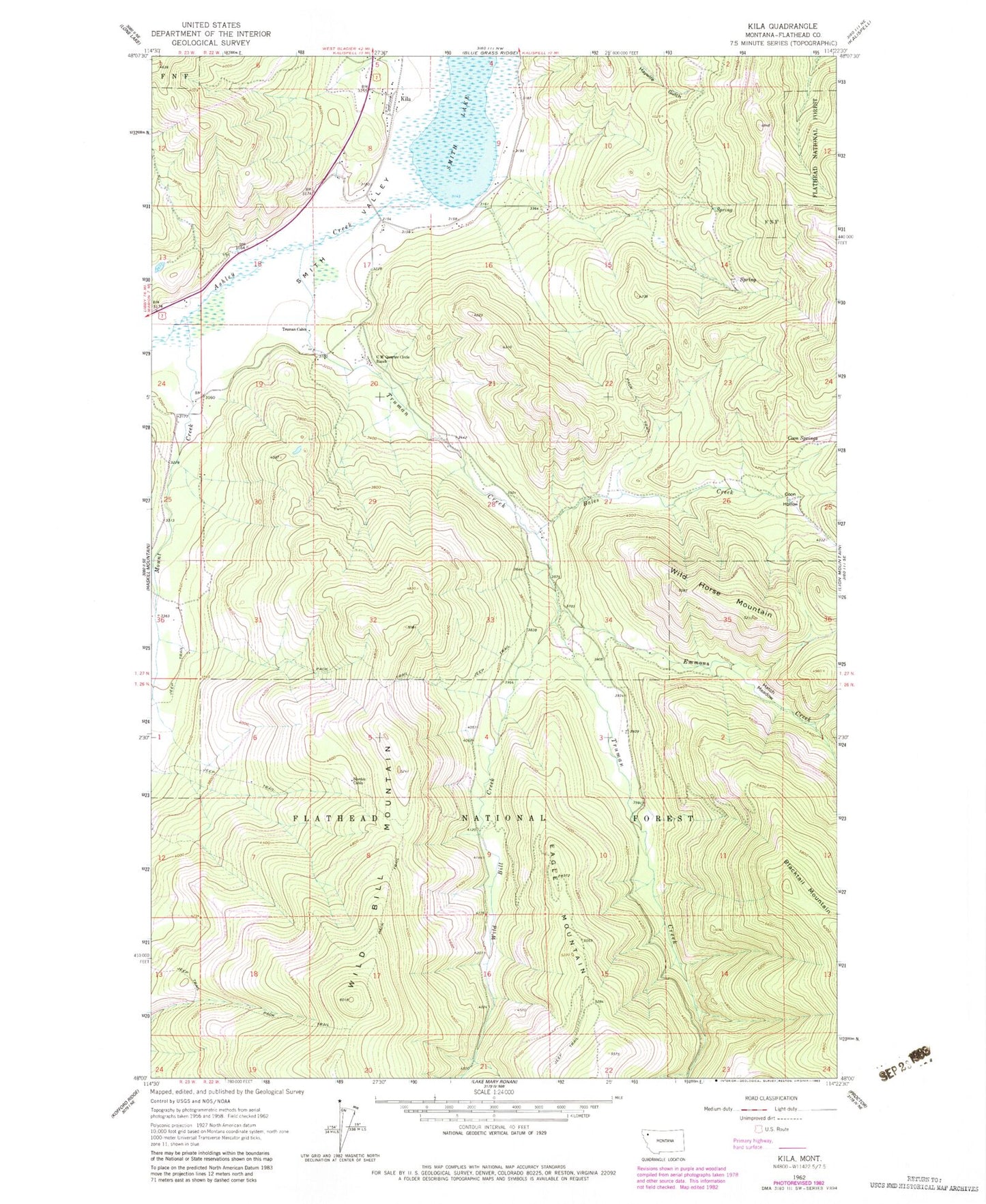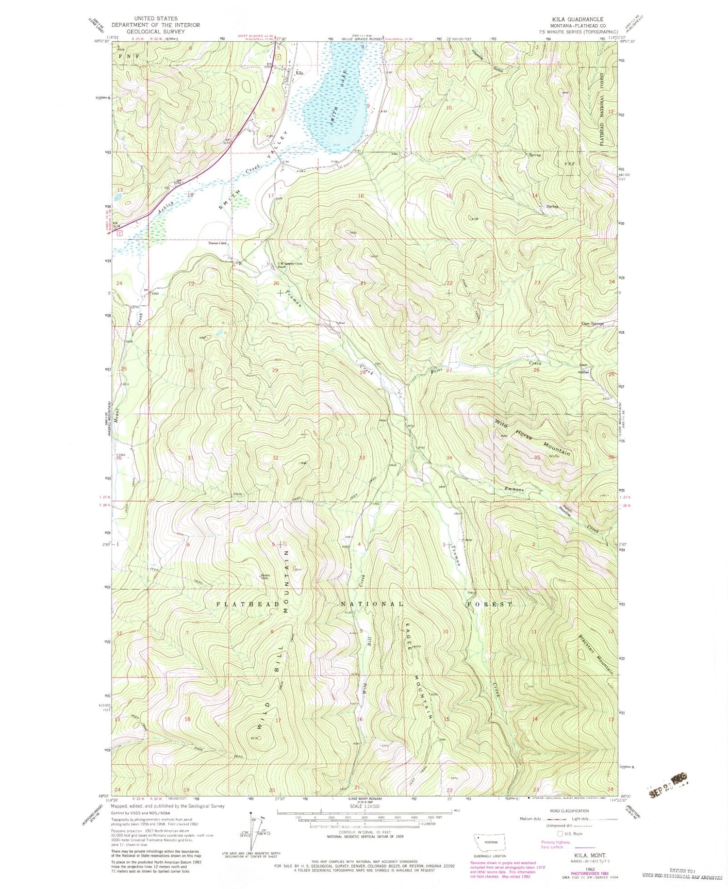
MyTopo
Classic USGS Kila Montana 7.5'x7.5' Topo Map
Couldn't load pickup availability
Historical USGS topographic quad map of Kila in the state of Montana. Map scale may vary for some years, but is generally around 1:24,000. Print size is approximately 24" x 27"
This quadrangle is in the following counties: Flathead.
The map contains contour lines, roads, rivers, towns, and lakes. Printed on high-quality waterproof paper with UV fade-resistant inks, and shipped rolled.
Contains the following named places: Bales Creek, C M Quarter Circle Ranch, Coon Hollow, Coon Springs, Eagle Mountain, Emmons Creek, Hatch Meadow, Jackson Draw, Kila, Kila Campground, Kila Census Designated Place, Kila Post Office, Kila School, Mount Creek, Murray Post Office, Norden Cabin, Smith Lake, Smith Lake Fishing Access Site, Smith Lake Waterfowl Production Area, Truman Cabin, Truman Creek, Wild Bill Creek, Wild Bill Mountain, Wild Horse Mountain