
MyTopo
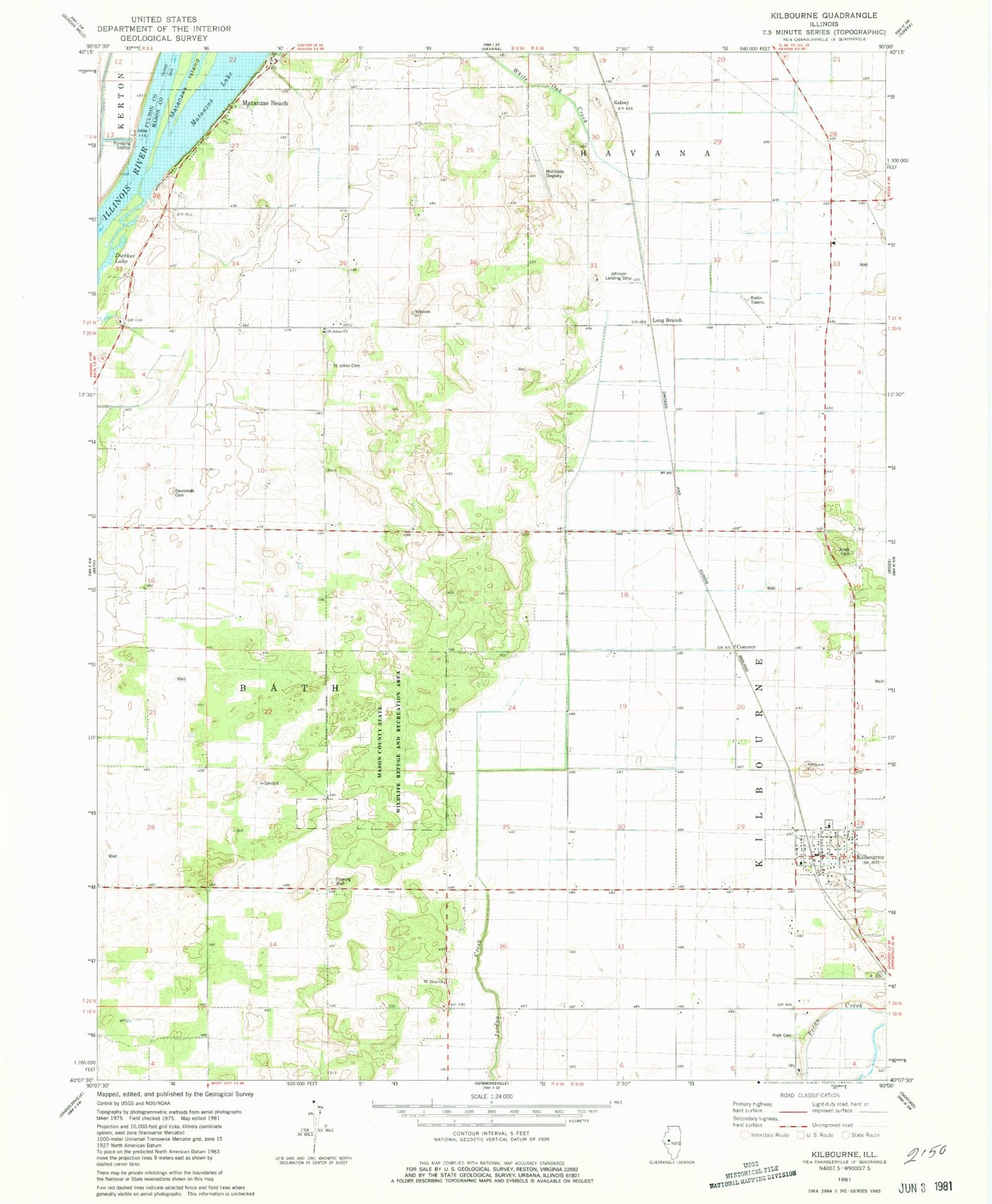
Classic USGS Kilbourne Illinois 7.5'x7.5' Topo Map
Couldn't load pickup availability
Historical USGS topographic quad map of Kilbourne in the state of Illinois. Map scale may vary for some years, but is generally around 1:24,000. Print size is approximately 24" x 27"
This quadrangle is in the following counties: Fulton, Mason.
The map contains contour lines, roads, rivers, towns, and lakes. Printed on high-quality waterproof paper with UV fade-resistant inks, and shipped rolled.
Contains the following named places: Conover, Dierker Lake, Frog Pond School, Hardin School, Havana Regional Airport, Johnson Landing Strip, Jones Cemetery, Jones School, Kelsey, Kilbourne, Kilbourne Baptist Church, Kilbourne Cemetery, Kilbourne Fire Department, Kilbourne Post Office, Lakewood, Long Branch, Long Branch Sand Prairie Nature Preserve, Mason County State Wildlife Refuge and Recreation Area, Matanzas, Matanzas Beach, Matanzas Lake, Matanzas Prairie Nature Preserve, Matanzas School, Mid-State Dragway, Mount Zion Cemetery, Mount Zion Church, Pratt Cemetery, Saint Johns Cemetery, Saint Johns Church, Sand Prairie - Scrub Oak Nature Preserve, Sedan Station, Township of Bath, Village of Kilbourne, White Hall School


