
MyTopo
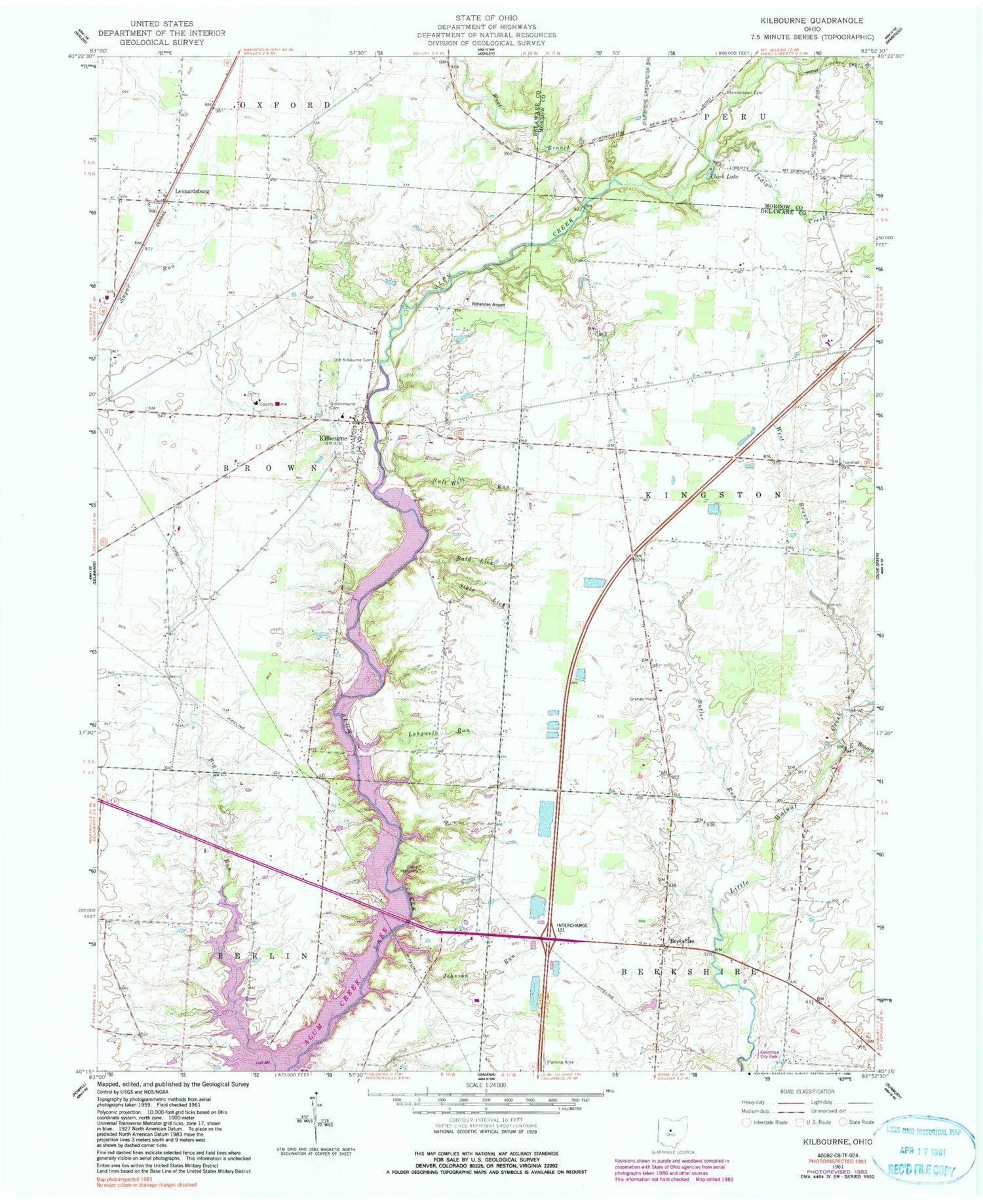
Classic USGS Kilbourne Ohio 7.5'x7.5' Topo Map
Couldn't load pickup availability
Historical USGS topographic quad map of Kilbourne in the state of Ohio. Map scale may vary for some years, but is generally around 1:24,000. Print size is approximately 24" x 27"
This quadrangle is in the following counties: Delaware, Morrow.
The map contains contour lines, roads, rivers, towns, and lakes. Printed on high-quality waterproof paper with UV fade-resistant inks, and shipped rolled.
Contains the following named places: Alum Creek, Alum Creek Post Office, Alum Creek School, Bald Lick, Berkshire, Berkshire Cemetery, Berkshire Post Office, Berkshire Township Hall, Big Run School, Bohannan Airport, Brown School, Brown's Lakeside Landings Airport, Butler Run, Camp Mahoney, Carter School, Clark Lake, Columbus City Park, Dale Tree Farm, Delaware County Home, East Branch Little Walnut Creek, Elm Valley School, Erdy Farm Airport, Estates At Sherman Lake, Fly-A-Way Farm Airport, Fontanell School, Green Mound Cemetery, Independence Hall School, Indigo Creek, Johnson Run, Kilbourne, Kilbourne Census Designated Place, Kilbourne Post Office, Kingston Center, Kingston Center Post Office, Leonardsburg, Leonardsburg Post Office, Longwell Run, Lott School, Lovat Farm, Oak Hall School, Old Kilbourne Cemetery, Salt Well Run, Scott School, Shadowlake Farm, Sheets School, Sherman Lakes, Slate Lick, Smith School, Stantontown Cemetery, Township of Brown, Township of Kingston, Vansickle School, West Branch Alum Creek, West Branch Little Walnut Creek, Whispering Creek, Whitehall School, ZIP Code: 43032


