MyTopo
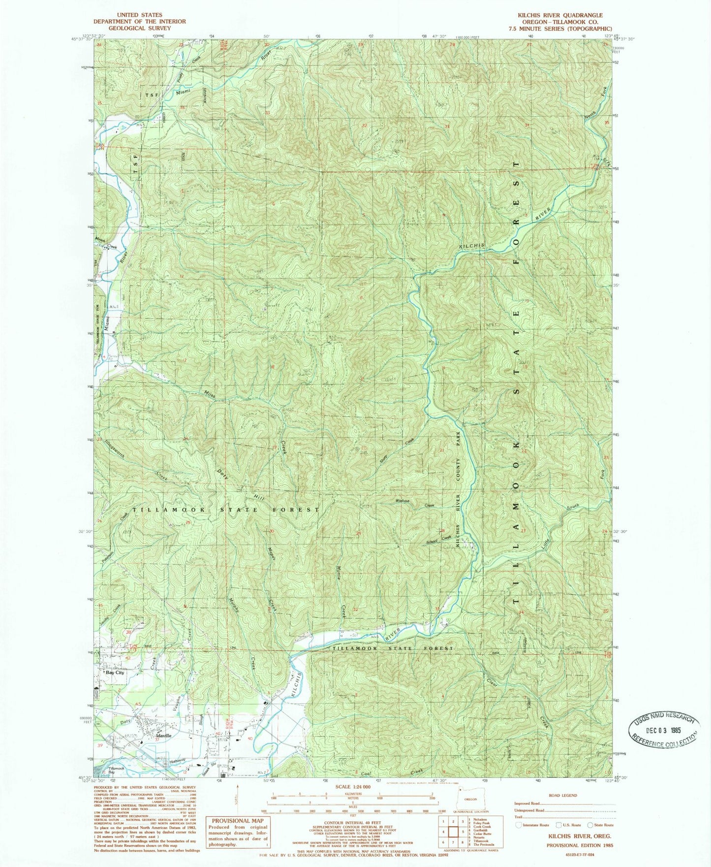
Classic USGS Kilchis River Oregon 7.5'x7.5' Topo Map
Couldn't load pickup availability
Historical USGS topographic quad map of Kilchis River in the state of Oregon. Map scale may vary for some years, but is generally around 1:24,000. Print size is approximately 24" x 27"
This quadrangle is in the following counties: Tillamook.
The map contains contour lines, roads, rivers, towns, and lakes. Printed on high-quality waterproof paper with UV fade-resistant inks, and shipped rolled.
Contains the following named places: Aiken Canyon, Averill Dairy, Bay City IOOF Cemetery, Blue Star Creek, Clear Creek, Clinton Creek, Coal Creek, Diamond Creek, Dietz Creek, Doty Hill, Gilmore Creek, Hathaway Slough, Idaville, Idaville Census Designated Place, Idaville Post Office, Iris Creek, Jody Creek, Kilchis River County Park, Kilchis River Park County Drift Boat Launch, Kilchis Valley Dairy, Little South Fork Kilchis River, Mapes Creek, Mapes Creek County Drift Boat Launch, Minich Creek, Moss Creek, Murphy Creek, Myrtle Creek, North Fork Kilchis River, Pipe Creek, Prouty Creek, Purcell Creek, Riverdale Post Office, Riverdale School, Roller Creek, Sam Downs Creek, School Creek, Sharp Creek, Shirley Creek, Slide Creek, South Fork Kilchis River, Spruce Creek, Stuart Creek, Thomas Creek, Tilden Bluffs, Tilton Creek, Turning Point Dairy, Vaughn Creek, Waldron Creek, Washout Creek, Watertank Creek, Whitney Creek, Zigzag Canyon