MyTopo
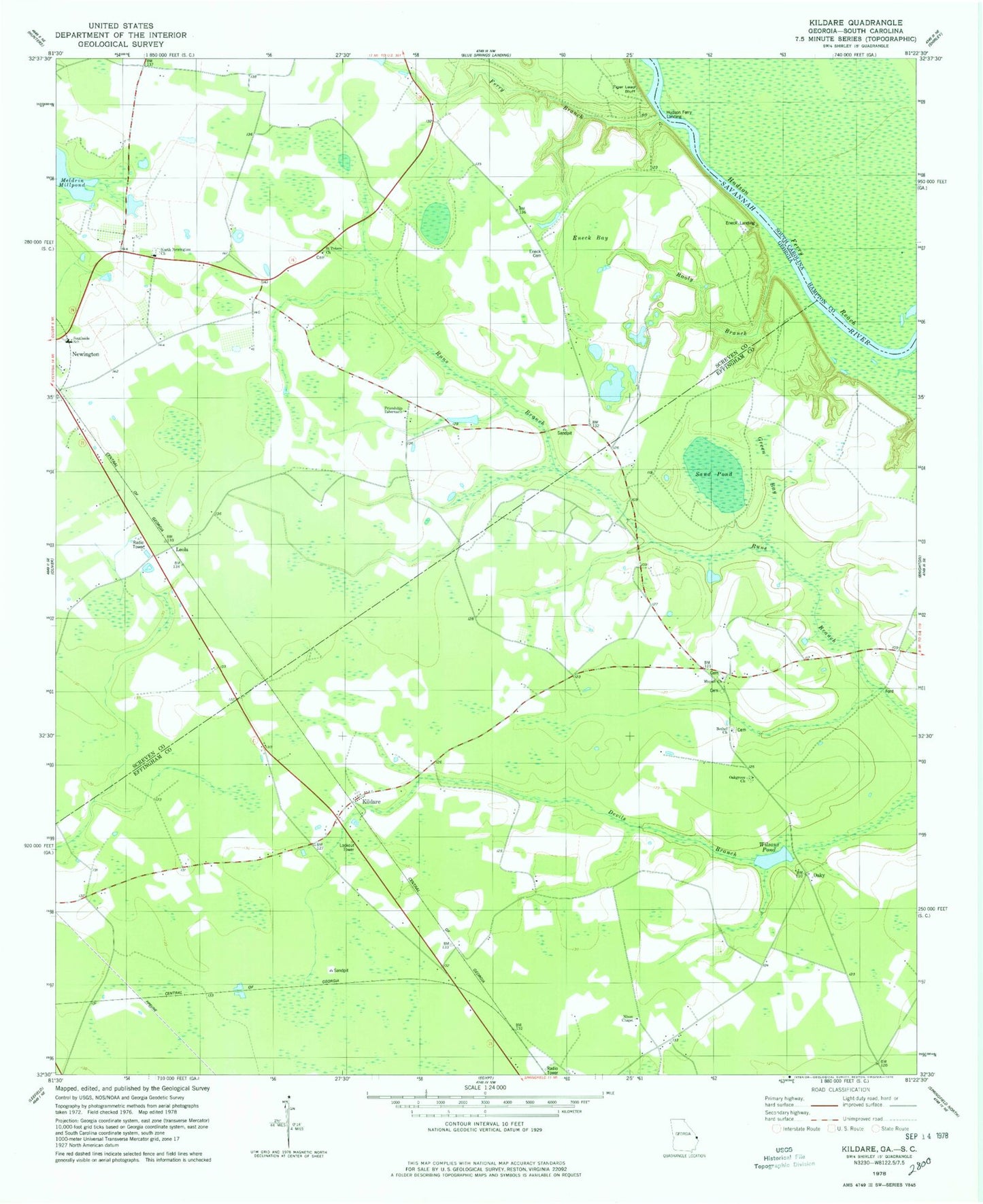
Classic USGS Kildare Georgia 7.5'x7.5' Topo Map
Couldn't load pickup availability
Historical USGS topographic quad map of Kildare in the states of Georgia, South Carolina. Map scale may vary for some years, but is generally around 1:24,000. Print size is approximately 24" x 27"
This quadrangle is in the following counties: Effingham, Hampton, Screven.
The map contains contour lines, roads, rivers, towns, and lakes. Printed on high-quality waterproof paper with UV fade-resistant inks, and shipped rolled.
Contains the following named places: Bethel Church, Colson School, Coursey Cemetery, Coursey School, Dugger Cemetery, Effingham County Fire Rescue Station 7, Eneck, Eneck Bay, Eneck Cemetery, Eneck Landing, Ferry Branch, Friendship Tabernacle, Green Bay, Hudson Ferry, Hudson Ferry Landing, Hudson Ferry Reach, Kildare, Mariah Grove School, Mizpah Church, Mizpah School, Nixon Chapel, North Newington Church, Oakgrove Church, Oaky, Rooty Branch, Saint Peters Church, Saint Peters School, Sand Pond, Southside School, Tiger Leap Bluff, Walker Grove School, Wallace Temple, Wilsons Pond, ZIP Code: 30446