MyTopo
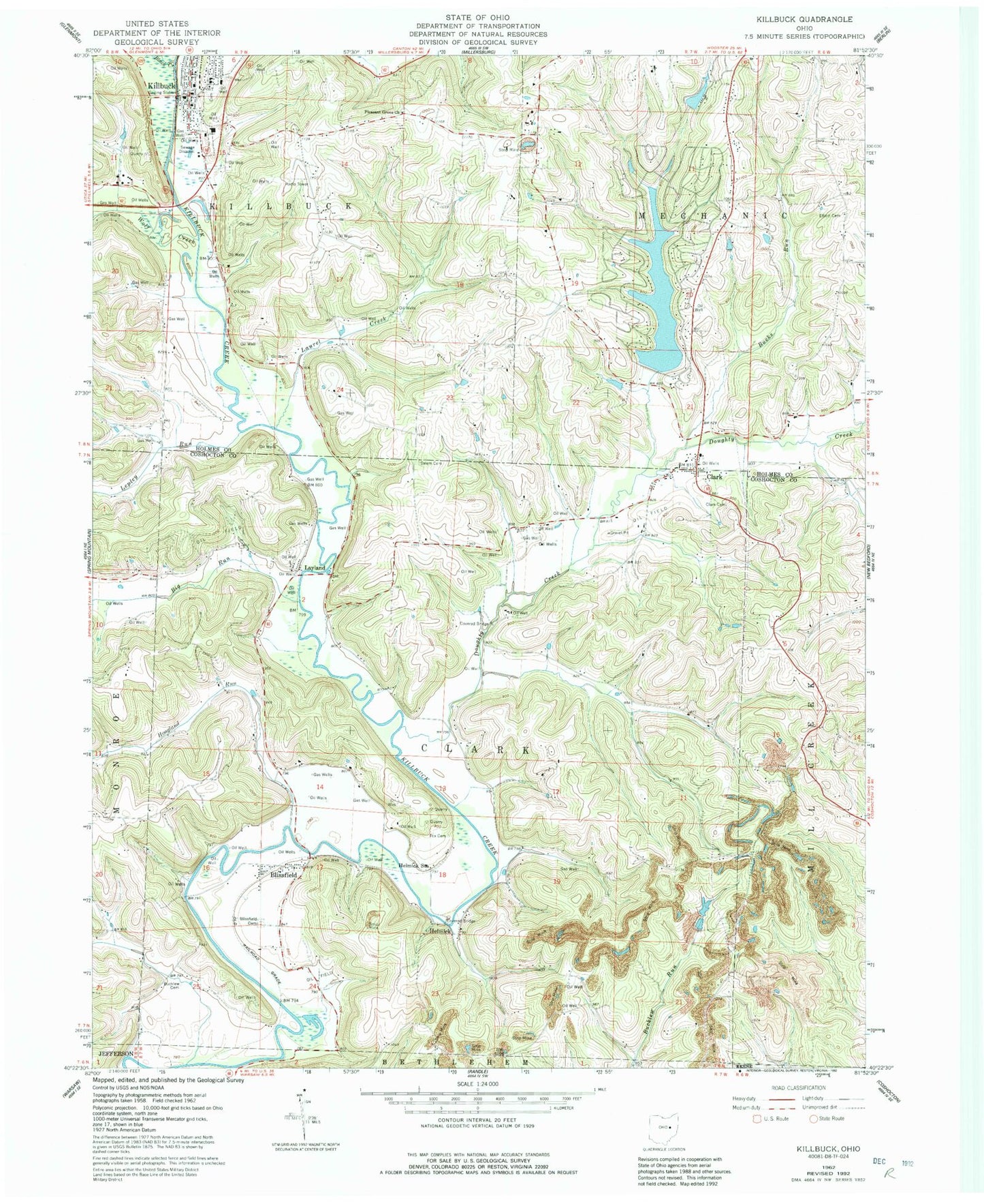
Classic USGS Killbuck Ohio 7.5'x7.5' Topo Map
Couldn't load pickup availability
Historical USGS topographic quad map of Killbuck in the state of Ohio. Map scale may vary for some years, but is generally around 1:24,000. Print size is approximately 24" x 27"
This quadrangle is in the following counties: Coshocton, Holmes.
The map contains contour lines, roads, rivers, towns, and lakes. Printed on high-quality waterproof paper with UV fade-resistant inks, and shipped rolled.
Contains the following named places: Big Run, Black Creek, Blissfield, Blissfield Cemetery, Blissfield Post Office, Bucklew Cemetery, Bucks Run, Clark, Clark Cemetery, Clark Post Office, Doughty Creek, Elliott Cemetery, Fox Cemetery, Green Valley School, Greenhorn School, Helmick, Helmick Bridge, Helmick Post Office, Helmick Station, Hickory Lake, Hickory Lake Dam, Hoagland Run, Holmes Fire District 1 Buckhorn Station, Killbuck, Killbuck Cemetery, Killbuck Elementary School, Killbuck Post Office, Killbuck Township Fire Department, Lake Buckhorn, Lake Buckhorn Census Designated Place, Lake Buckhorn Dam, Laurel Creek, Laurel Run School, Layland, Layland Post Office, Layland School, Lepley Run, Mill Creek Landfill, Mount Dispute School, Mount Union, Pleasant Grove Cemetery, Pleasant Grove School, Salem Cemetery, Stony Point School, Township of Clark, Township of Killbuck, Village of Killbuck, Weatherwax Cemetery, Wolf Creek, ZIP Code: 43805