
MyTopo
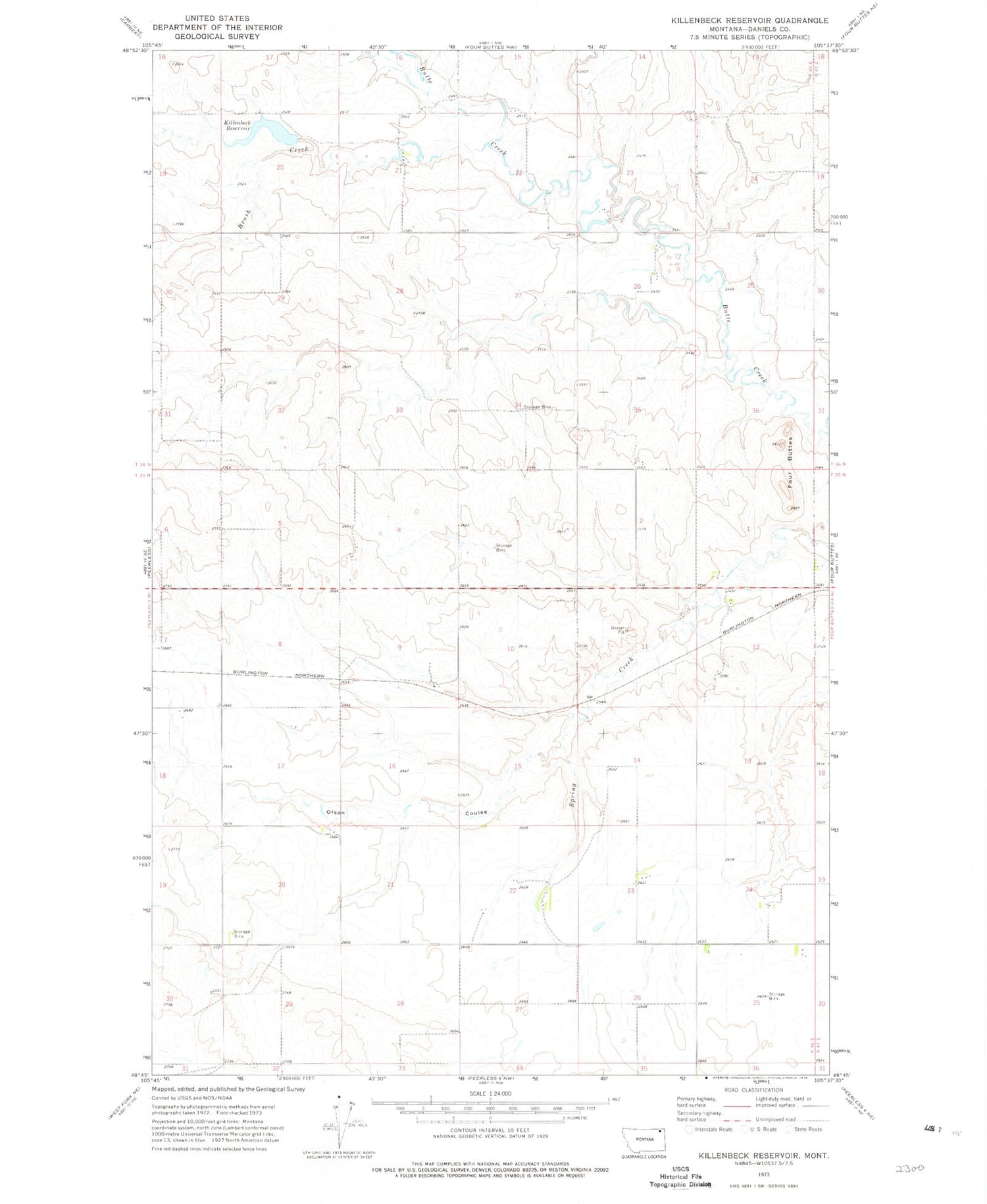
Classic USGS Killenbeck Reservoir Montana 7.5'x7.5' Topo Map
Couldn't load pickup availability
Historical USGS topographic quad map of Killenbeck Reservoir in the state of Montana. Map scale may vary for some years, but is generally around 1:24,000. Print size is approximately 24" x 27"
This quadrangle is in the following counties: Daniels.
The map contains contour lines, roads, rivers, towns, and lakes. Printed on high-quality waterproof paper with UV fade-resistant inks, and shipped rolled.
Contains the following named places: 35N46E01CCDA01 Well, 35N46E01CCDA02 Well, 35N46E04CBCD01 Well, 35N46E04CBDB01 Well, 35N46E09DCAA01 Well, 35N46E10DDDD01 Well, 35N46E11AADC01 Well, 35N46E11AADC02 Well, 35N46E12BACB01 Well, 35N46E12BACB02 Well, 35N46E17ABCA01 Well, 35N46E20AAAB01 Well, 35N46E20AAAB02 Well, 35N46E20CCCD01 Well, 35N46E22CBDD01 Well, 35N46E22CBDD02 Well, 35N46E22DBDA01 Well, 35N46E23ACCA01 Well, 35N46E23ACCC01 Well, 35N46E24DBCA01 Well, 35N46E25AAAC01 Well, 35N46E25BBBA01 Well, 35N46E26CDAC01 Well, 35N46E30ADDB01 Well, 35N47E06CCBC01 Well, 36N46E15CDDD01 Well, 36N46E20ABDD01 Well, 36N46E21ACCB01 Well, 36N46E23AAAA01 Well, 36N46E31BAAA01 Well, 36N46E33ABBB01 Well, 36N46E35DCCC01 Well, Brush Creek, Four Buttes, Gluten, Killenbeck Lake Dam, Killenbeck Reservoir, Olson Coulee


