
MyTopo
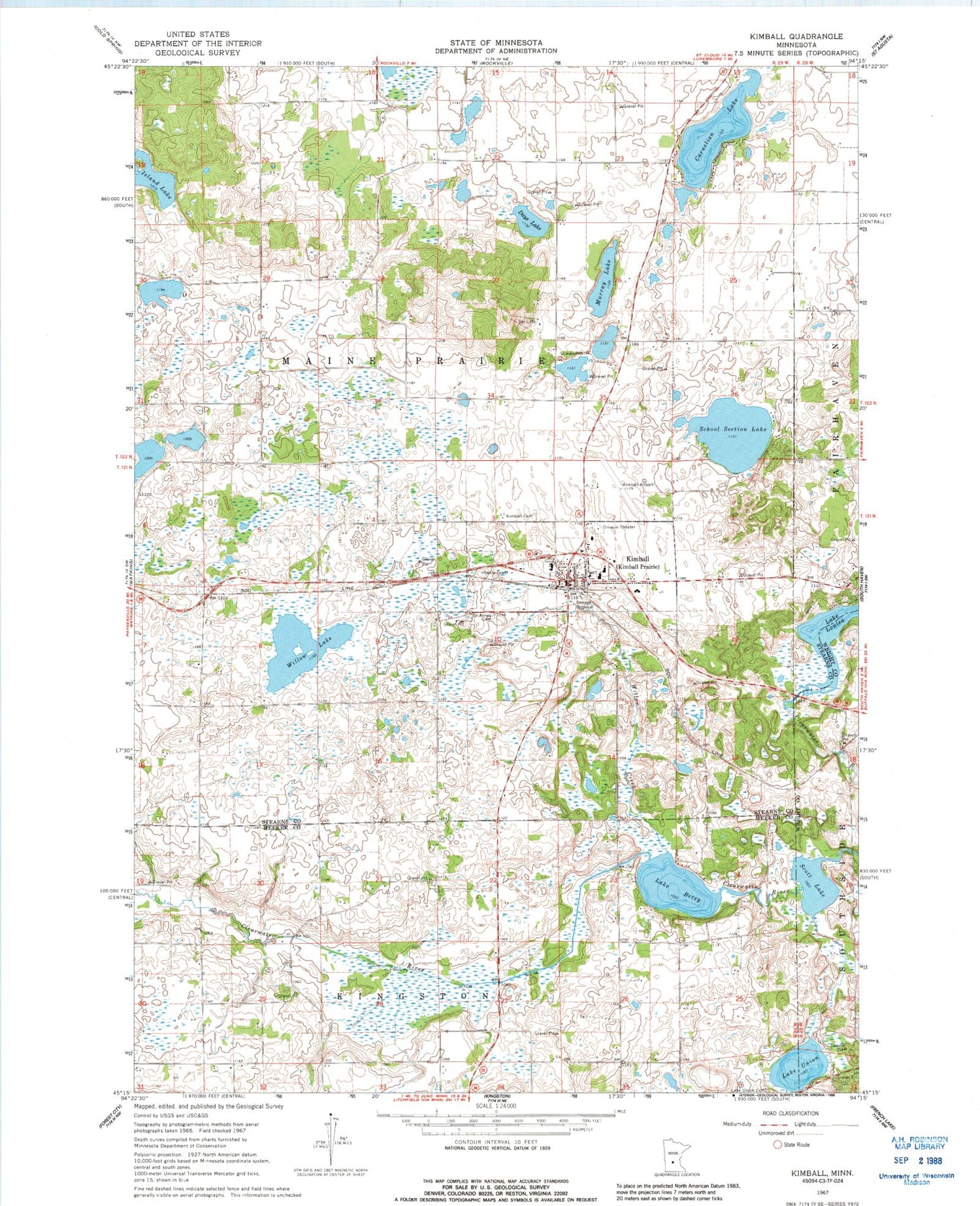
Classic USGS Kimball Minnesota 7.5'x7.5' Topo Map
Couldn't load pickup availability
Historical USGS topographic quad map of Kimball in the state of Minnesota. Map scale may vary for some years, but is generally around 1:24,000. Print size is approximately 24" x 27"
This quadrangle is in the following counties: Meeker, Stearns, Wright.
The map contains contour lines, roads, rivers, towns, and lakes. Printed on high-quality waterproof paper with UV fade-resistant inks, and shipped rolled.
Contains the following named places: Carnelian Lake, Church of Christ, Church of Saint Anne, City of Kimball, County Ditch Number Fortysix, Days Lake, Island Lake, Kimball, Kimball Cemetery, Kimball Fire Department, Kimball Golf Club, Kimball Great River Library, Kimball High School, Kimball Police Department, Kimball Post Office, Kimball Prairie Post Office, Kimball United Methodist Church, Lake Betsy, Lake Union, Murray Lake, Powder Ridge Ski Area, Saint Annes Cemetery, Saint John's Lutheran Church, School Section Lake, Scott Lake, Township of Maine Prairie, Willow Creek, Willow Lake, ZIP Code: 55353


