MyTopo
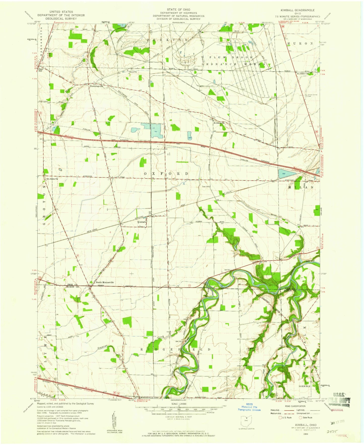
Classic USGS Kimball Ohio 7.5'x7.5' Topo Map
Couldn't load pickup availability
Historical USGS topographic quad map of Kimball in the state of Ohio. Map scale may vary for some years, but is generally around 1:24,000. Print size is approximately 24" x 27"
This quadrangle is in the following counties: Erie, Huron.
The map contains contour lines, roads, rivers, towns, and lakes. Printed on high-quality waterproof paper with UV fade-resistant inks, and shipped rolled.
Contains the following named places: Bloomingville, Bloomingville Cemetery, Bloomingville Census Designated Place, Bloomingville Post Office, Claytondale Farms, Deering Farms, East Branch Huron River, Ehove Joint Vocational School, Erf Family Farms, Erie Sand Barrens Nature Preserve, Fools Gold Farms, Jacobsburg Cemetery, Kimball, Kimball Post Office, Kuebelar Ditch, Miller Farms, North Monroeville, North Monroeville Cemetery, North Monroeville Post Office, Olemacher Ditch, Oxford Lutheran Cemetery, Plum Brook Station, Prout, Prout Post Office, Ruggles Cemetery, Saint John Lutheran Church, Saint Johns Cemetery, Saint Johns Church, Scheid Ditch, Schlessman Ditch, Seymour Creek, Sherer Ditch, Silvertips Farms, Township of Oxford, Township of Ridgefield, Union Corners, Weilnau Farms, West Branch Huron River, WLKR-FM (Norwalk), WVAC-AM (Norwalk), Zorn Acres Airport, Zorn Beutal Ditch