MyTopo
Classic USGS Kimballton Iowa 7.5'x7.5' Topo Map
Couldn't load pickup availability
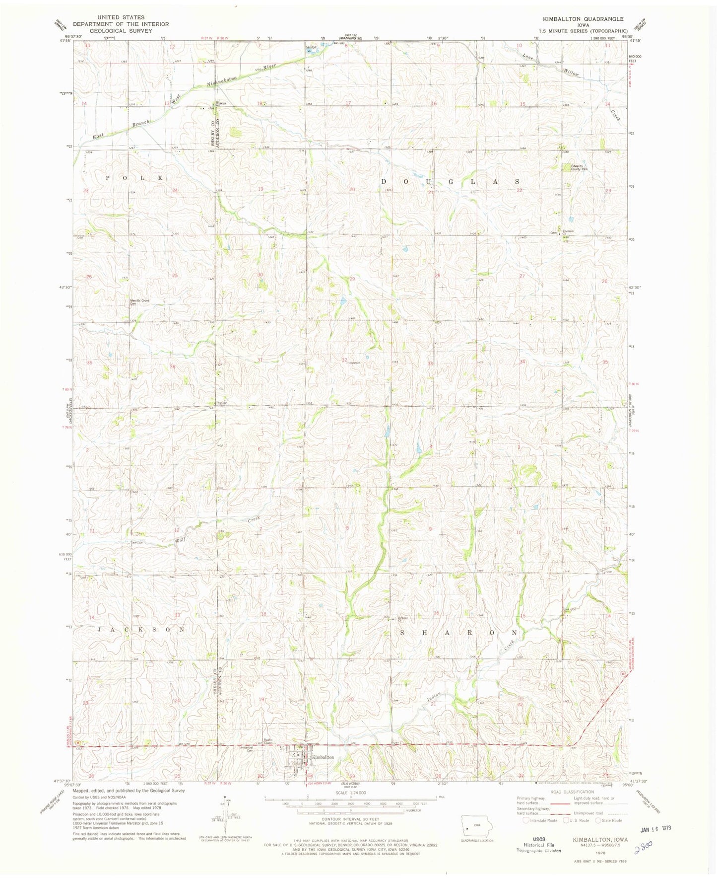
Historical USGS topographic quad map of Kimballton in the state of Iowa. Map scale may vary for some years, but is generally around 1:24,000. Print size is approximately 24" x 27"
This quadrangle is in the following counties: Audubon, Shelby.
The map contains contour lines, roads, rivers, towns, and lakes. Printed on high-quality waterproof paper with UV fade-resistant inks, and shipped rolled.
Contains the following named places: Bethany Lutheran Church, Bull Run, City of Kimballton, Ebenezer Cemetery, Ebenezer Church, Edwards County Park, Fiscus, Fiscus Post Office, General Store Museum, Immanuel Cemetery, Immanuel Lutheran Church, Kimballton, Kimballton City Fire Department, Kimballton Library, Kimballton Post Office, Kimballton Town Hall, Little Mermaid Statue, Merrills Grove Cemetery, Poplar, Poplar Cemetery, Poplar Post Office, Township of Douglas, Township of Sharon, Zinke Farm, ZIP Code: 51543