MyTopo
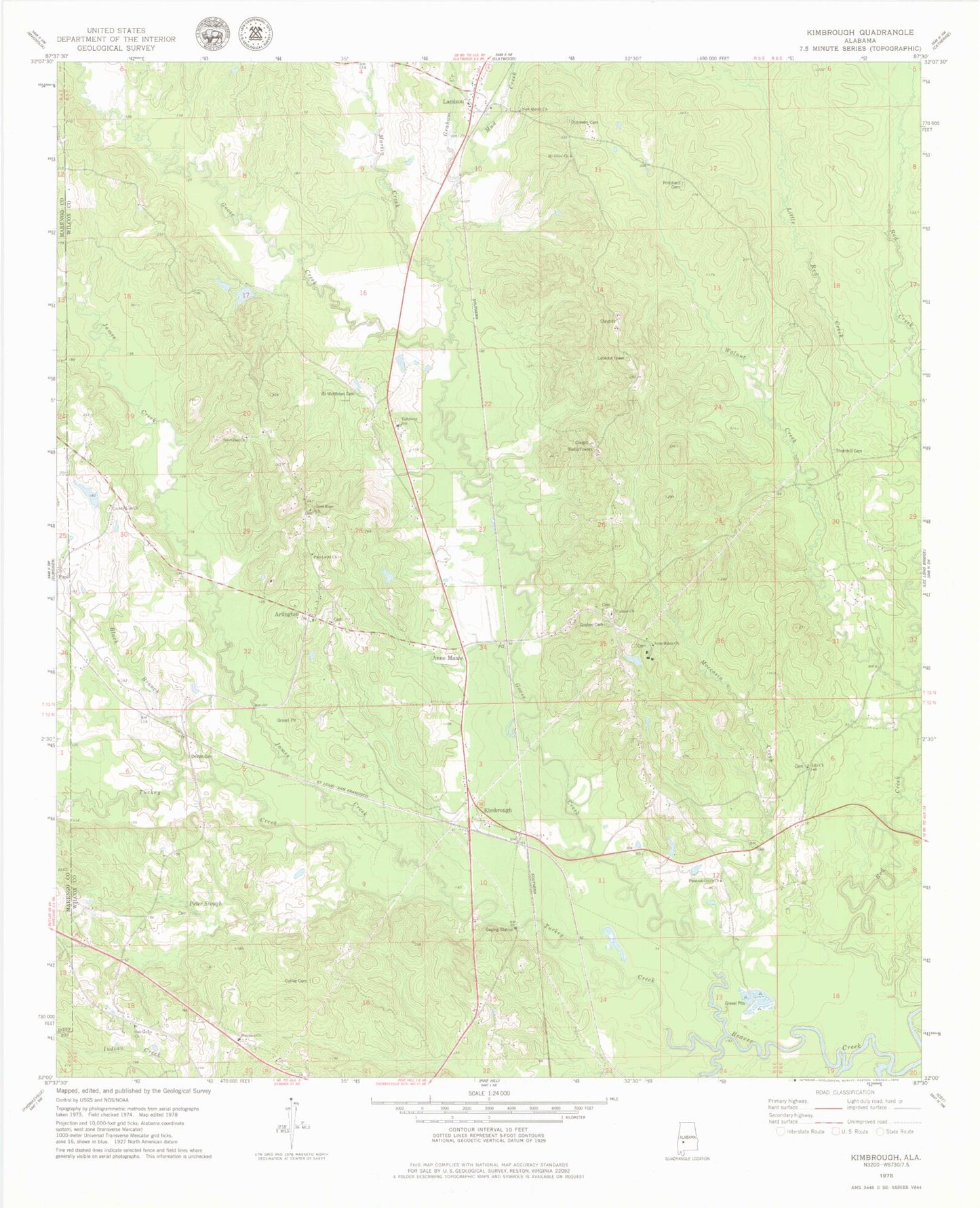
Classic USGS Kimbrough Alabama 7.5'x7.5' Topo Map
Couldn't load pickup availability
Historical USGS topographic quad map of Kimbrough in the state of Alabama. Map scale may vary for some years, but is generally around 1:24,000. Print size is approximately 24" x 27"
This quadrangle is in the following counties: Marengo, Wilcox.
The map contains contour lines, roads, rivers, towns, and lakes. Printed on high-quality waterproof paper with UV fade-resistant inks, and shipped rolled.
Contains the following named places: Anne Manie, Anne Manie Church, Annemanie Post Office, Arlington, Arlington Methodist Church, Arlington Post Office, Arlington Station, Bailey Creek, Black Branch, Canaan Cemetery, Canaan Cumberland Presbyterian Church, Collier Cemetery, County Line Baptist Church, County Line School, DeVan Cemetery, Dunaway Cemetery, Epiphany Lutheran Church, Epiphany School, Good Hope Church, Goose Creek, Goshen Cemetery, Goshen Church, Graham Creek, James C Ratcliffe Dam, James Creek, Kimbrough, Kimbrough Church, Lamison, Lamison Church, Lamison Post Office, Lily Church, Little Creek, Macedonia Church, Martin Creek, Moccasin Creek, Mount Olive Church, Mud Creek, New Queen Church, Oak Grove Church, Peter Slough, Pine Level Church, Pleasant Green Church, Pope, Pritchard Cemetery, Ratcliffe Lake, Saint Matthews Cemetery, Sanctified Church, Sheldon and Arnolds Store, Thornhill Cemetery, Turkey Creek, Twilleys Store, Walnut Creek, Welcome Church, West Wilcox Fire and Rescue Department, ZIP Codes: 36722, 36769