MyTopo
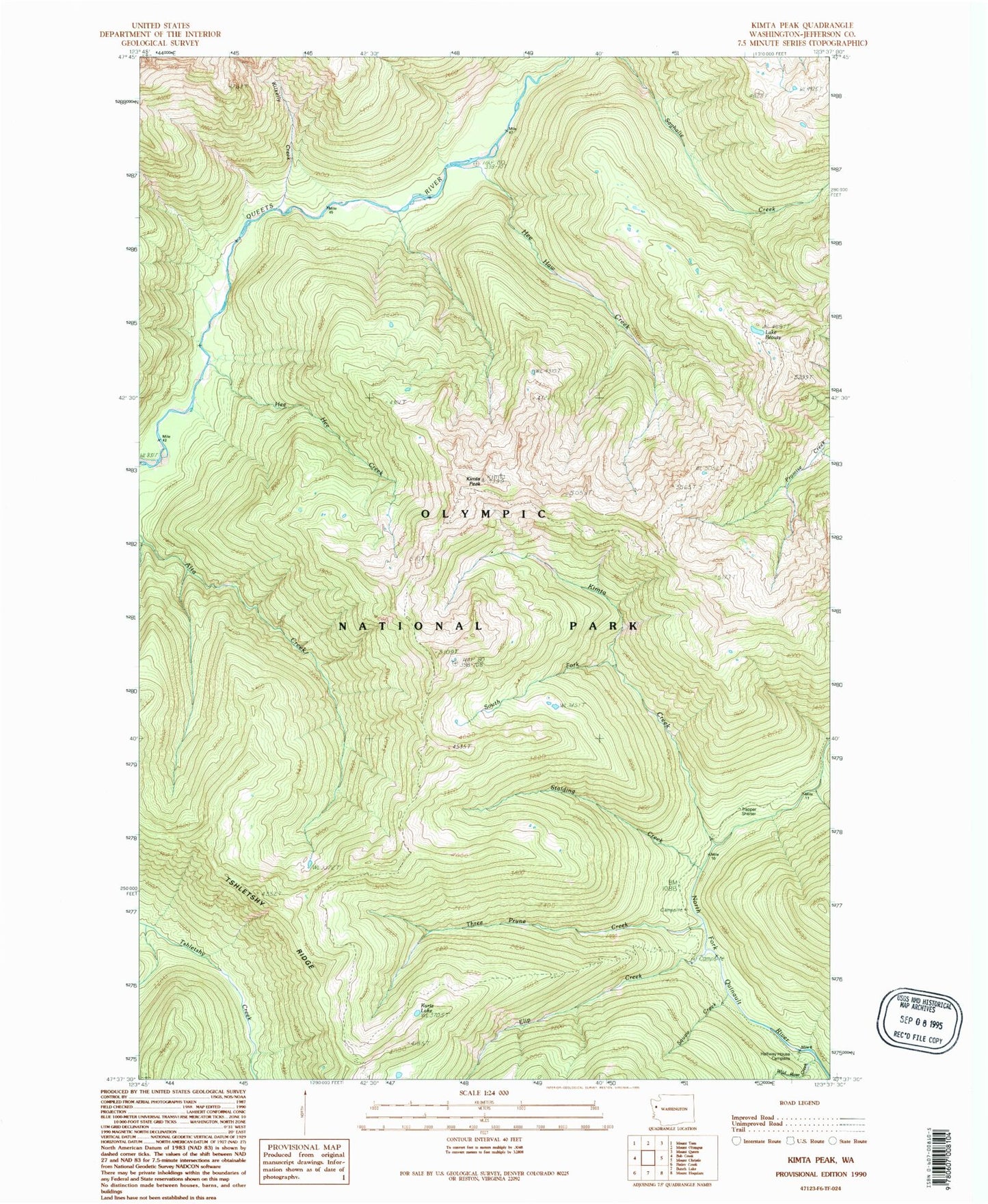
Classic USGS Kimta Peak Washington 7.5'x7.5' Topo Map
Couldn't load pickup availability
Historical USGS topographic quad map of Kimta Peak in the state of Washington. Typical map scale is 1:24,000, but may vary for certain years, if available. Print size: 24" x 27"
This quadrangle is in the following counties: Jefferson.
The map contains contour lines, roads, rivers, towns, and lakes. Printed on high-quality waterproof paper with UV fade-resistant inks, and shipped rolled.
Contains the following named places: Lake Beauty, Elip Creek, Francis Creek Campsite, Hee Haw Creek, Hee Hee Creek, Kilkelly Creek, Kimta Creek, Kimta Peak, Kurtz Lake, Paull Creek, Skyline Trail (historical), South Fork Kimta Creek, Squaw Creek, Stalding Creek, Three Prune Creek, Three Prune Shelter (historical), Tshletshy Ridge, Wild Rose Creek, Halfway House Campsite, Trapper Shelter, Kimta Lake, Three Prune Lakes