
MyTopo
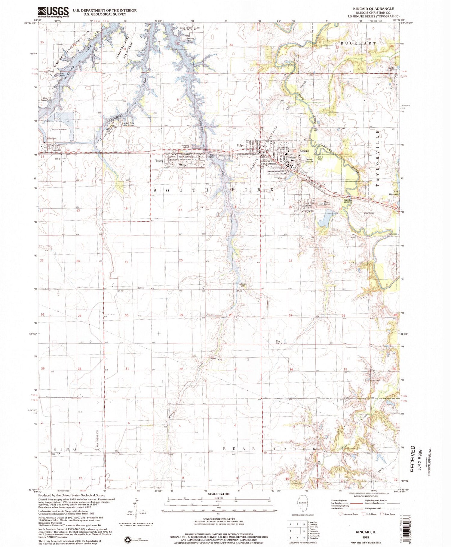
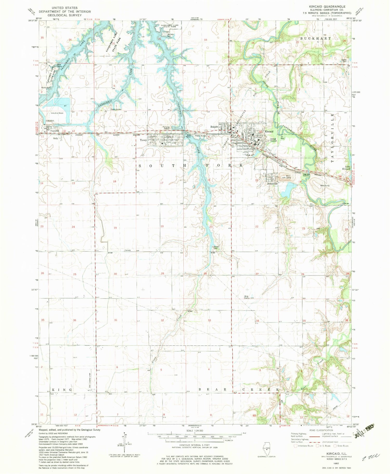
Classic USGS Kincaid Illinois 7.5'x7.5' Topo Map
Couldn't load pickup availability
Historical USGS topographic quad map of Kincaid in the state of Illinois. Map scale may vary for some years, but is generally around 1:24,000. Print size is approximately 24" x 27"
This quadrangle is in the following counties: Christian.
The map contains contour lines, roads, rivers, towns, and lakes. Printed on high-quality waterproof paper with UV fade-resistant inks, and shipped rolled.
Contains the following named places: Achenback Cemetery, Bethany Cemetery, Bethany Church, Bloome Farms, Bulpitt, Cottonwood School, Deal Landing Strip, Hedge College School, Jeisyville, Kincaid, Kincaid Baptist Church, Kincaid City Lake Dam, Kincaid Consolidated Oil Field, Kincaid Elementary School, Kincaid Police Department, Kincaid Post Office, Leigh School, Maple Grove School, Midland Fire Protection District, Pleasant Hill Church, Pleasant View School, Rosedale School, Sangchris Lake, Sicily, South Fork High School, Tovey, Tovey Humphrey Station, Tovey Post Office, Township of South Fork, Village of Bulpitt, Village of Jeisyville, Village of Kincaid, Village of Tovey, Walnut Hill Cemetery, Walnut Hill School, ZIP Codes: 62517, 62540, 62570


