MyTopo
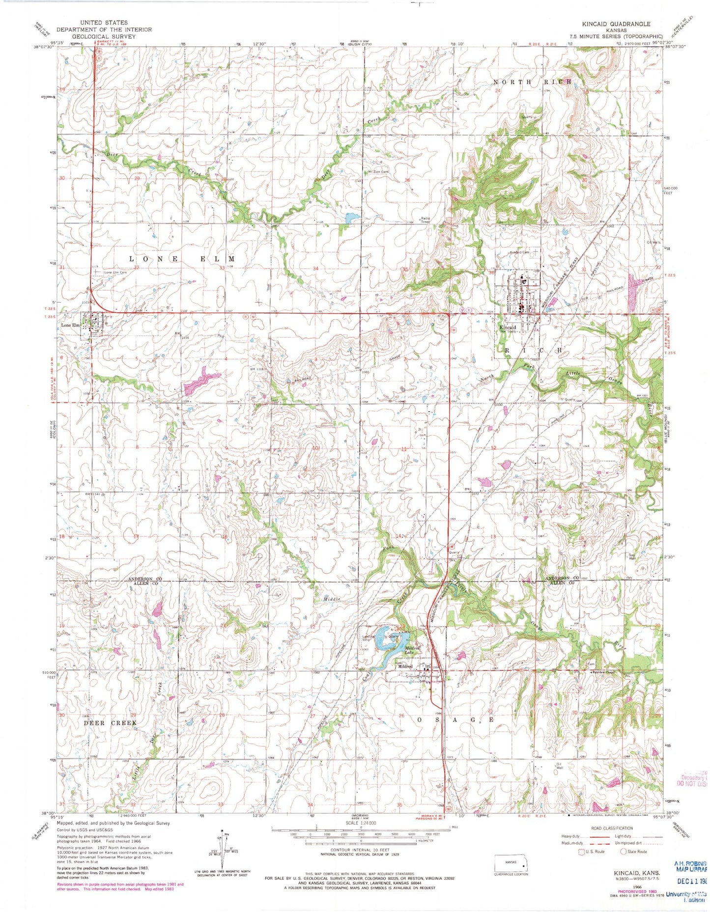
Classic USGS Kincaid Kansas 7.5'x7.5' Topo Map
Couldn't load pickup availability
Historical USGS topographic quad map of Kincaid in the state of Kansas. Map scale may vary for some years, but is generally around 1:24,000. Print size is approximately 24" x 27"
This quadrangle is in the following counties: Allen, Anderson.
The map contains contour lines, roads, rivers, towns, and lakes. Printed on high-quality waterproof paper with UV fade-resistant inks, and shipped rolled.
Contains the following named places: Beachner Grain Elevator Number 23, City of Kincaid, City of Lone Elm, City of Mildred, Coal Creek, Crest East Elementary School, Equity, Fairview Cemetery, Fairview Chapel, Kincaid, Kincaid Cemetery, Kincaid City Marshal's Office, Kincaid Fire Department - Lone Elm Station, Kincaid Fire Station, Kincaid Post Office, Kincaid United Methodist Church, Kincaid Wastewater Plant, Lone Elm, Lone Elm Cemetery, Mildred, Mildred Census Designated Place, Mildred Lake, Mildred Lake Dam, Mildred United Methodist Church, Mount Zion Cemetery, Township of Lone Elm, Township of Rich, ZIP Code: 66039