MyTopo
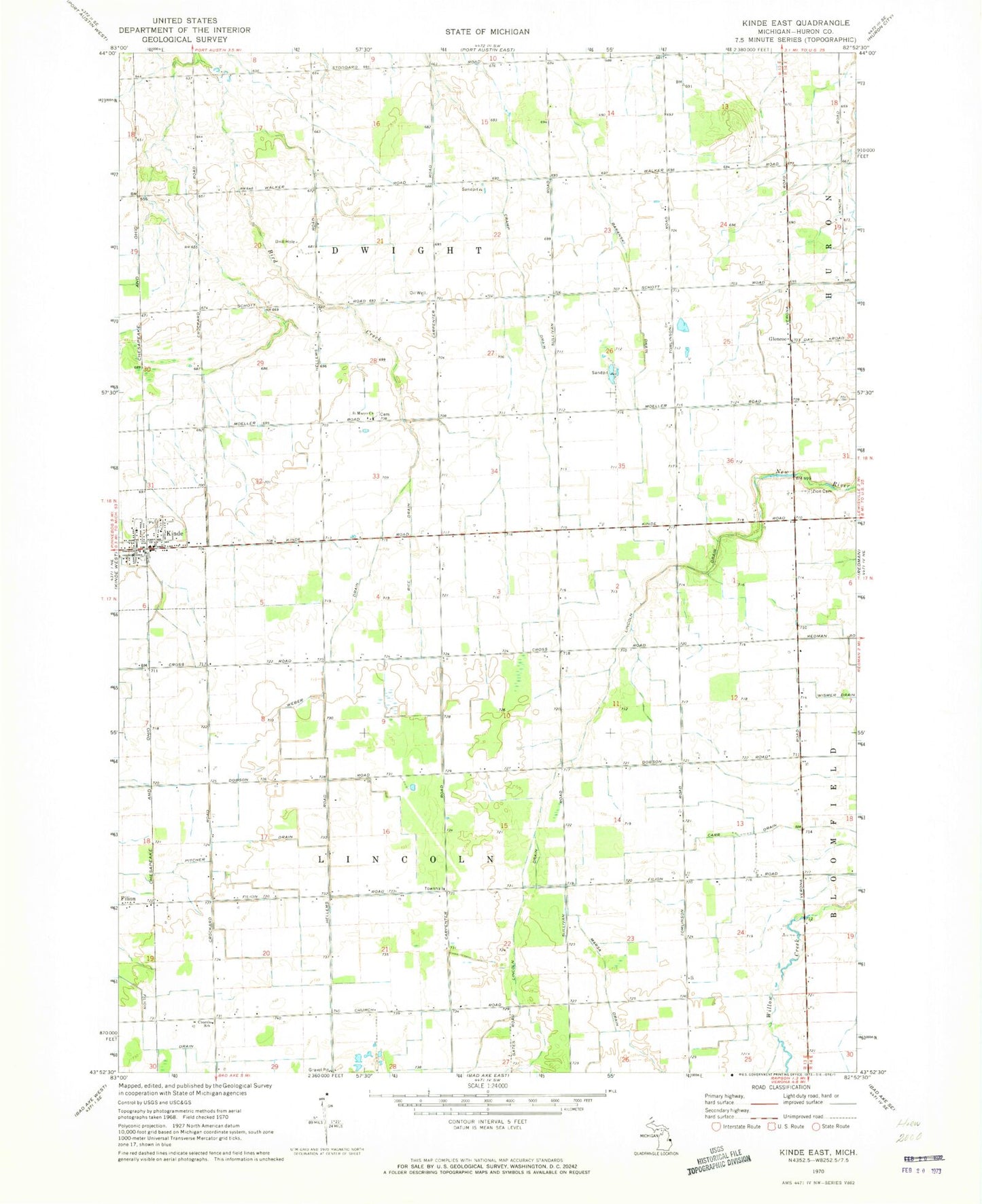
Classic USGS Kinde East Michigan 7.5'x7.5' Topo Map
Couldn't load pickup availability
Historical USGS topographic quad map of Kinde East in the state of Michigan. Map scale may vary for some years, but is generally around 1:24,000. Print size is approximately 24" x 27"
This quadrangle is in the following counties: Huron.
The map contains contour lines, roads, rivers, towns, and lakes. Printed on high-quality waterproof paper with UV fade-resistant inks, and shipped rolled.
Contains the following named places: Carr Drain, Church School, Cramp Drain, Filion Drain, Filion Station, Glencoe, Glencoe Post Office, Kinde, Kinde Area Fire Department, Kinde Police Department, Kinde Post Office, Kinde Presbyterian Church, Kinde Station, Kinde Village Hall, Lincoln Drain, Marsa Drain, Pitcher Drain, Rice Drain, Saint Edward's Church, Saint Mary of Czestochowa Roman Catholic Church Historical Marker, Saint Marys Church, Saint Mary's Polish Catholic Cemetery, Saint Peters Lutheran Church, Township of Dwight, Township of Lincoln, Varney Post Office, Varney Station, Village of Kinde, Weber Drain, WFMM-FM (Harbor Beach), Zion Saint Peters Lutheran Cemetery, ZIP Codes: 48432, 48445