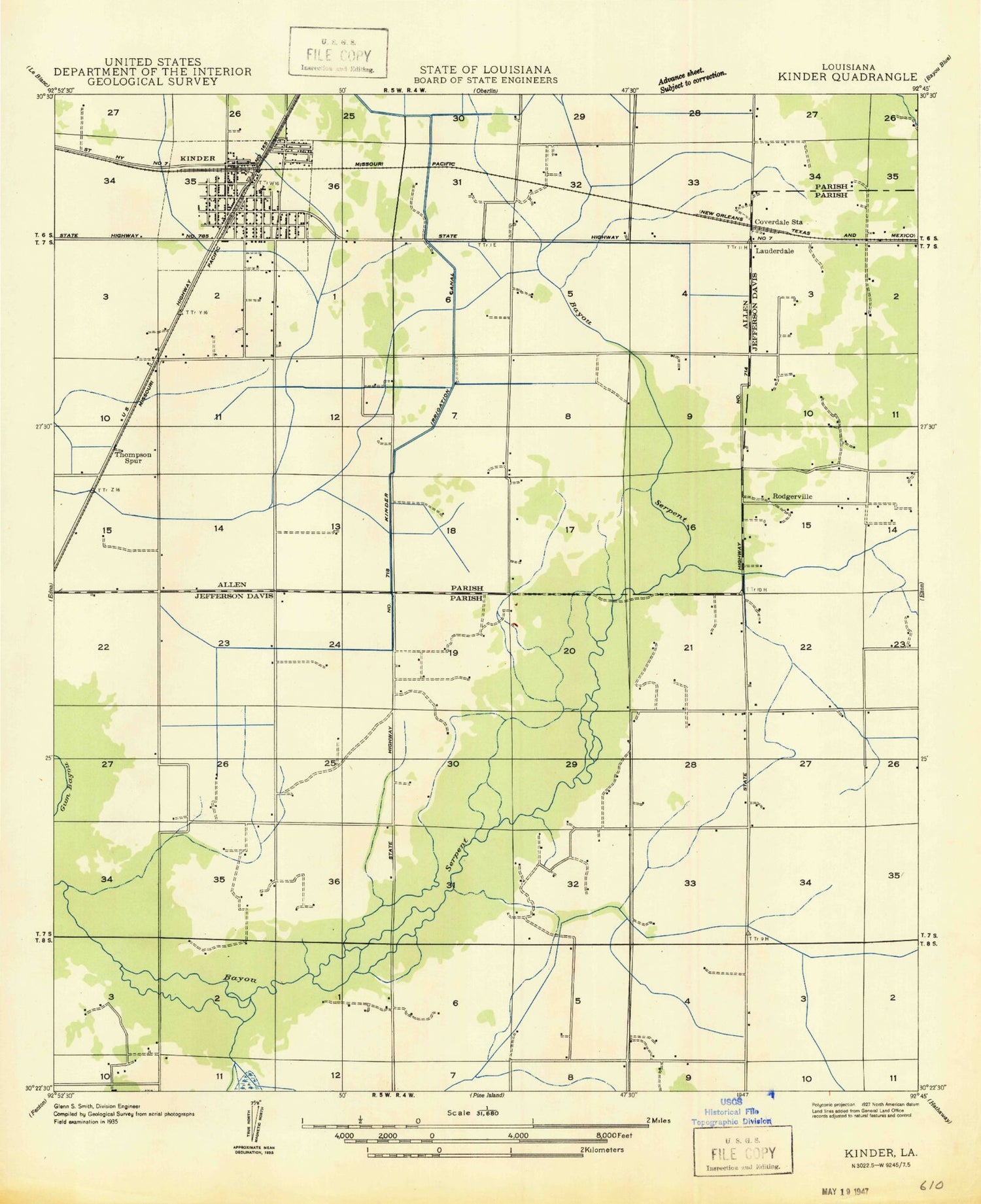
MyTopo
Classic USGS Kinder Louisiana 7.5'x7.5' Topo Map
Couldn't load pickup availability
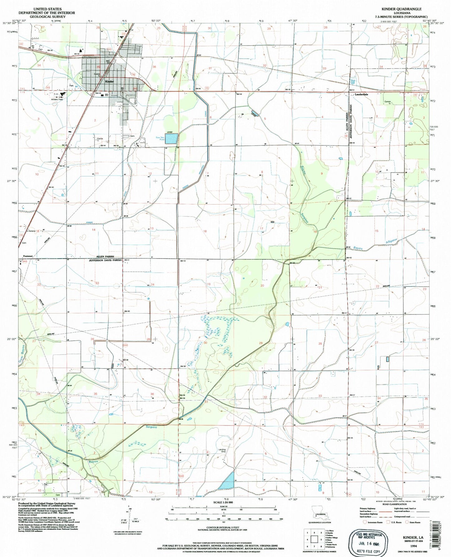
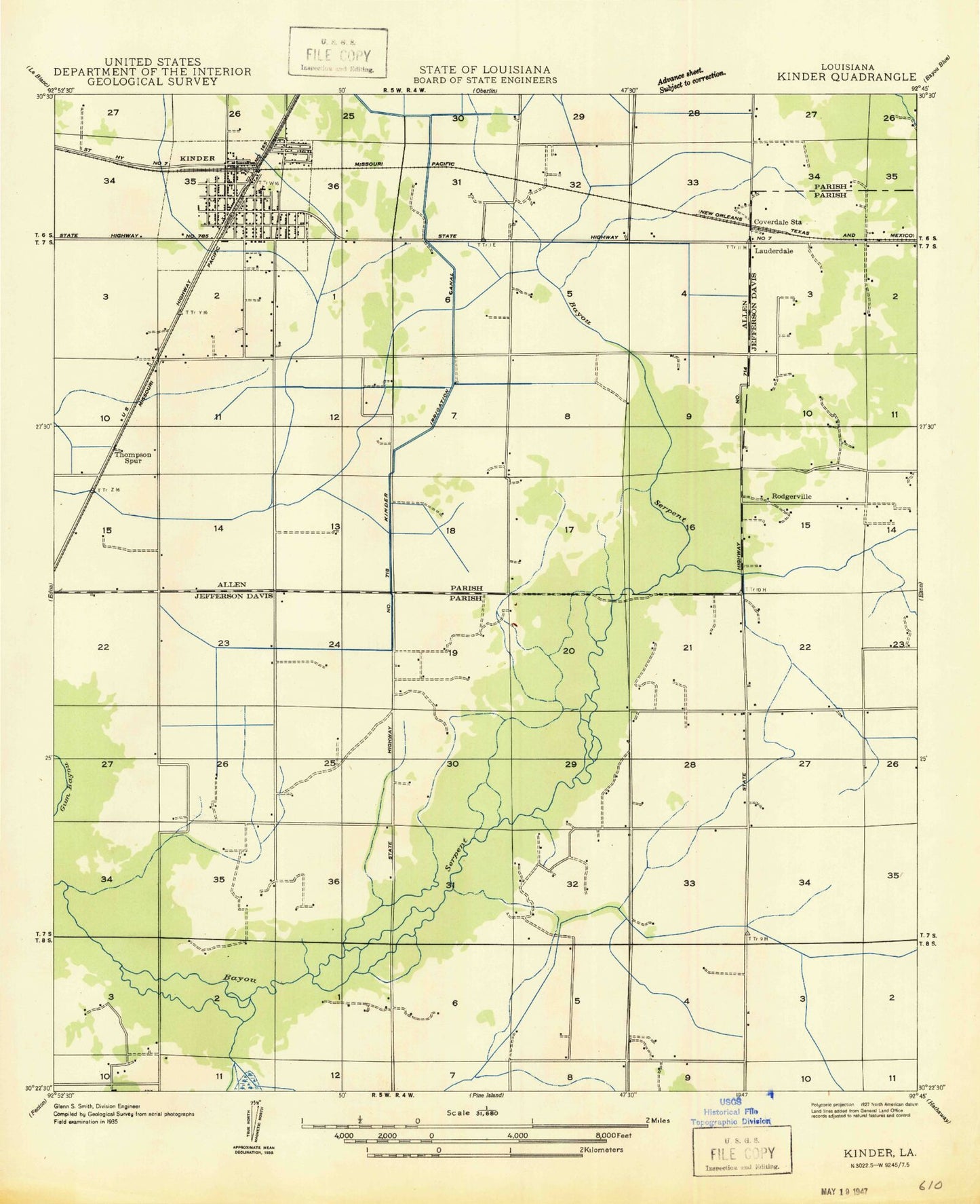
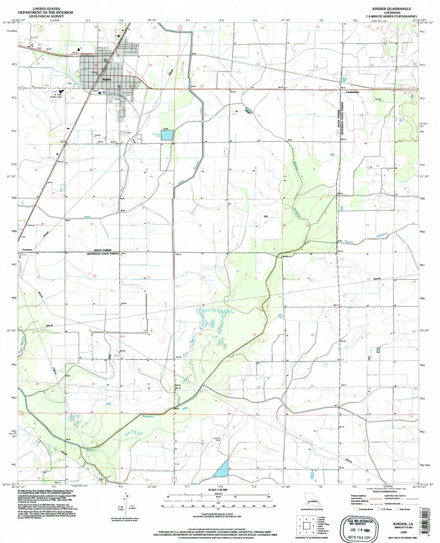
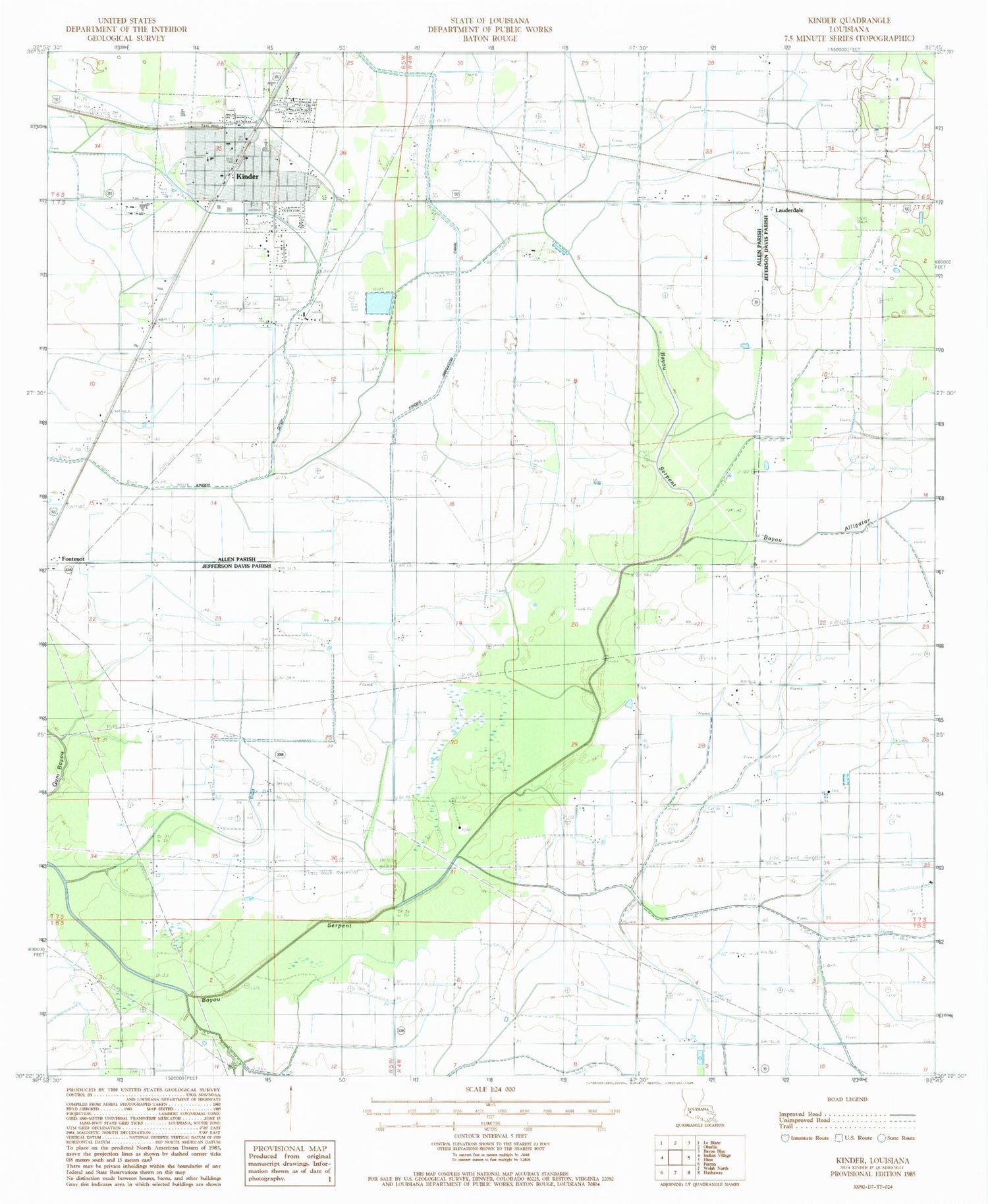
Historical USGS topographic quad map of Kinder in the state of Louisiana. Map scale may vary for some years, but is generally around 1:24,000. Print size is approximately 24" x 27"
This quadrangle is in the following counties: Allen, Jefferson Davis.
The map contains contour lines, roads, rivers, towns, and lakes. Printed on high-quality waterproof paper with UV fade-resistant inks, and shipped rolled.
Contains the following named places: Allen Parish Hospital, Allen Parish Library Kinder Branch, Bayou Alligator, Christ Praise and Worship Center, Church Alive of Kinder, Coverdale, First Baptist Church, First United Methodist Church, Hannah Chapel African Methodist Episcopal Church, Kinder, Kinder Bible Church, Kinder Canal, Kinder Church of Christ, Kinder Ditch, Kinder Elementary School, Kinder Fire Department, Kinder High School, Kinder Middle School, Kinder Police Department, Kinder Post Office, Kinder Water Treatment Plant, Lauderdale, LeBleu Cemetery, Louisiana Noname 107 Dam, McGee Cemetery, New Hope Assembly Church, North Edna Oil Field, Parish Governing Authority District 6, Saint Philip Neri Church, Thompson Spur, Town of Kinder, Ward Two, West Edna Gas Field