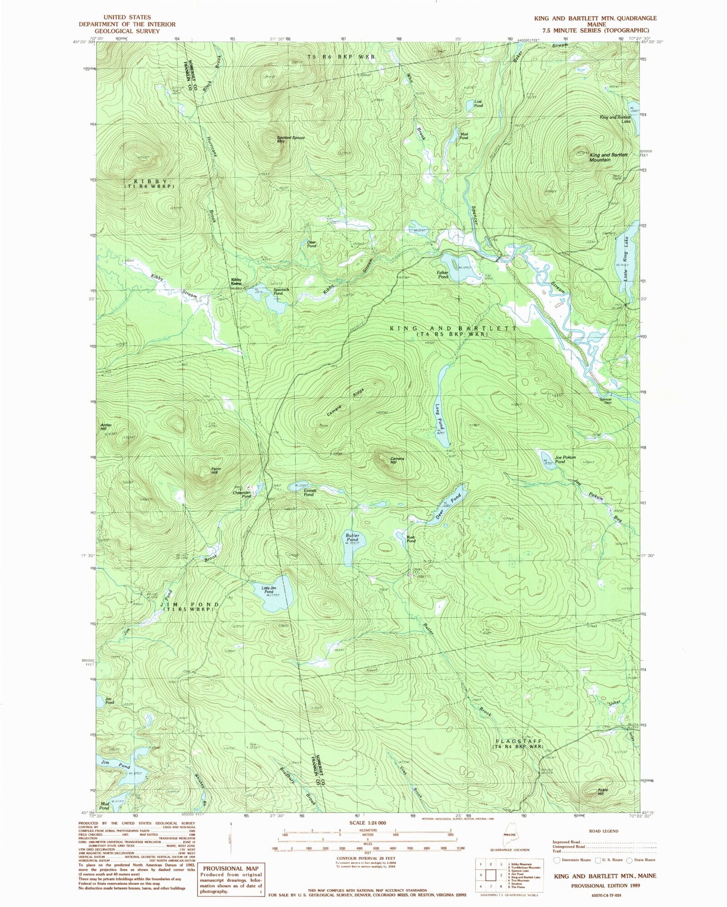
MyTopo
Classic USGS King And Bartlett Mountain Maine 7.5'x7.5' Topo Map
Couldn't load pickup availability
Historical USGS topographic quad map of King And Bartlett Mountain in the state of Maine. Typical map scale is 1:24,000, but may vary for certain years, if available. Print size: 24" x 27"
This quadrangle is in the following counties: Franklin, Somerset.
The map contains contour lines, roads, rivers, towns, and lakes. Printed on high-quality waterproof paper with UV fade-resistant inks, and shipped rolled.
Contains the following named places: Black Brook, Butler Pond, Camera Hill, Camera Ridge, Chittenden Pond, Deer Pond, Everett Pond, Farm Hill, Felker Pond, Hurricane Brook, Jim Pond Brook, Joe Pokum Pond, Kibby Kamp, Kibby Stream, King and Bartlett Mountain, Little Jim Pond, Little King Lake, Long Pond, Lost Pond, Mud Pond, Mud Pond, Otter Pond, Pickle Hill, Rush Pond, Spectacle Pond, Spencer Dam, Spotted Spruce Mountain, The Chimes, Whit Brook, Spencer Stream Dam, Spencer Stream, King and Bartlett Township