MyTopo
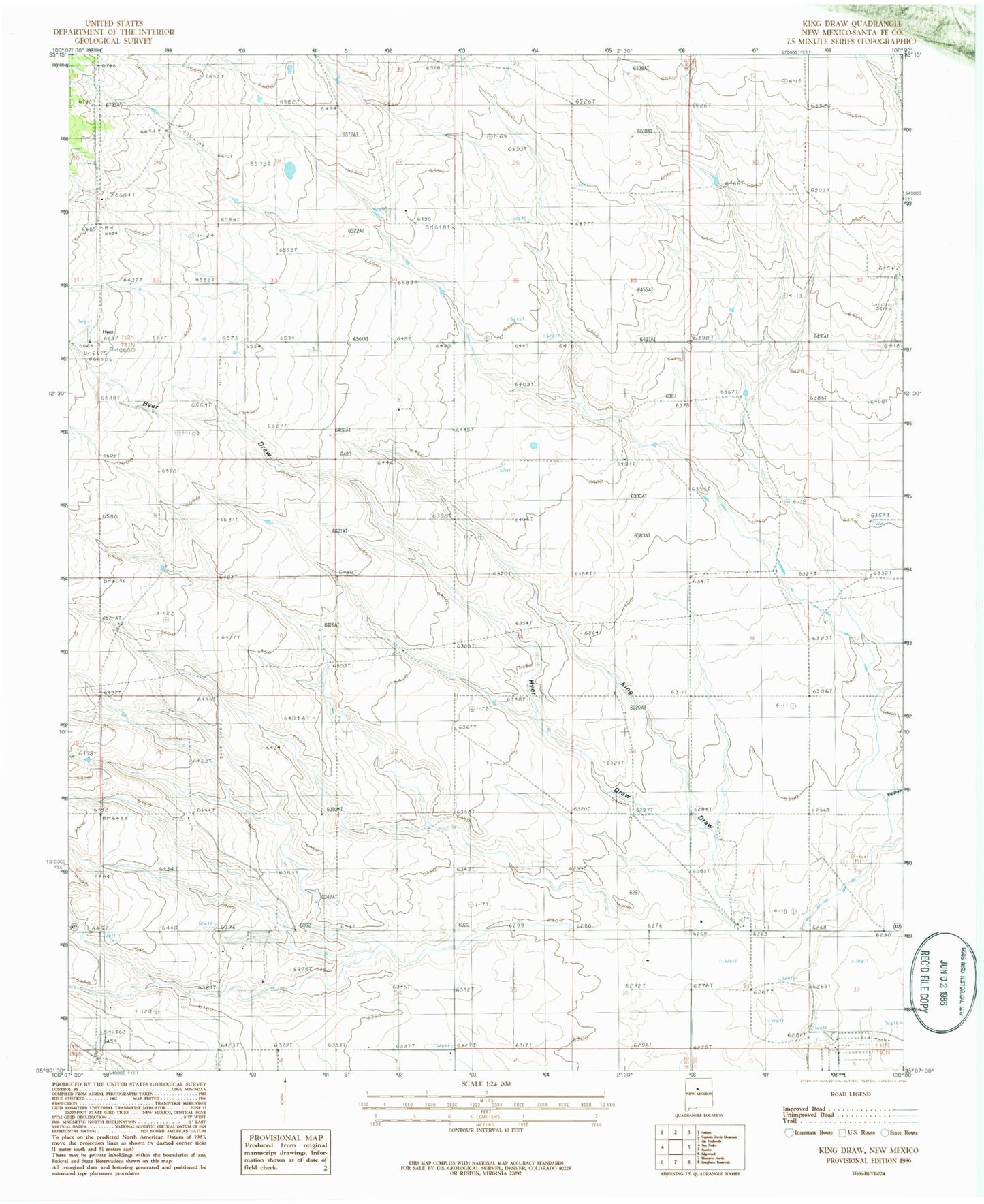
Classic USGS King Draw New Mexico 7.5'x7.5' Topo Map
Couldn't load pickup availability
Historical USGS topographic quad map of King Draw in the state of New Mexico. Map scale may vary for some years, but is generally around 1:24,000. Print size is approximately 24" x 27"
This quadrangle is in the following counties: Santa Fe.
The map contains contour lines, roads, rivers, towns, and lakes. Printed on high-quality waterproof paper with UV fade-resistant inks, and shipped rolled.
Contains the following named places: 10264 Water Well, Big Draw, Big Sky Airport, Canada de la Narrias, F Yates Ranch, Fullingim Ranch, Godec Ranch, Hyer, Hyer Cemetery, Hyer Draw, Hyer Post Office, Irby Ranch, J Yates Ranch, King Bros Ranch, King Draw, P Simmons Place, Santa Fe County Volunteer Fire Stanley District Station 1, Van Scoyk Ranch