MyTopo
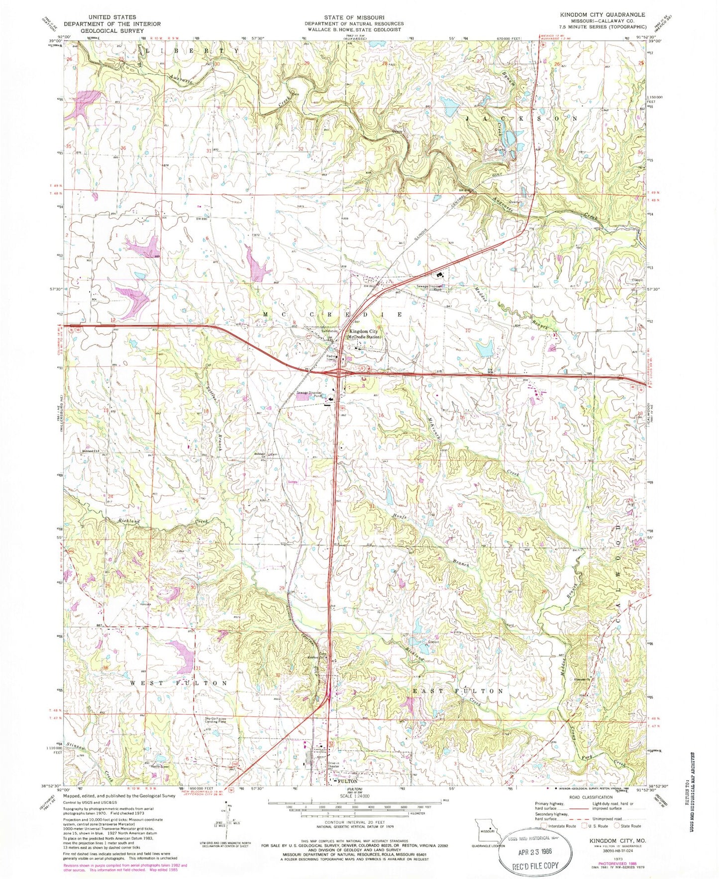
Classic USGS Kingdom City Missouri 7.5'x7.5' Topo Map
Couldn't load pickup availability
Historical USGS topographic quad map of Kingdom City in the state of Missouri. Map scale may vary for some years, but is generally around 1:24,000. Print size is approximately 24" x 27"
This quadrangle is in the following counties: Callaway.
The map contains contour lines, roads, rivers, towns, and lakes. Printed on high-quality waterproof paper with UV fade-resistant inks, and shipped rolled.
Contains the following named places: Allen Branch, Atkinson Lake Dam, Atkinson School, Backer Dam, Baker Lake, Baker Lake Dam, Borman Lake Dam, Bynum Creek, Callaway, Craig School, Dorsey School, Ebenezer Church, Guthrie Lake, Guthrie Lake Dam, Hardin School, Houfs Branch, Kingdom City, Kingdom City Post Office, Leeper Branch, Lehenbaur Lake Section 25 Dam, Maddox Branch, Maddox School, Martien School, McCredie, McCredie Experiment Station Dam, McCredie Watershed W-1 Reservoir, McKinney Creek, North Callaway Fire Protection District Station 1, North Callaway High School, Renner Dam, Richland Church, Richland Creek, Rocky Branch, Saint Eunice School, Sallees Branch, Sky-Go Farms Airport, Township of McCredie, Village of Kingdom City, ZIP Code: 65262