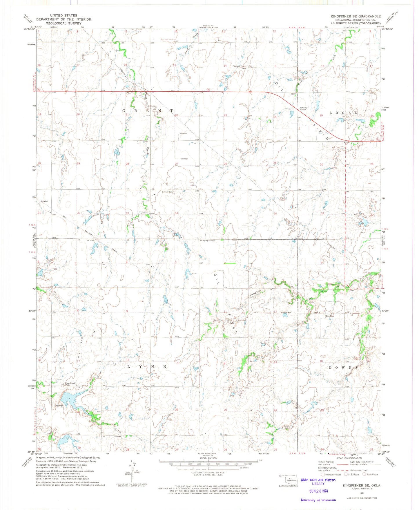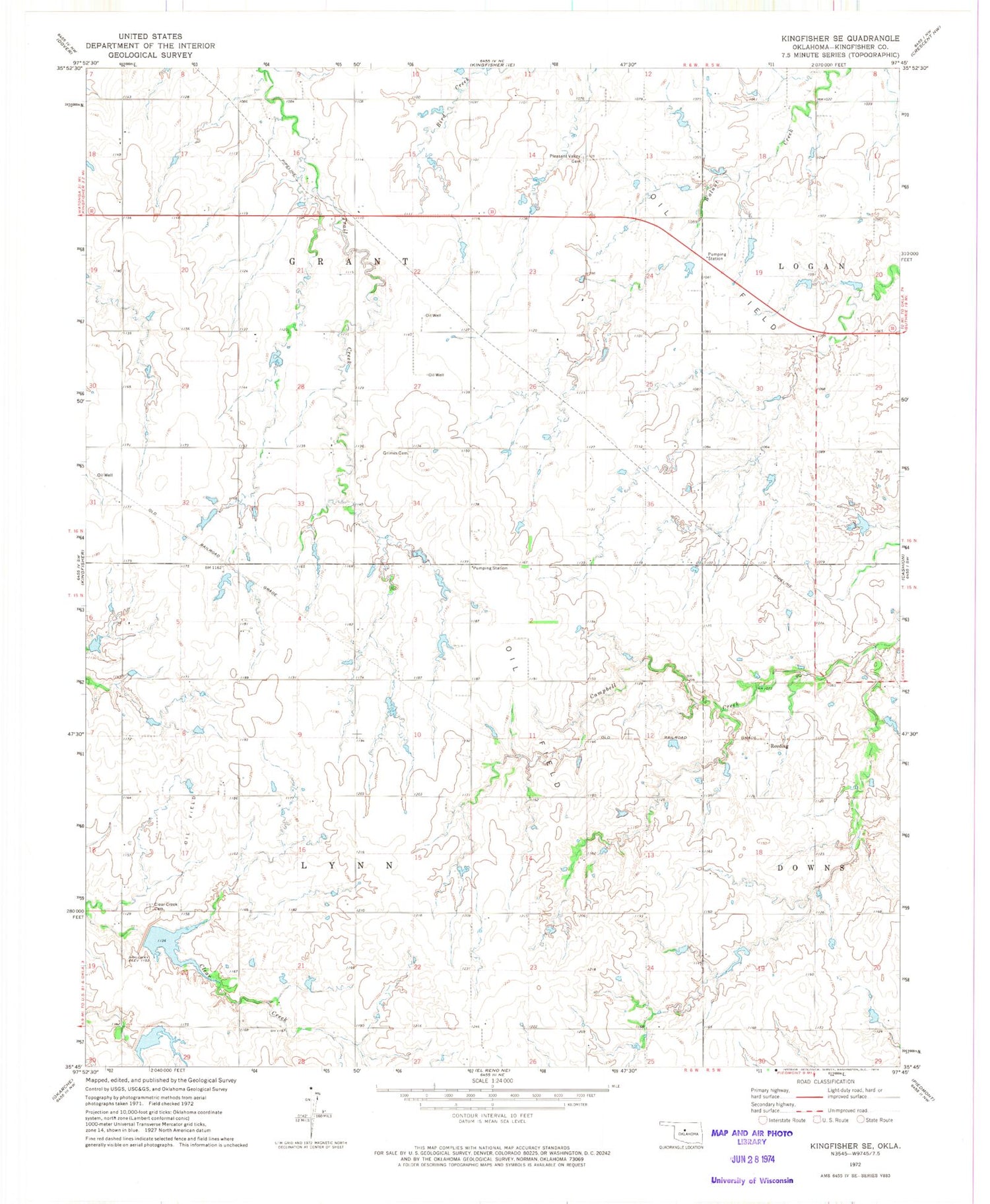
MyTopo
Classic USGS Kingfisher SE Oklahoma 7.5'x7.5' Topo Map
Couldn't load pickup availability
Historical USGS topographic quad map of Kingfisher SE in the state of Oklahoma. Map scale may vary for some years, but is generally around 1:24,000. Print size is approximately 24" x 27"
This quadrangle is in the following counties: Kingfisher.
The map contains contour lines, roads, rivers, towns, and lakes. Printed on high-quality waterproof paper with UV fade-resistant inks, and shipped rolled.
Contains the following named places: Big 4 Rural Volunteer Fire Department, Clear Creek Cemetery, Dave's Place Airport, Grimes Cemetery, Jech Creek, Oknoname 07303 Dam, Oknoname 07303 Reservoir, Oknoname 07311 Reservoir, Oknoname 083022 Dam, Oknoname 083022 Reservoir, Pleasant Valley Cemetery, Reeding, Township of Grant, Township of Lynn, Uncle John Creek Site 12 Dam, Uncle John Creek Site 12 Reservoir, Uncle John Creek Site 13 Dam, Uncle John Creek Site 13 Reservoir