MyTopo
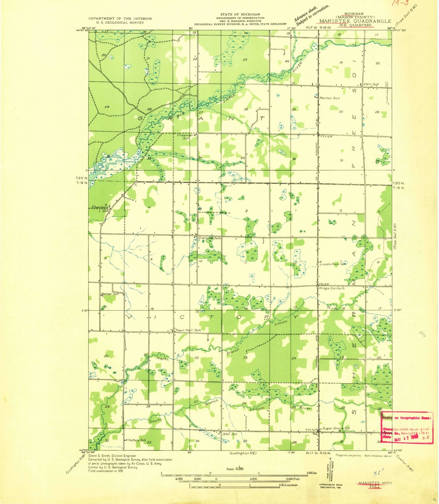
Classic USGS Kings Corners Michigan 7.5'x7.5' Topo Map
Couldn't load pickup availability
Historical USGS topographic quad map of Kings Corners in the state of Michigan. Typical map scale is 1:24,000, but may vary for certain years, if available. Print size: 24" x 27"
This quadrangle is in the following counties: Mason.
The map contains contour lines, roads, rivers, towns, and lakes. Printed on high-quality waterproof paper with UV fade-resistant inks, and shipped rolled.
Contains the following named places: Costello Creek, Davis Creek, Freeman Creek, Kings Corners, Lincoln River School, Maple Grove Cemetery, North Branch Lincoln River, North Victory Cemetery, Saint Johns Church, South Branch Lincoln River, Sugar Grove, Trinity Church, Olson Drain, Victory Township School, West Shore Community College, Grant Township Cemetery, WCMW-TV (Manistee), Township of Grant, Township of Victory, Sugargrove Post Office (historical), Sugar Grove Cemetery