
MyTopo
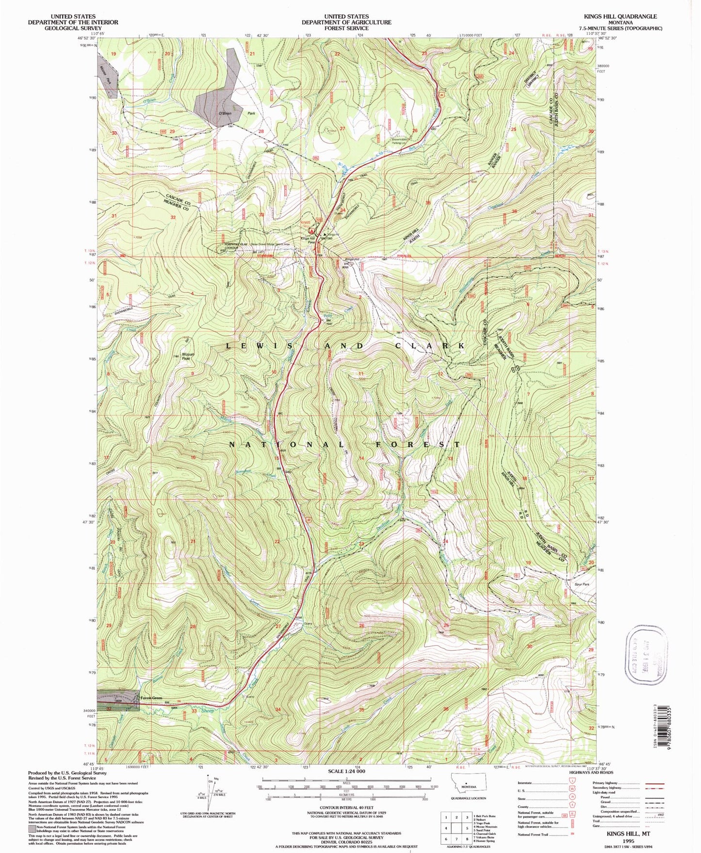
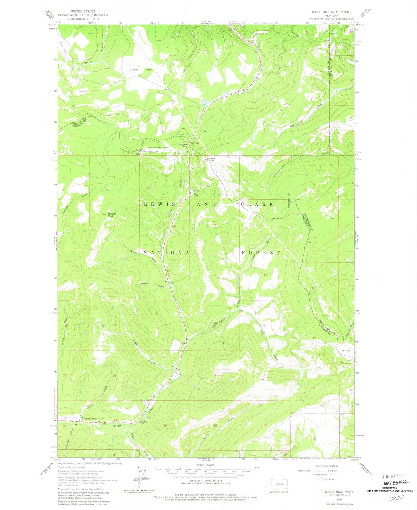
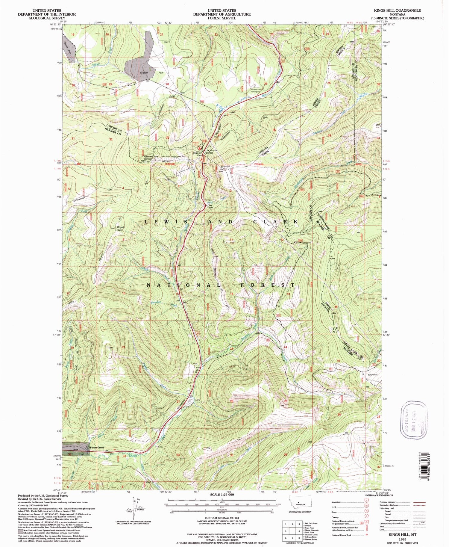
Classic USGS Kings Hill Montana 7.5'x7.5' Topo Map
Couldn't load pickup availability
Historical USGS topographic quad map of Kings Hill in the state of Montana. Map scale may vary for some years, but is generally around 1:24,000. Print size is approximately 24" x 27"
This quadrangle is in the following counties: Cascade, Judith Basin, Meagher.
The map contains contour lines, roads, rivers, towns, and lakes. Printed on high-quality waterproof paper with UV fade-resistant inks, and shipped rolled.
Contains the following named places: Arkansas Traveller Ski Trail, Barnaboo Creek, Big Seven Ski Trail, Black Diamond Ski Trail, Bonine Creek, Brown-eyed Queen Ski Trail, Canyon Creek, Cascade Creek, Compromise Pass Ski Trail, Cumberland Ski Trail, Deadman Creek, Dynamite Ski Trail, Forest Green, Frisco Ski Trail, Galen Post Office, Geronimo Ski Trail, Glory Hole Ski Trail, Golden Goose Ski Trail, Good Luck Ski Trail, Gun Barrel Ski Trail, James Bond Ski Trail, King Hill Winter Sports Area, Kings Hill, Kings Hill Campground, Kings Hill Guard Station, Kings Hill Pass, Kings Hill Quarry, Lamb Creek, Lamb Creek Campground, Last Chance Gulch Ski Trail, Lewis and Clark National Forest, Lishen Creek, Mizpah Creek, Mizpah Peak, Mizpah Race Hill Ski Trail, Mizpah Ski Trail, Moly Ski Trail, Muley Ski Trail, North Fork Deadman Creek, Nugget Creek, O'Brien Park, Pan Handle Ski Trail, Pay Dirt Ski Trail, Petty Creek, Porphyry Peak, Porphyry Peak Lookout, Prentice Ski Trail, Quicksilver Lower Ski Trail, Quicksilver Upper Ski Trail, Ripley Lower Ski Trail, Ripley Upper Ski Trail, Ruby Gulch Ski Trail, Ruby Ski Trail, Second Thought Ski Trail, Silverhorn Ski Trail, Sluice Box Ski Trail, Sour Dough Hill Ski Trail, South Fork Deadman Creek, Speculation Ski Trail, Thale Post Office, Yogo Ski Trail