MyTopo
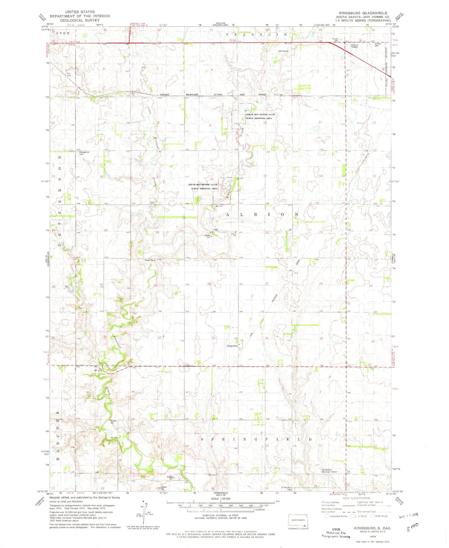
Classic USGS Kingsburg South Dakota 7.5'x7.5' Topo Map
Couldn't load pickup availability
Historical USGS topographic quad map of Kingsburg in the state of South Dakota. Map scale may vary for some years, but is generally around 1:24,000. Print size is approximately 24" x 27"
This quadrangle is in the following counties: Bon Homme.
The map contains contour lines, roads, rivers, towns, and lakes. Printed on high-quality waterproof paper with UV fade-resistant inks, and shipped rolled.
Contains the following named places: Albion School, Bon Homme County, Evan Church, Evangelical Cemetery, Kingsburg, Little Emanuel Creek, North Bon Homme State Public Shooting Area, Saint Leo Cemetery, Sattler Cemetery, School Number 31, School Number 32, School Number 33, School Number 34, School Number 60, School Number 75, School Number 76, School Number 77, South Bon Homme State Public Shooting Area, Springfield Municipal Airport, Township of Albion, Township of Springfield, Tyndall Cemetery, Unorganized Territory of Southwest Bon Homme