MyTopo
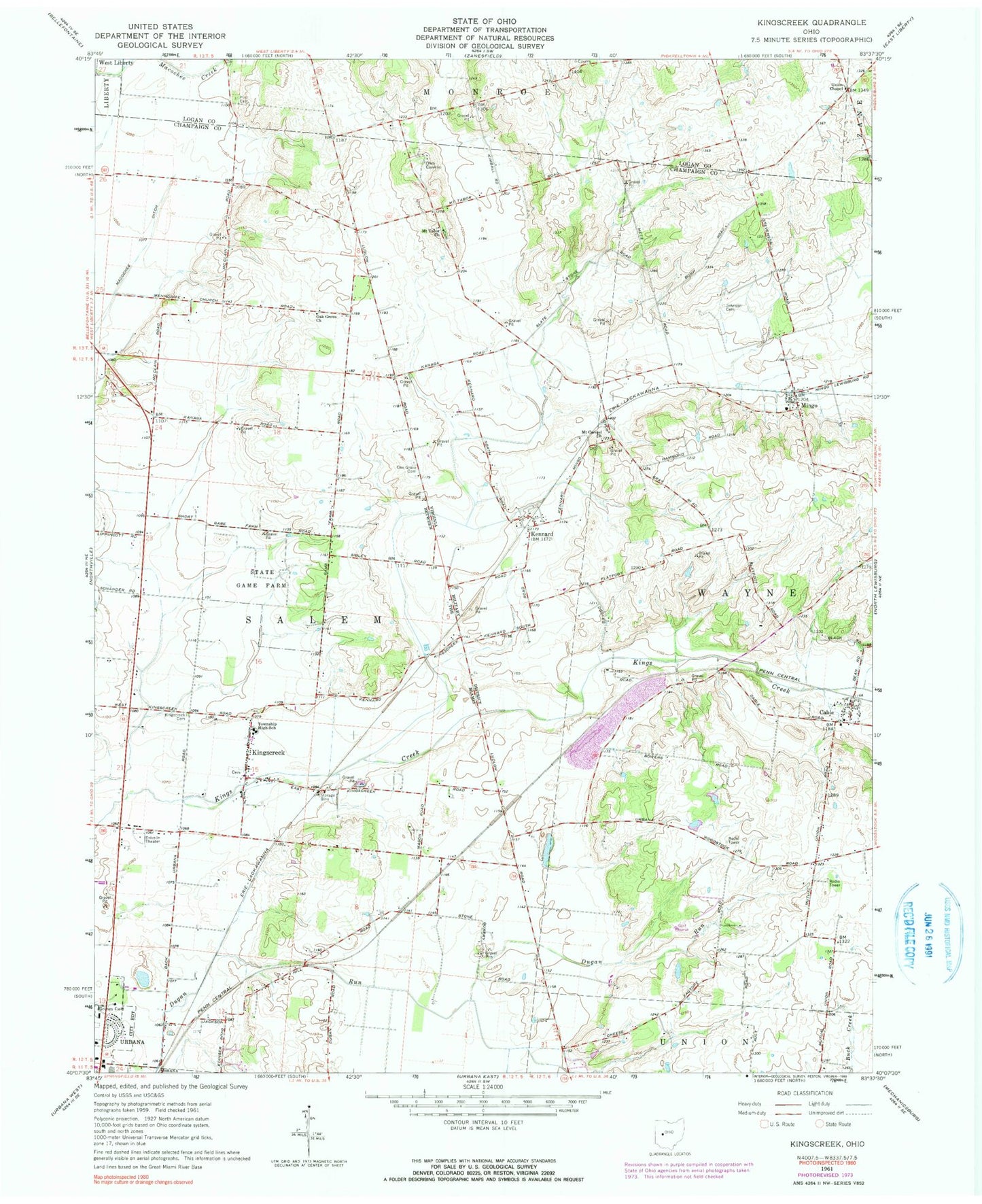
Classic USGS Kingscreek Ohio 7.5'x7.5' Topo Map
Couldn't load pickup availability
Historical USGS topographic quad map of Kingscreek in the state of Ohio. Map scale may vary for some years, but is generally around 1:24,000. Print size is approximately 24" x 27"
This quadrangle is in the following counties: Champaign, Logan.
The map contains contour lines, roads, rivers, towns, and lakes. Printed on high-quality waterproof paper with UV fade-resistant inks, and shipped rolled.
Contains the following named places: Cable, Cable Cemetery, Cable Post Office, Dugan Prairie, Freshwater Farms of Ohio, Grimes Field, Hagenbaugh, Johnson Cemetery, Kennard, Kennard Church of the Nazarene, Kennard Post Office, Kings Creek Mill, Kings Creek Post Office, Kingscreek, Kingscreek Baptist Cemetery, Kingscreek Baptist Church, Kingscreek Cemetery, Kingscreek United Methodist Church, Mackachack, Mar-nel Mobile Home Park, Mingo, Mingo Post Office, Mount Carmel Cemetery, Mount Carmel Church, Mount Tabor Cemetery, Mount Tabor Church, Mount Tabor School, Oak Grove Cemetery, Oak Grove Church, Piatt Cemetery, School Number 12, Township of Salem, Township of Wayne, Union Chapel, Woodland Golf Course, ZIP Code: 43009