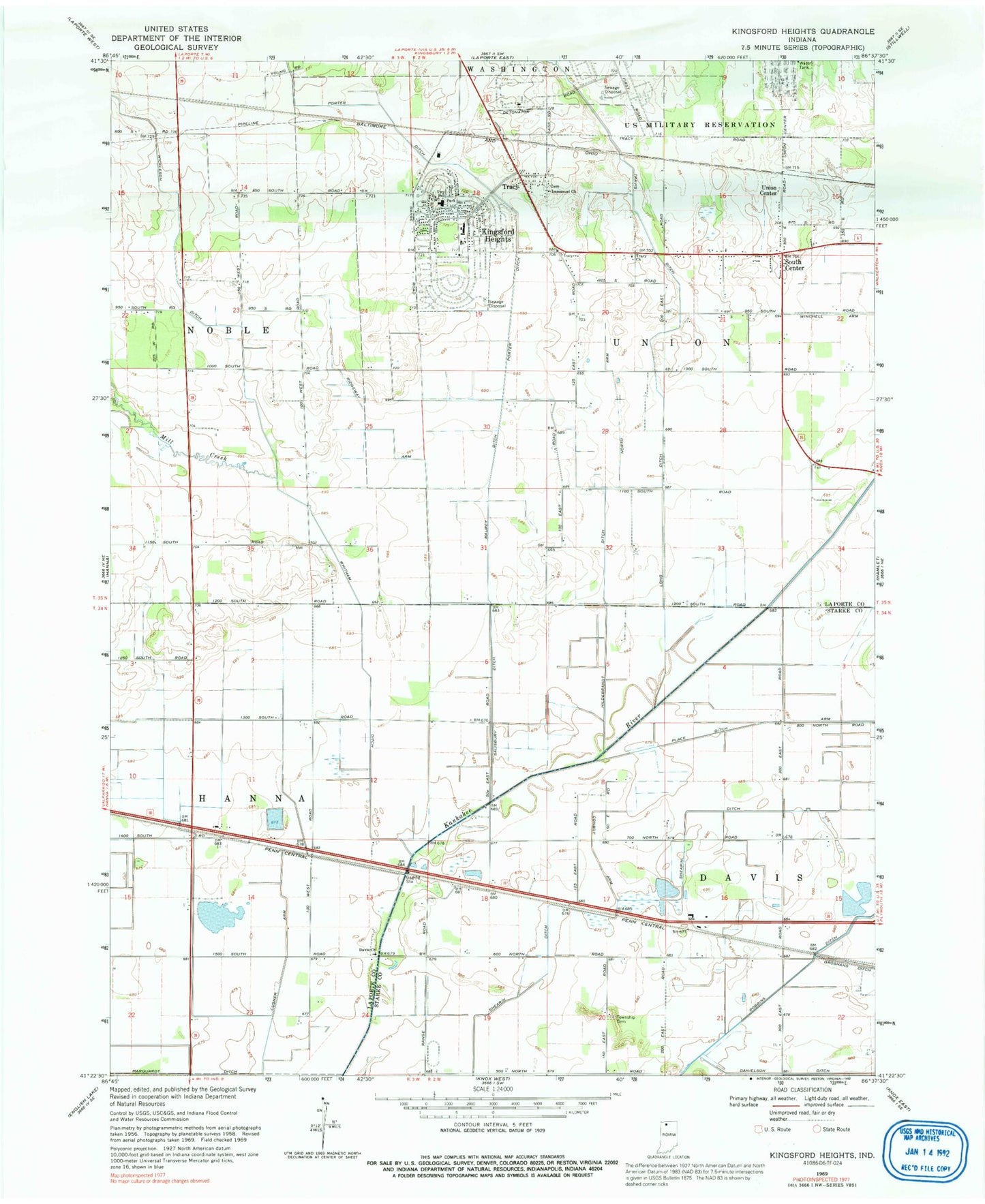
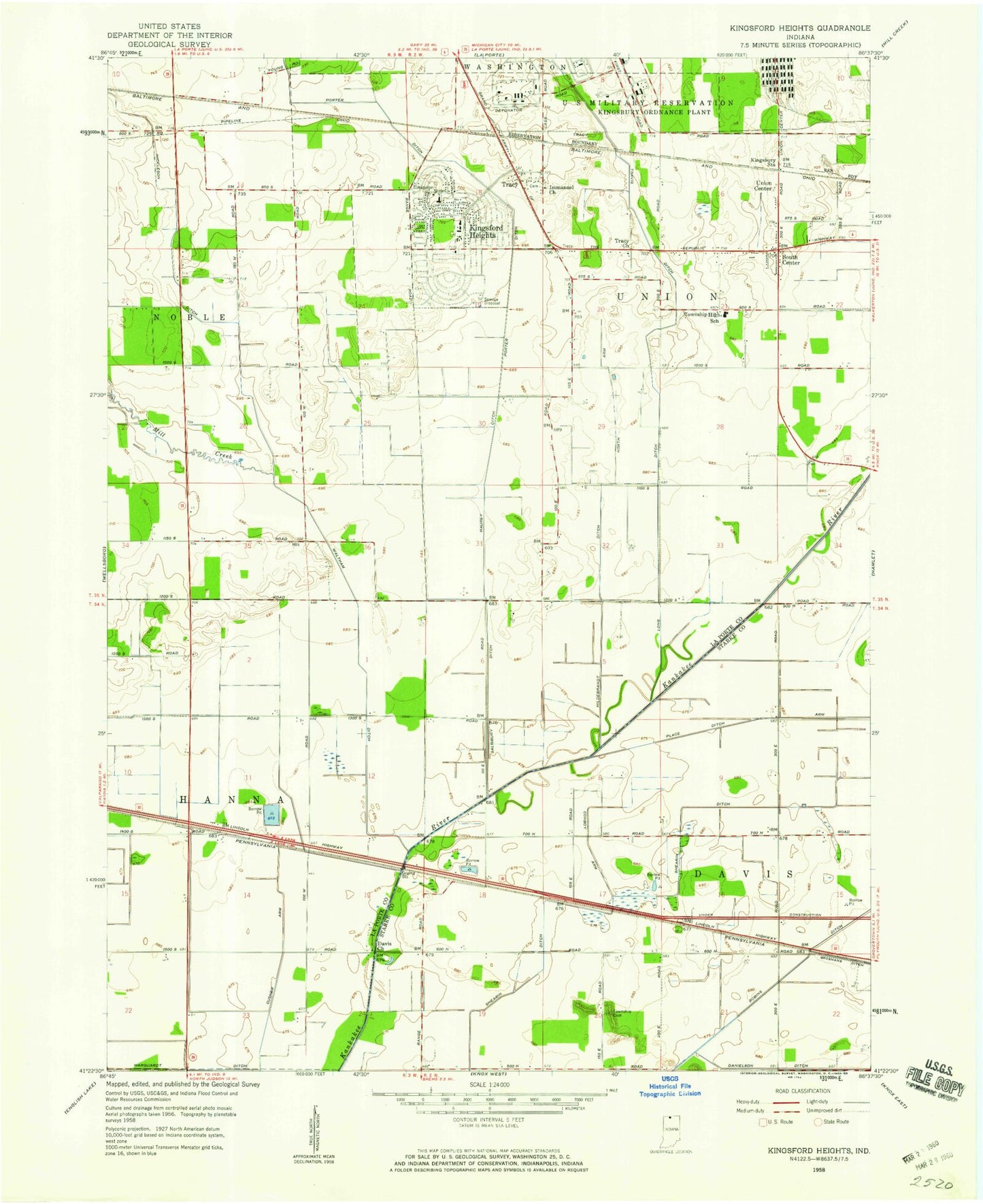
MyTopo
Classic USGS Kingsford Heights Indiana 7.5'x7.5' Topo Map
Couldn't load pickup availability
Historical USGS topographic quad map of Kingsford Heights in the state of Indiana. Map scale may vary for some years, but is generally around 1:24,000. Print size is approximately 24" x 27"
This quadrangle is in the following counties: LaPorte, Starke.
The map contains contour lines, roads, rivers, towns, and lakes. Printed on high-quality waterproof paper with UV fade-resistant inks, and shipped rolled.
Contains the following named places: Conboy Arm, Cusher Arm, Davis Church, Hickleson Ditch, Hildebrandt Ditch, Immanuel Church, Kingsford Heights, Kingsford Heights Elementary School, Kingsford Heights Post Office, Kingsford Union Volunteer Fire Department, Long Ditch, Marquardt Ditch, Maurey Ditch, Mill Creek, North Arm, Place Ditch Arm, Porter Ditch, Ridgeway Arm, Salisbury Ditch, Shamrock Airport, Shearin Ditch, South Center, Town of Kingsford Heights, Township of Davis, Township of Hanna, Township of Union, Tracy, Tracy Church, Union Center, Whitham Ditch, Winchell Arm, ZIP Code: 46346