
MyTopo
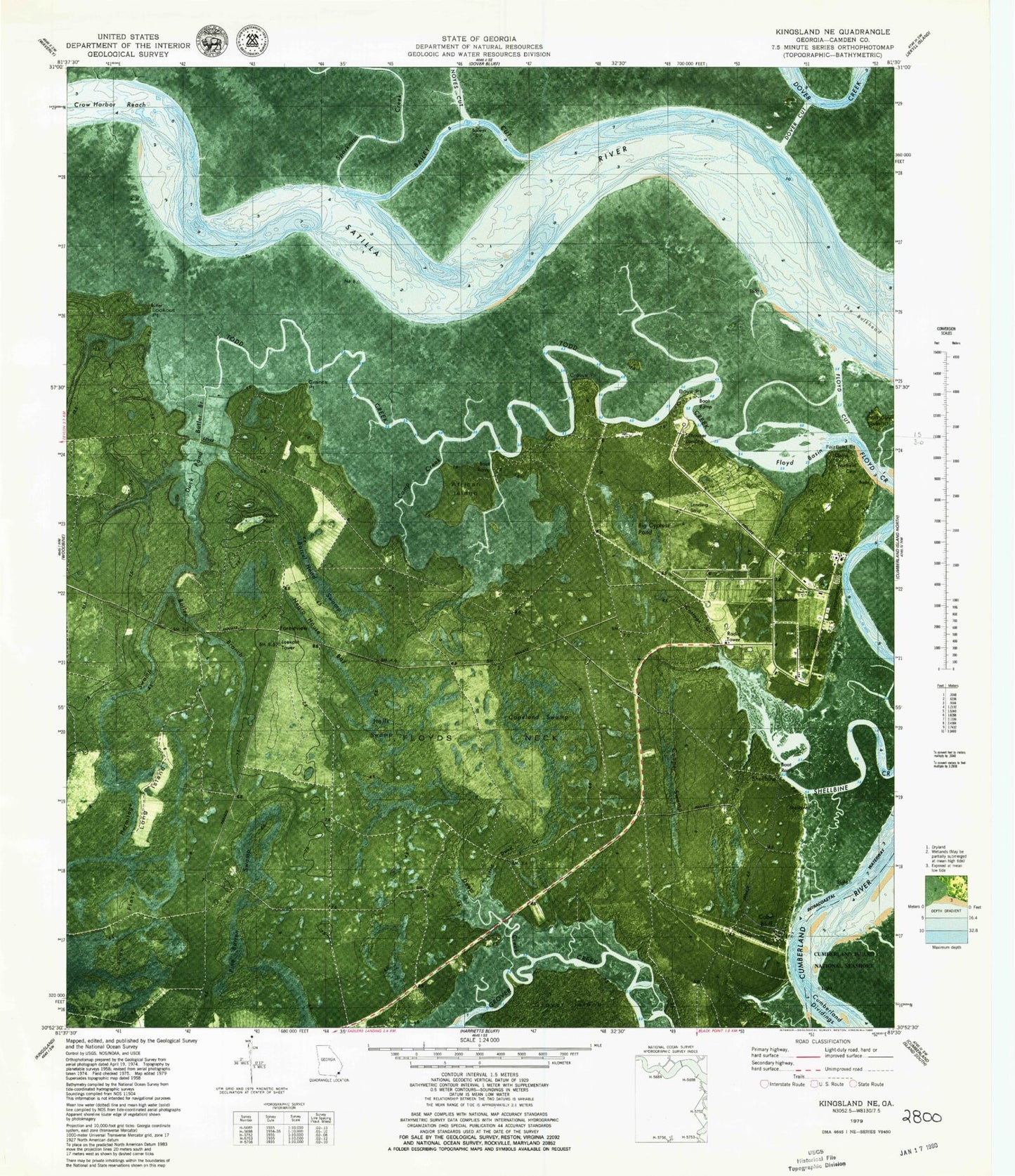
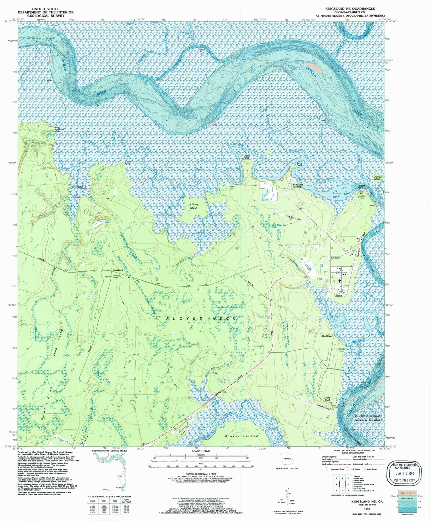
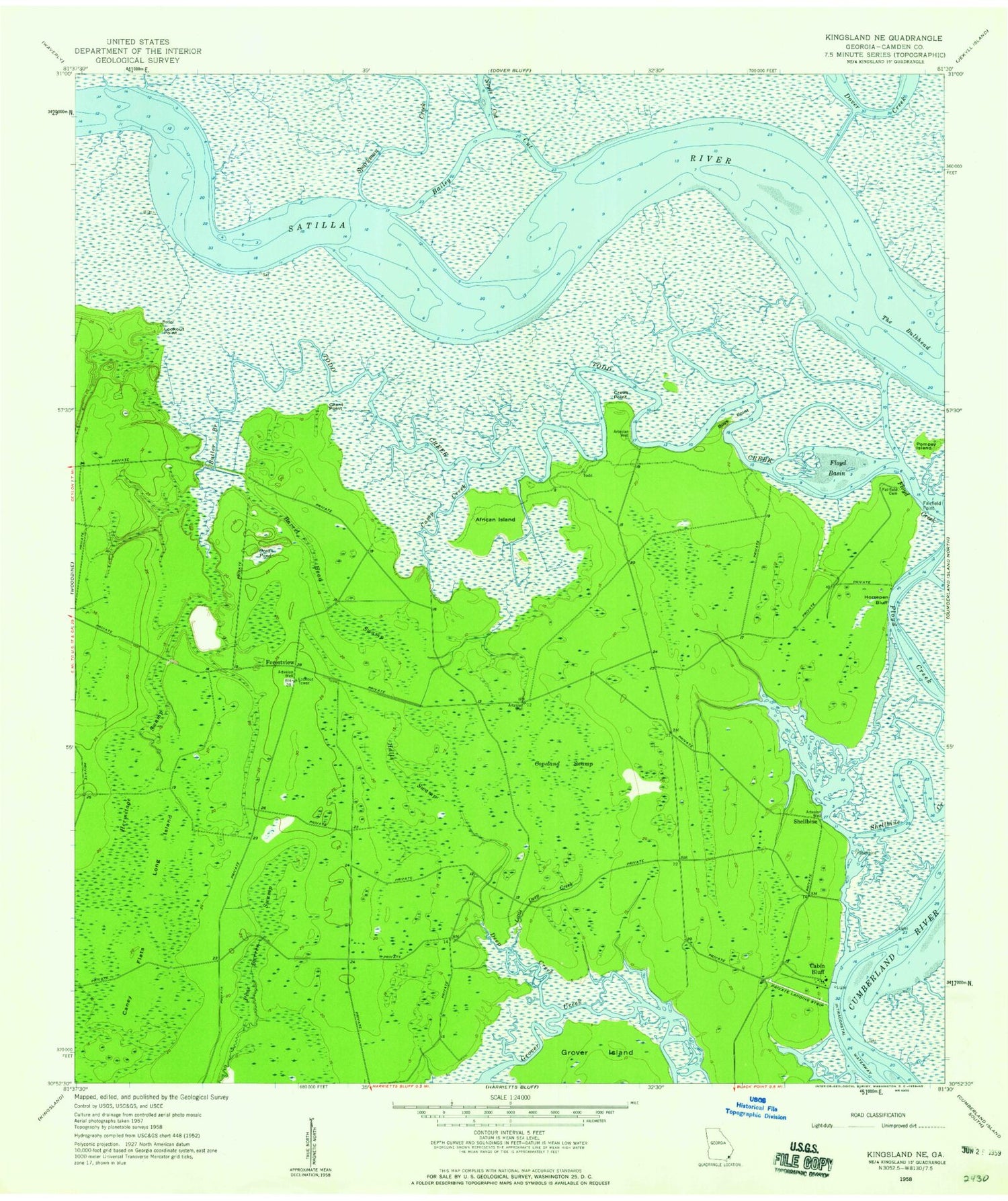
Classic USGS Kingsland NE Georgia 7.5'x7.5' Topo Map
Couldn't load pickup availability
Historical USGS topographic quad map of Kingsland NE in the state of Georgia. Map scale may vary for some years, but is generally around 1:24,000. Print size is approximately 24" x 27"
This quadrangle is in the following counties: Camden.
The map contains contour lines, roads, rivers, towns, and lakes. Printed on high-quality waterproof paper with UV fade-resistant inks, and shipped rolled.
Contains the following named places: African Island, Bailey Cut, Barrel Head Swamp, Bell View, Bellevue Plantation, Big Cypress Pond, Boys Point, Butler Branch, Cabin Bluff, Camp Creek, Caney Flats, Cooper Swamp, Copeland Swamp, Cottage Creek, Crews Point, Cumberland Dividings, Cumberland River, Deep Creek, Dover Cut, Duck Pond, Fairfield Cemetery, Fairfield Point, Fairview Church, Floyd Basin, Floyd Creek, Floyd Cut, Floyds Neck, Forestview, Grants Point, Grover Creek, Grover Island, Grover View, Halls Swamp, Hermitage Plantation, Hermitage Swamp, Horsepen Bluff, Long Island, Lookout Point, Negro House Bay, Noyles Cut, Ocean Pond, Pine Barren Swamp, Pompey Island, Schooner Landing, Shellbine, Sparkman Creek, The Bulkhead, Todd Creek, Union Carbide Plant Strip