MyTopo
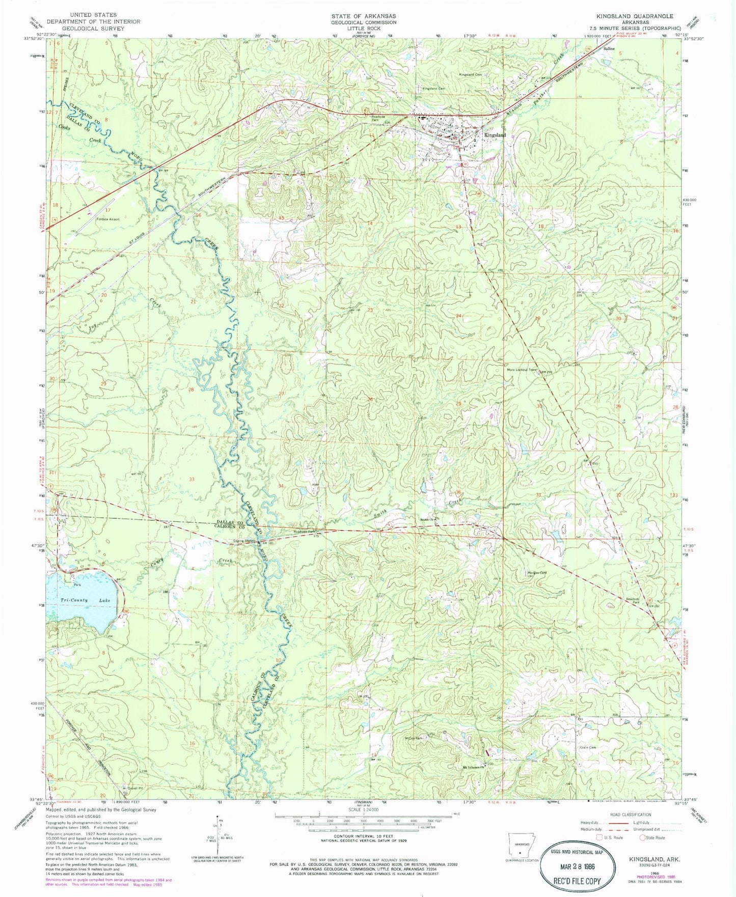
Classic USGS Kingsland Arkansas 7.5'x7.5' Topo Map
Couldn't load pickup availability
Historical USGS topographic quad map of Kingsland in the state of Arkansas. Map scale may vary for some years, but is generally around 1:24,000. Print size is approximately 24" x 27"
This quadrangle is in the following counties: Calhoun, Cleveland, Dallas.
The map contains contour lines, roads, rivers, towns, and lakes. Printed on high-quality waterproof paper with UV fade-resistant inks, and shipped rolled.
Contains the following named places: Camp Creek, Caney Creek, City of Kingsland, Cooks Creek, Crain Cemetery, Draughon, Fordyce Municipal Airport, Jug Creek, Kingsland, Kingsland Cemetery, Kingsland Cemetery East, Kingsland Elementary School, Kingsland High School, Kingsland Police Department, Kingsland Post Office, Kingsland Volunteer Fire Department, Larson Lake, Marks Mill Battleground, McCoy Cemetery, Meek, Morgan Cemetery, Moro Lookout Tower, Mount Lebanon Church, Saline, Smith Church, Smith Creek, Tipton, Township of Dry Run, Tri-County Lake, Tri-County Lake Dam