MyTopo
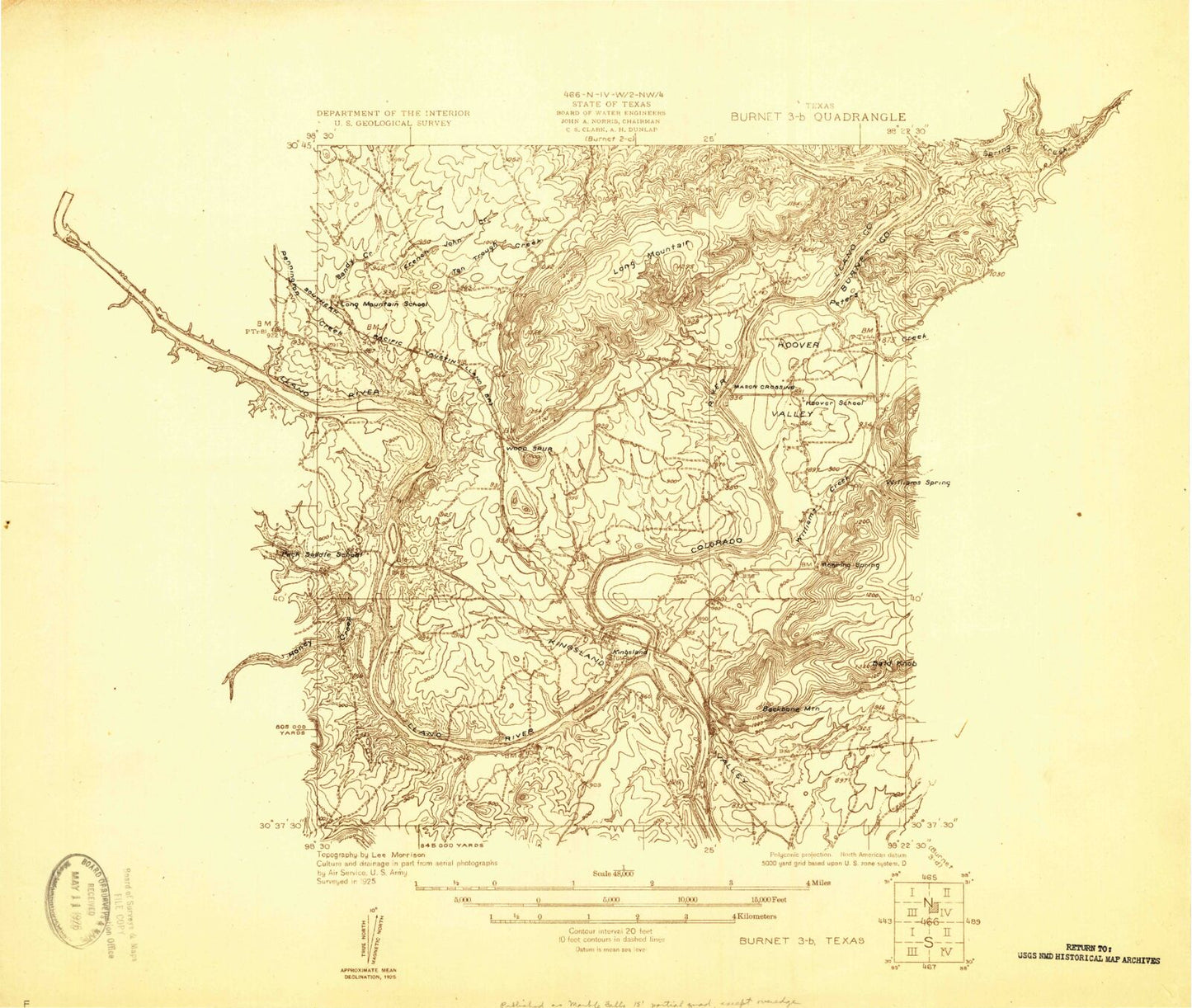
Classic USGS Kingsland Texas 7.5'x7.5' Topo Map
Couldn't load pickup availability
Historical USGS topographic quad map of Kingsland in the state of Texas. Typical map scale is 1:24,000, but may vary for certain years, if available. Print size: 24" x 27"
This quadrangle is in the following counties: Burnet, Llano.
The map contains contour lines, roads, rivers, towns, and lakes. Printed on high-quality waterproof paper with UV fade-resistant inks, and shipped rolled.
Contains the following named places: Backbone Mountain, Bald Knob, Boil Spring, Buchanan Dam, Buckner Boys Ranch, Clear Creek, Dry Creek, French John Creek, Haywood Memorial Church, Honey Creek, Hoovers Valley, Hoovers Valley Cemetery, Inks Lake, Kingsland, Kingsland Cemetery, Kingsland Lake, Lakeshore Church, Long Mountain, Mill Creek, Murchinson Cemetery, Pennington Creek, Roy Inks Dam, Saint Charles Catholic Church, Sandy Creek, Tantrough Creek, Williams Creek, Williams Spring, Llano River, Moss Creek, Peters Creek, Inks Dam National Fish Hatchery, Camp Longhorn Airport, Kingsland Estates Airport, Shirley Williams Airport, Carver Pre - Kindergarten Center, State Highway 29 Bridge, Lakeside Heights, First Union Church, Buchanan West Baptist Church, Chapel of the Hills Baptist Church, Buchanan Dam Post Office, Genesis Lutheran Church, Highland Lakes United Methodist Church, Inks Dam Substation, First Baptist Church, Highland Lakes Church of Christ, Kingsland Volunteer Fire Department, Kingsland Post Office, Kingsland Community Church, Kingsland Branch Library, Highland Lakes Baptist Church, Packsaddle Elementary School, Hoover Valley Chapel, Lakeside Retreat Church, Hill Country Full Gospel Church, Kingsland Census Designated Place, Llano County Sheriff's Office, Llano County Constable's Office, Turkey Feather Spring


