MyTopo
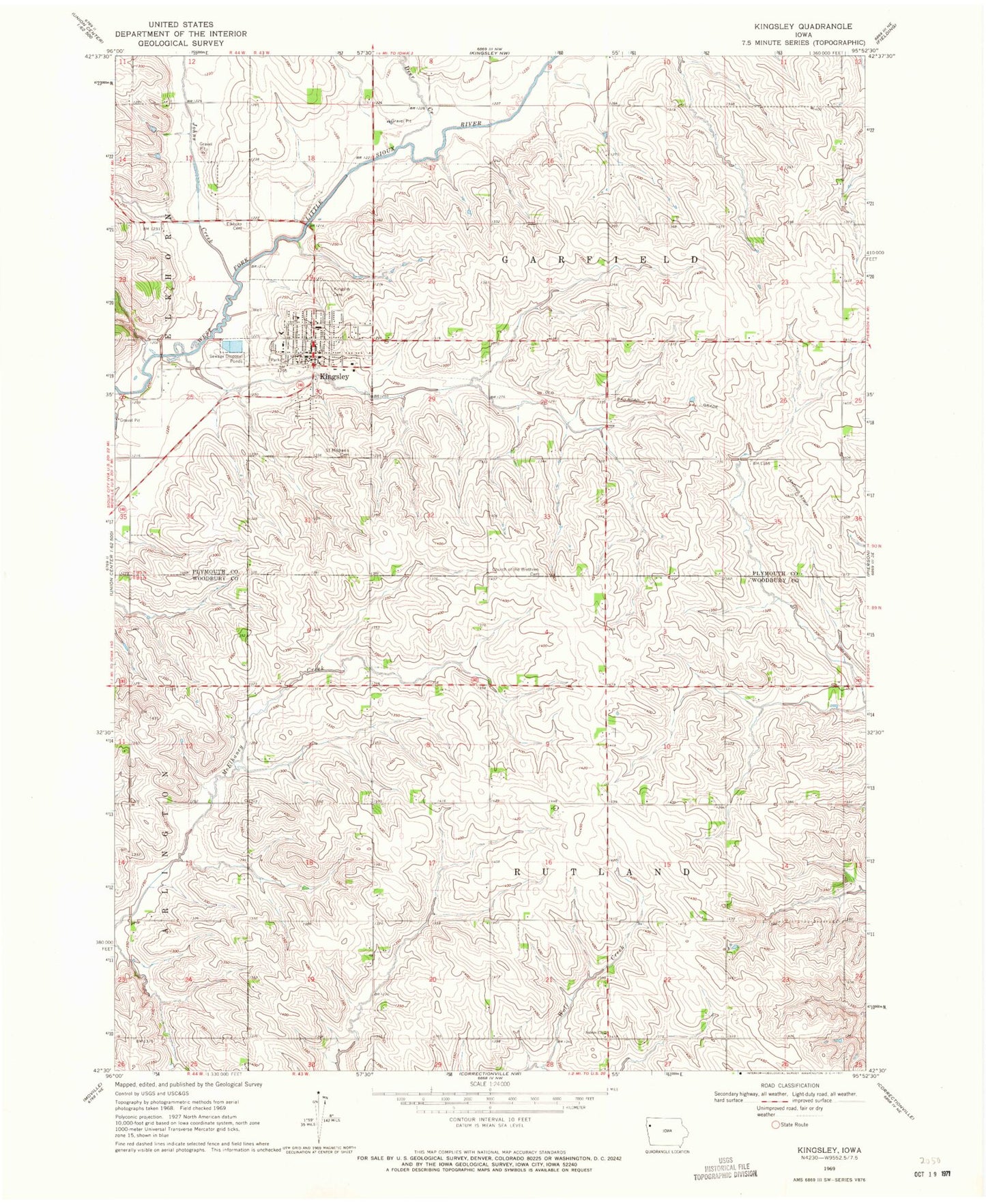
Classic USGS Kingsley Iowa 7.5'x7.5' Topo Map
Couldn't load pickup availability
Historical USGS topographic quad map of Kingsley in the state of Iowa. Map scale may vary for some years, but is generally around 1:24,000. Print size is approximately 24" x 27"
This quadrangle is in the following counties: Plymouth, Woodbury.
The map contains contour lines, roads, rivers, towns, and lakes. Printed on high-quality waterproof paper with UV fade-resistant inks, and shipped rolled.
Contains the following named places: Brookside Golf Club, Church of the Brethren, Church of the Brethren Cemetery, City of Kingsley, Colonial Manor of Kingsley, Deer Creek, Elkhorn Cemetery, Farmers Cooperative Elevator, First Lutheran Church, Johns Creek, Kingsley, Kingsley - Pierson Elementary School, Kingsley - Pierson High School, Kingsley Baptist Church, Kingsley Cemetery, Kingsley Chiropractic Clinic, Kingsley Fire Department, Kingsley Medical Clinic, Kingsley Nursing and Rehabilitation Center, Kingsley Post Office, Kingsley Public Library, Lozier Post Office, Northwest Foot and Ankle Association, Saint Michaels Cemetery, Saint Michaels Church, Salem Church, Township of Garfield, Township of Rutland, United Methodist Church, ZIP Code: 51028