MyTopo
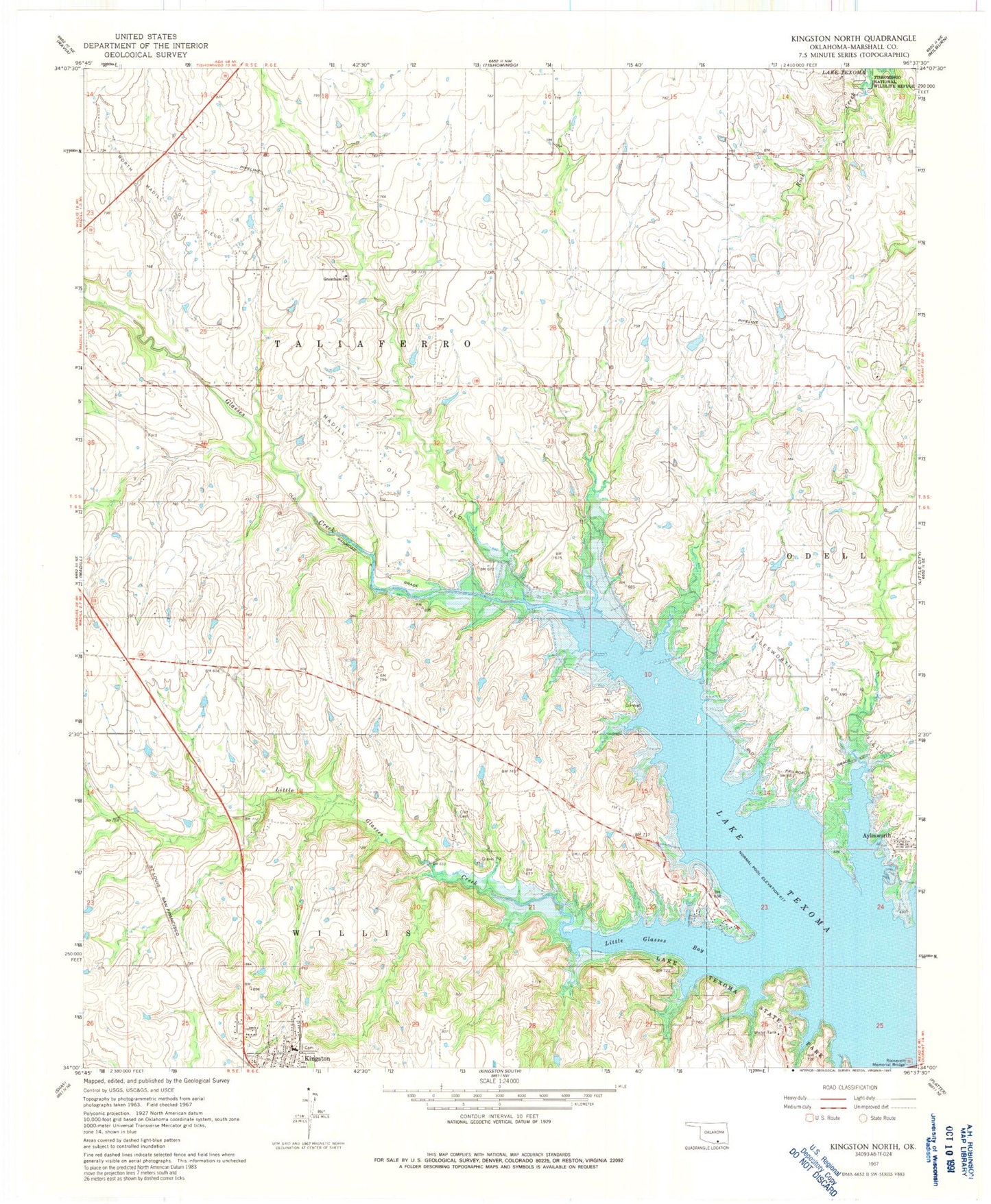
Classic USGS Kingston North Oklahoma 7.5'x7.5' Topo Map
Couldn't load pickup availability
Historical USGS topographic quad map of Kingston North in the state of Oklahoma. Map scale may vary for some years, but is generally around 1:24,000. Print size is approximately 24" x 27"
This quadrangle is in the following counties: Marshall.
The map contains contour lines, roads, rivers, towns, and lakes. Printed on high-quality waterproof paper with UV fade-resistant inks, and shipped rolled.
Contains the following named places: Aylesworth, Aylesworth Oil Field, Chickasaw Children's Village, Cliff Cemetery, Cushing Country Club Dam, Cushing Country Club Reservoir, Glasses Creek, Grantham Church, Kingston Cemetery, Kingston Elementary School, Kingston High School, Kingston Middle School, Little Glasses Bay, Little Glasses Creek, Madill Oil Field, Moore Burney Cemetery, North Madill Oil Field, Roosevelt Memorial Bridge, Town of Kingston