MyTopo
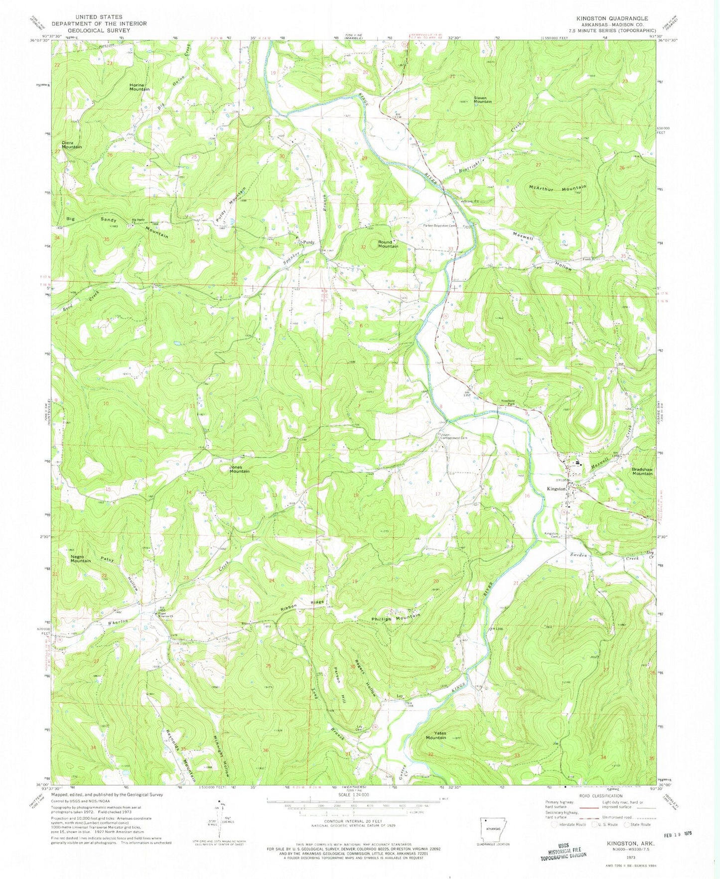
Classic USGS Kingston Arkansas 7.5'x7.5' Topo Map
Couldn't load pickup availability
Historical USGS topographic quad map of Kingston in the state of Arkansas. Map scale may vary for some years, but is generally around 1:24,000. Print size is approximately 24" x 27"
This quadrangle is in the following counties: Madison.
The map contains contour lines, roads, rivers, towns, and lakes. Printed on high-quality waterproof paper with UV fade-resistant inks, and shipped rolled.
Contains the following named places: Big Sandy Church, Big Sandy Church Cemetery, Big Sandy Mountain, Boatright Creek, Dry Creek, Gusses Creek, Horine Mountain, Jones Mountain, KFAY-FM (Huntsville), Kingston, Kingston Cemetery, Kingston Census Designated Place, Kingston Elementary School, Kingston Fire Department, Kingston High School, Kingston Post Office, Long Branch, Loy, Loy Cemetery, Maxwell Creek, Maxwell Hollow, McArthur Mountain, McKnight Hollow, Negro Mountain, Ozark Skies Airpark, Parker - Boydston Cemetery, Parson Hill, Patsy Hollow, Phillips Mountain, Purdy, Purdy Mountain, Reynolds Mountain, Ribbon Ridge, Rogers Hollow, Round Mountain, Slaven Mountain, Spanker Branch, Sweden Creek, Tate Hollow, Township of Kings River, Township of Marble, Township of Purdy, Township of Wharton, Township of Wharton Creek, Truth, Upper Campground Cemetery, Upper Wharton Church, Yates Mountain