MyTopo
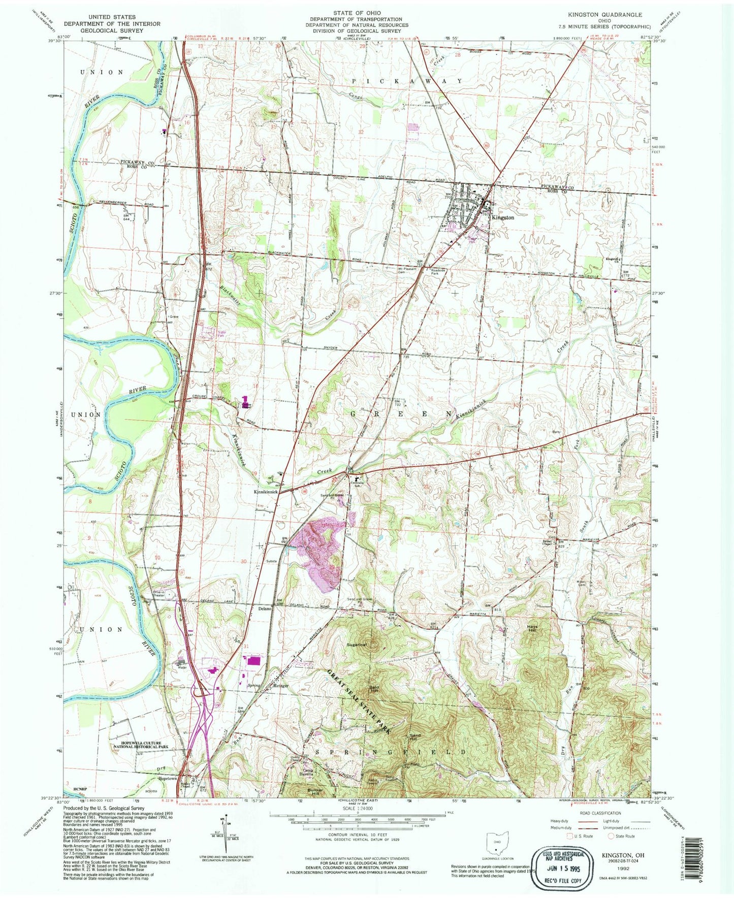
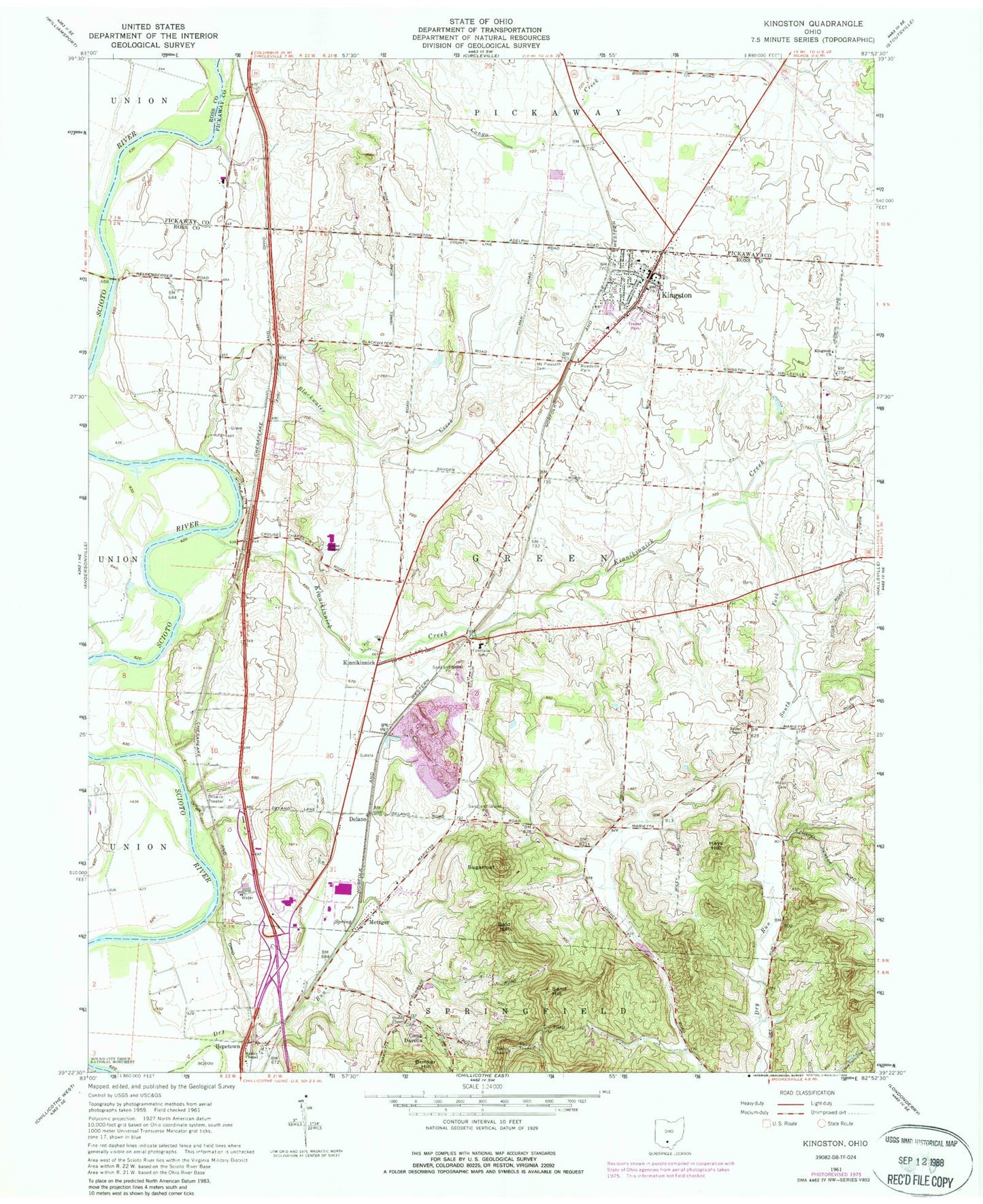
Classic USGS Kingston Ohio 7.5'x7.5' Topo Map
Couldn't load pickup availability
Historical USGS topographic quad map of Kingston in the state of Ohio. Typical map scale is 1:24,000, but may vary for certain years, if available. Print size: 24" x 27"
This quadrangle is in the following counties: Pickaway, Ross.
The map contains contour lines, roads, rivers, towns, and lakes. Printed on high-quality waterproof paper with UV fade-resistant inks, and shipped rolled.
Contains the following named places: Bald Hill, Bethel Chapel, Blackwater Creek, Camp Davella, Centralia School, Crouse Chapel, Kingston Church, Miller Cemetery, Overly Chapel, South Fork Kinnikinnick Creek, Wesley Chapel, Bunker Hill, Hays Hill, Metzger, Sand Hill, Courtright (historical), Kinnikinnick, Zane Trace Middle School, Delano, Hopetown, Kingston, Sugarloaf, Kinnikinnick Creek, Medical Center Hospital Heliport, WFCB-FM (Chillicothe), Township of Green, Bethel Cemetery, Crouse Chapel Cemetery, Hopetown Cemetery, Mount Pleasant Presbyterian Cemetery, Overly Chapel Cemetery, Hopetown Post Office (historical), Kinnikinnick Post Office (historical), Kingston Post Office, Village of Kingston, Adena Regional Medical Center, Springfield Township Volunteer Fire Department Station 3, Green Township Fire Department Station 2, Green Township Fire Department, Sabre Farms, Ohio State Highway Patrol - Chillicothe Patrol Post