MyTopo
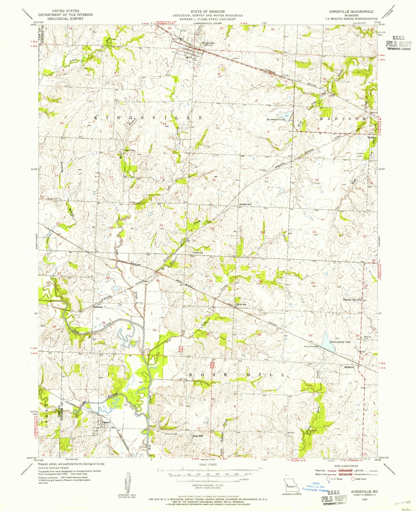
Classic USGS Kingsville Missouri 7.5'x7.5' Topo Map
Couldn't load pickup availability
Historical USGS topographic quad map of Kingsville in the state of Missouri. Map scale may vary for some years, but is generally around 1:24,000. Print size is approximately 24" x 27"
This quadrangle is in the following counties: Cass, Johnson.
The map contains contour lines, roads, rivers, towns, and lakes. Printed on high-quality waterproof paper with UV fade-resistant inks, and shipped rolled.
Contains the following named places: Camp Branch, City of Kingsville, Coon Creek, Duncan Cemetery, Duncan School, East Lost Creek, Eldridge Lake, Eldridge Lake Dam, Fender J H Airport, Fenwick, Gilbert Cemetery, Hartman Lake Dam, Holden Cemetery, Hornsby Branch, Hornsby Cemetery, Johnson County Fire Protection District 2 Station 1 Kingsville Headquarters, Johnson County Fire Protection District 2 Station 4 Rose Hill, Johnson E-24 Lake, Jurden School, Kestersen Lake, Kesterson Dam, Kingsville, Kingsville Consolidated Cemetery, Kingsville Elementary School, Kingsville High School, Kingsville Post Office, La Tour Census Designated Place, Latour, Latour School, Lenny Lake Dam, Lost Creek, McCannon Lake Dam, Medford, Medford Cemetery, Number 201 Reservoir, Olive Hill Post Office, Pleasant View School, Rock Island Lake, Rock Island Lake Dam, Rose Hill, Rose Hill Cemetery, Scaley Bark School, South Fork Blackwater River Watershed Dam E-24, Stout School, Township of Kingsville, Village of La Tour, West Branch Lost Creek