
MyTopo
Classic USGS Kinmundy Illinois 7.5'x7.5' Topo Map
Couldn't load pickup availability
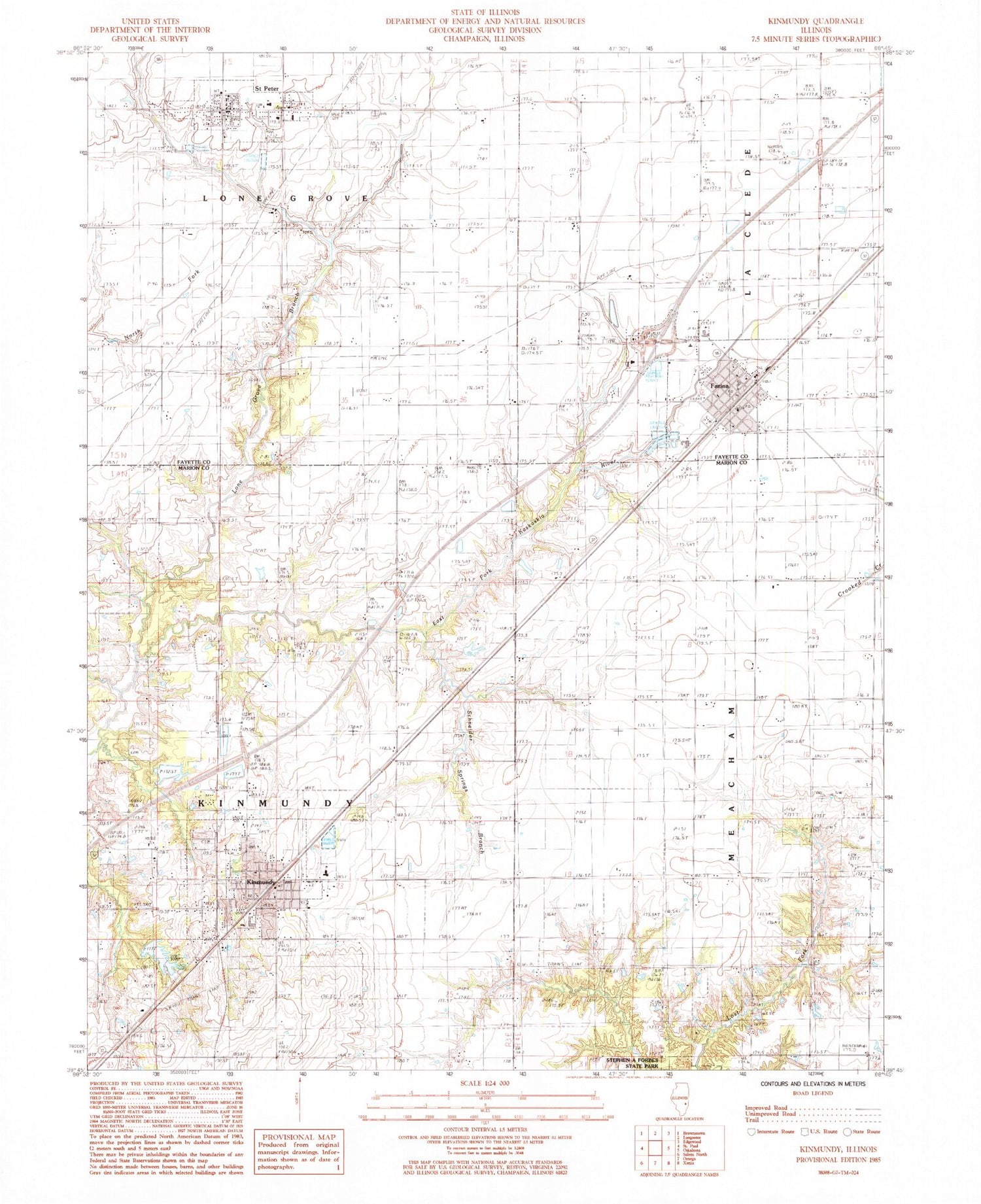
Historical USGS topographic quad map of Kinmundy in the state of Illinois. Map scale may vary for some years, but is generally around 1:24,000. Print size is approximately 24" x 27"
This quadrangle is in the following counties: Fayette, Marion.
The map contains contour lines, roads, rivers, towns, and lakes. Printed on high-quality waterproof paper with UV fade-resistant inks, and shipped rolled.
Contains the following named places: Ambuehl School, Booker School, City of Kinmundy, Cockrell Cemetery, Evergreen Cemetery, Farina, Farina Cemetery, Farina Fire Protection District, Farina Post Office, Farina Village Police Department, Farina Volunteer Ambulance Service, First Apostolic Church, Gray Cemetery, Kinmundy, Kinmundy Alma Fire District, Kinmundy First Methodist Church, Kinmundy Lake, Kinmundy Lake Dam, Kinmundy Post Office, Lacey School, Lone Grove Branch, Lone Grove School, Prairie Grove School, Rockhold School, Saint Elizabeth Ann Catholic Church, Saint Peter, Saint Peter Lutheran Cemetery, Saint Peter Lutheran Church, Saint Peter Post Office, Saint Peter Volunteer Fire Department, Schneider Springs Branch, Shanghai School, Sherman School, South Central Elementary School-Farina, South Central Elementary School-Kinmundy, South Central High School, South Central Middle School, Township of Kinmundy, Township of La Clede, Township of Lone Grove, Township of Meacham, Village of Farina, Village of Saint Peter, Wolf School, Young School, ZIP Code: 62854


