MyTopo
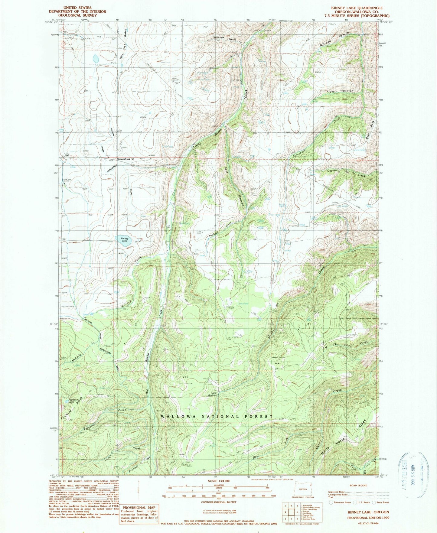
Classic USGS Kinney Lake Oregon 7.5'x7.5' Topo Map
Couldn't load pickup availability
Historical USGS topographic quad map of Kinney Lake in the state of Oregon. Map scale may vary for some years, but is generally around 1:24,000. Print size is approximately 24" x 27"
This quadrangle is in the following counties: Wallowa.
The map contains contour lines, roads, rivers, towns, and lakes. Printed on high-quality waterproof paper with UV fade-resistant inks, and shipped rolled.
Contains the following named places: Big Sheep Trail Stock Driveway, Canal Creek, Cats Back, Cold Springs, Craven Canyon, Divide Cow Camp, Divide Post Office, Ferguson Creek, Ferguson Recreation Site, Gorsline Gulch, Kinney Lake, McCully Creek, Mitchell Canyon, Mountain Sheep Dam, Owl Creek, Papoose Lake, Pleasant Center, Rail Canyon, Redmont Creek, Sheep Creek Hill Summit, Twobuck Creek, Wallowa Valley Improvement Canal, West Fork Carrol Creek, White Horse Ridge