MyTopo
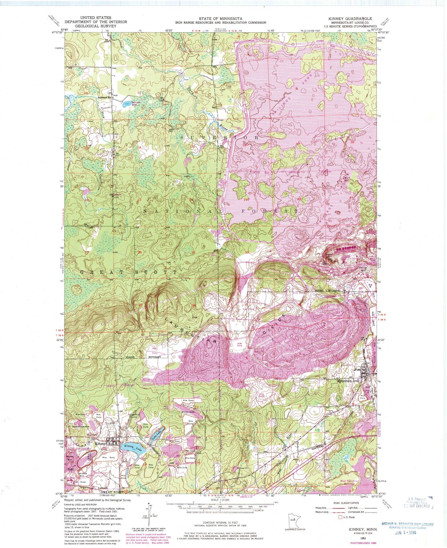
Classic USGS Kinney Minnesota 7.5'x7.5' Topo Map
Couldn't load pickup availability
Historical USGS topographic quad map of Kinney in the state of Minnesota. Map scale may vary for some years, but is generally around 1:24,000. Print size is approximately 24" x 27"
This quadrangle is in the following counties: St. Louis.
The map contains contour lines, roads, rivers, towns, and lakes. Printed on high-quality waterproof paper with UV fade-resistant inks, and shipped rolled.
Contains the following named places: Anderson School, Atkins Mine, City of Kinney, City of Mountain Iron, Forsyth Mine, Kinney, Kinney - Great Scott Fire Department Station 1, Kinney Lake, Kinney Police Department, Kinney Post Office, Kinney Public Library, Lucknow, McNiven Creek, Mesaba Quarry, Minntac Tailings Dike, Mott Mine, New Pilot Mine, Severson Lake, Seville-Midway Mine, Timber Creek, Township of Great Scott, Wanless Mine, Whiteside Mine, Yates Lake, ZIP Codes: 55713, 55758