MyTopo
Classic USGS Kinnikinick Lake Arizona 7.5'x7.5' Topo Map
Couldn't load pickup availability
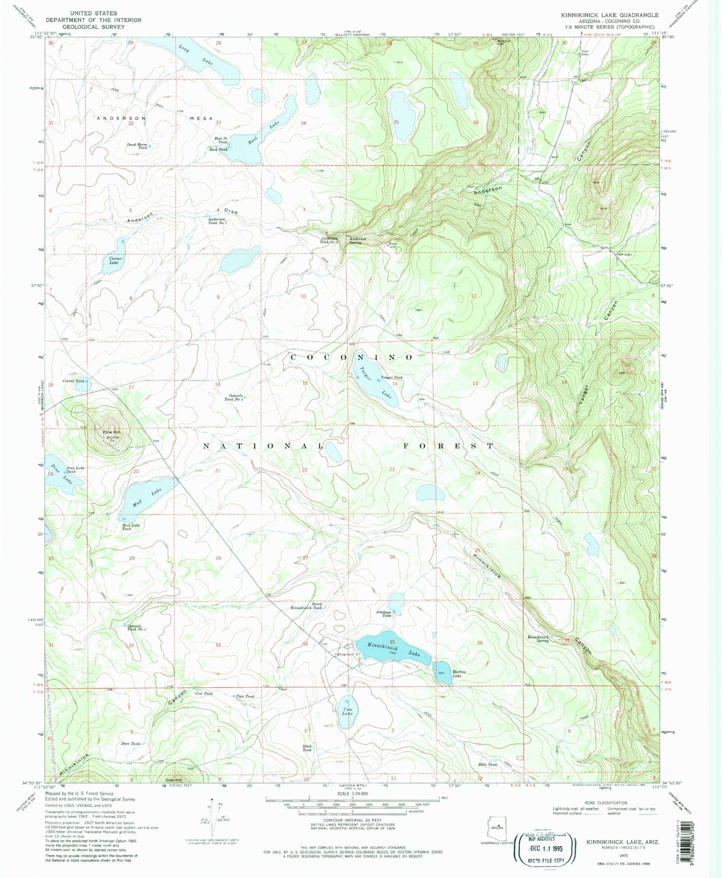
Historical USGS topographic quad map of Kinnikinick Lake in the state of Arizona. Typical map scale is 1:24,000, but may vary for certain years, if available. Print size: 24" x 27"
This quadrangle is in the following counties: Coconino.
The map contains contour lines, roads, rivers, towns, and lakes. Printed on high-quality waterproof paper with UV fade-resistant inks, and shipped rolled.
Contains the following named places: Anderson Draw, Anderson Spring, Anderson Tank Number One, Anderson Tank Number Two, Antelope Tank, Bills Tank, Boot Junior Tank, Boot Lake, Boot Tank, Corner Lake, Corral Tank, Cow Lake, Cow Tank, Dead Horse Tank, Ditch Tank, Dove Tank, Gonzalo Tank Number One, Gonzalo Tank Number Two, Kinnikinick Lake, Kinnikinick Spring, Long Lake, Morton Lake, Mud Lake, Mud Lake Tank, North Kinnikinick Tank, Pine Hill, Pine Lake, Pine Lake Tank, Tule Tank, Yaeger Lake, Yaeger Tank, Burro Spring, Kinnikinick Campground, Kinnikinick Dam, McDermit Lake, Morton Canyon Wash, Morton Dam, North Kinnikinick Tank, Raymond Tank, Yeager Number One Tank, Yeager Draw, D-Bart Tank, Diversion Dam, Antelope Lake, Antelope Tank, Pollino Tank, High N Dry Tank, Dry Lake Tank, Corner Tank, Unit East Tank, Upper Long Tank, Replacement Tank, Kinnikinick Lake Boat Launch