
MyTopo
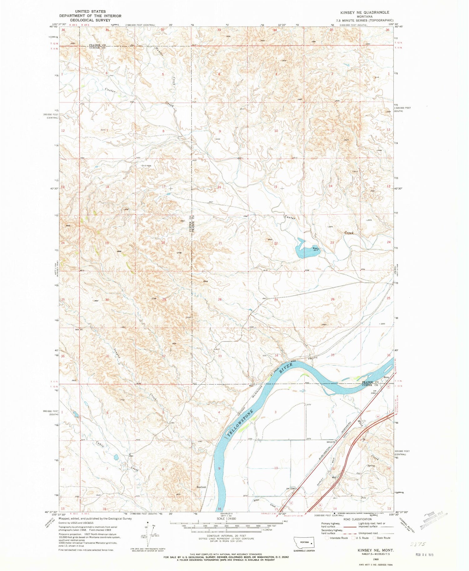
Classic USGS Kinsey NE Montana 7.5'x7.5' Topo Map
Regular price
$16.95
Regular price
Sale price
$16.95
Unit price
per
Couldn't load pickup availability
Historical USGS topographic quad map of Kinsey NE in the state of Montana. Map scale may vary for some years, but is generally around 1:24,000. Print size is approximately 24" x 27"
This quadrangle is in the following counties: Custer, Prairie.
The map contains contour lines, roads, rivers, towns, and lakes. Printed on high-quality waterproof paper with UV fade-resistant inks, and shipped rolled.
Contains the following named places: 10N49E01BAC_01 Well, 10N49E01CCAC01 Well, 10N49E05DBDC01 Well, 11N49E24ACCC01 Well, Benz, Bonfield, Bonfield Fishing Access Site, Custer Creek Dam, Devils Backbone, Haughian Number 12 Dam, Hunter Creek, Mack Creek, Saugus Creek, Shirley Main Canal, Williams Creek


