MyTopo
Classic USGS Kinsey Montana 7.5'x7.5' Topo Map
Couldn't load pickup availability
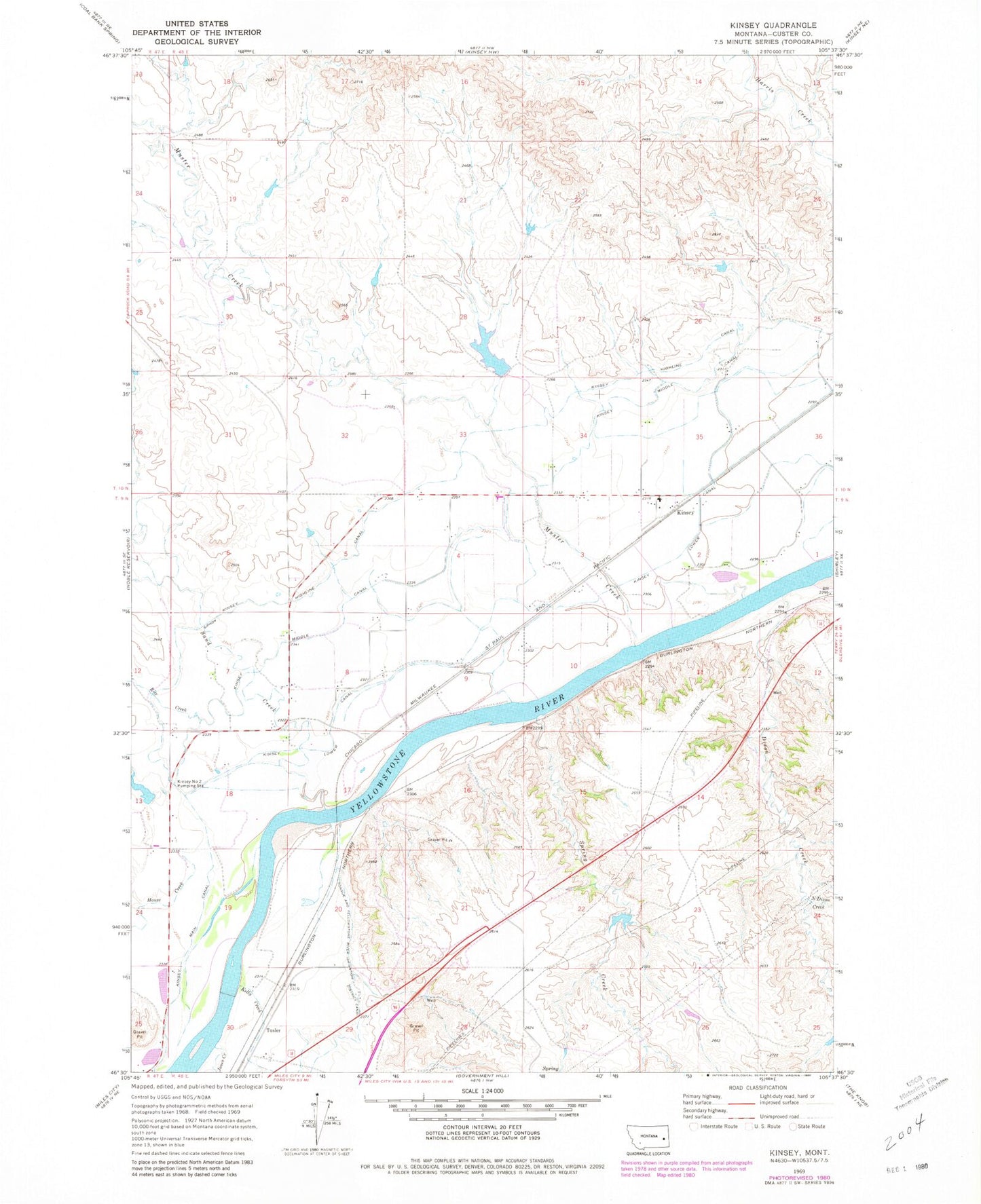
Historical USGS topographic quad map of Kinsey in the state of Montana. Map scale may vary for some years, but is generally around 1:24,000. Print size is approximately 24" x 27"
This quadrangle is in the following counties: Custer.
The map contains contour lines, roads, rivers, towns, and lakes. Printed on high-quality waterproof paper with UV fade-resistant inks, and shipped rolled.
Contains the following named places: 09N48E01CBBC01 Well, 09N48E01CBCD01 Well, 09N48E02BABA01 Well, 09N48E02BABA02 Well, 09N48E02BBAD01 Well, 09N48E04BBBA01 Well, 09N48E07CABA01 Well, 09N48E08CDC_01 Well, 09N48E09BDDA01 Well, 09N48E18AAAD01 Well, 09N48E18CBC_01 Well, 09N48E18CBCC01 Well, 09N48E18CCCB01 Well, 10N48E25DBCC01 Well, 10N48E26DCDD01 Well, 10N48E32ADAB01 Well, 10N48E36ABBA01 Well, 10N48E36CDCB01 Well, 10N48E36DBCD01 Well, Buffalo Rapids, Canyon Springs, Custer County Rural Volunteer Fire Company Kinsey, Diamond Number 1 Dam, Dickson Post Office, Dixon Creek, Dixons Rapids, House Creek, Jones Creek, Kelly Creek, Kinsey, Kinsey Association of Churches Protestant Community Church, Kinsey Bridge, Kinsey Bridge Fishing Access Site, Kinsey Highline Canal, Kinsey Lower Canal, Kinsey Main Canal, Kinsey Middle Canal, Kinsey Number 2 Pumping Station, Kinsey Post Office, Kinsey School, Muster Creek, North Dixon Creek, Owens, Rice Creek, Sand Creek, Spring Creek, Stiles Number 1 Dam, Tree Creek, Tusler, Tusler Post Office, Watts Number 1 Dam