MyTopo
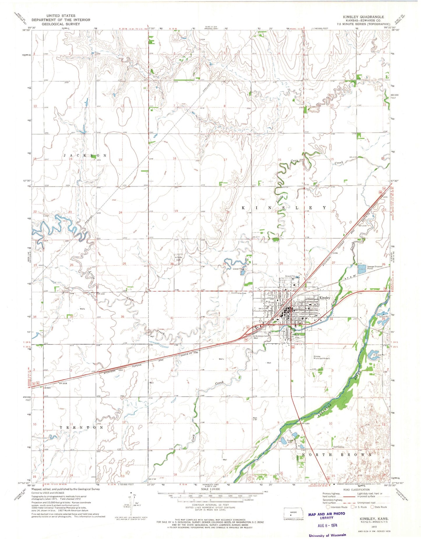
Classic USGS Kinsley Kansas 7.5'x7.5' Topo Map
Couldn't load pickup availability
Historical USGS topographic quad map of Kinsley in the state of Kansas. Map scale may vary for some years, but is generally around 1:24,000. Print size is approximately 24" x 27"
This quadrangle is in the following counties: Edwards.
The map contains contour lines, roads, rivers, towns, and lakes. Printed on high-quality waterproof paper with UV fade-resistant inks, and shipped rolled.
Contains the following named places: Allison Memorial Community and Youth Center, Ardell, City of Kinsley, Congregational United Church of Christ, Crossroads Victory Lighthouse Assembly of God Church, Edwards County Chamber of Commerce, Edwards County Courthouse, Edwards County Fairgrounds, Edwards County Health Department, Edwards County Historical Society Museum, Edwards County Jail, Edwards County Medical Center, Edwards County Sheriff's Office, First Christian Church, Four Aces Recreational Vehicle Park, Hillside Cemetery, Kinsley, Kinsley City Hall, Kinsley Country Club, Kinsley Fire Department, Kinsley Junior / Senior High School, Kinsley Library, Kinsley Municipal Airport, Kinsley Police Department, Kinsley Post Office, Kinsley Senior High School, Kinsley United Methodist Church, Kinsley Wastewater Plant, Little Coon Creek, Old Kinsley Cemetery, Our Redeemer Lutheran Church, Saint Nicholas Catholic Church, Saint Nicholas Cemetery, Saint Nicholas Elementary School, The Palace Theatre, The Pink Building, Township of Kinsley, ZIP Code: 67547