MyTopo
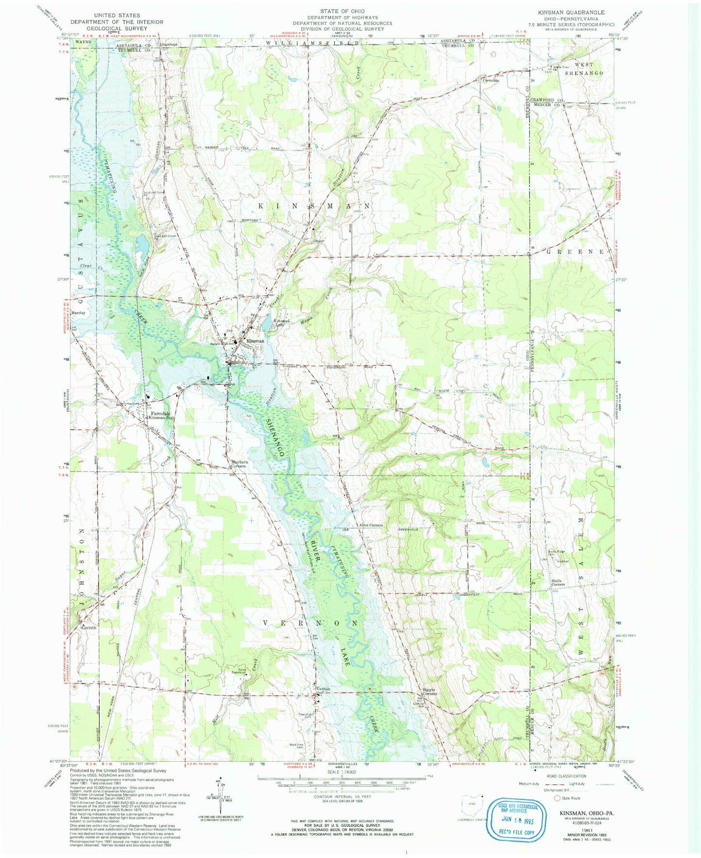
Classic USGS Kinsman Ohio 7.5'x7.5' Topo Map
Couldn't load pickup availability
Historical USGS topographic quad map of Kinsman in the states of Ohio, Pennsylvania. Map scale may vary for some years, but is generally around 1:24,000. Print size is approximately 24" x 27"
This quadrangle is in the following counties: Ashtabula, Crawford, Mercer, Trumbull.
The map contains contour lines, roads, rivers, towns, and lakes. Printed on high-quality waterproof paper with UV fade-resistant inks, and shipped rolled.
Contains the following named places: Allen Corners, Badger High School, Biggin Corners, Burghill Vernon Fire Department Station 19, Camp Sugarbush, Carr Farms, Clear Creek, Corinth, Corinth Post Office, Cornelian Post Office, Cornelion, Dewey, Dewey Post Office, Farmdale, Farmdale Post Office, Giddings Cemetery, Kinsman, Kinsman Center Census Designated Place, Kinsman Lake, Kinsman Post Office, Kinsman Presbyterian Church, Kinsman United Methodist Church, Kinsman Volunteer Fire Department, Maple Creek, Mayburn Corners, Mill Creek, Naturally Yours Farm, New Kinsman Cemetery, Pioneer Cemetery, Rock Ridge Cemetery, Saint Patricks Catholic Church, Sheets Field Airport, Stanhope, Stanhope Post Office, State Line Cemetery, State Line Church, Stratton Creek, Stulls Corners, Sugar Creek, Superior, Superior Post Office, Township of Kinsman, Township of Vernon, Valley View Farms, Vernon, Vernon United Methodist Church, West View Cemetery, ZIP Code: 44428