MyTopo
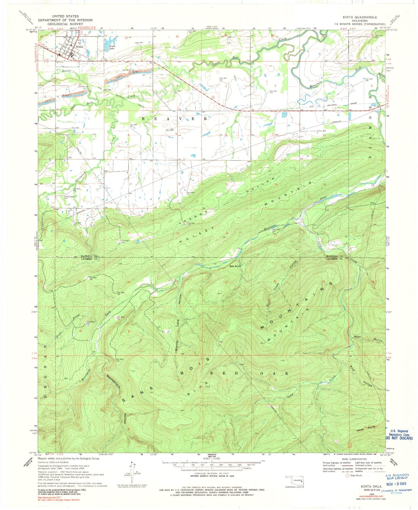
Classic USGS Kinta Oklahoma 7.5'x7.5' Topo Map
Couldn't load pickup availability
Historical USGS topographic quad map of Kinta in the state of Oklahoma. Map scale may vary for some years, but is generally around 1:24,000. Print size is approximately 24" x 27"
This quadrangle is in the following counties: Haskell, Latimer.
The map contains contour lines, roads, rivers, towns, and lakes. Printed on high-quality waterproof paper with UV fade-resistant inks, and shipped rolled.
Contains the following named places: Andrew Creek, Bear Gulch, Beaver Creek, Bee Bluff, Bird Hollow, Blue Mountain, Camp Creek, Chickasaw Creek, Dry Creek Hollow, Grassy Lake Hollow, Hulsey Mountain, Kinta, Kinta Elementary School, Kinta Fire Department, Kinta High School, Kinta Lake, Kinta Lake Dam, Kinta Post Office, Mountain Fork, Right Prong Mountain Fork, Sans Bois Mountains, Shady Grove Cemetery, Smokestack Hollow, Town of Kinta, Township of Beaver, Turkey Creek, Twentynine Hollow, Vaughn Hollow, White Rocks, ZIP Code: 74552