MyTopo
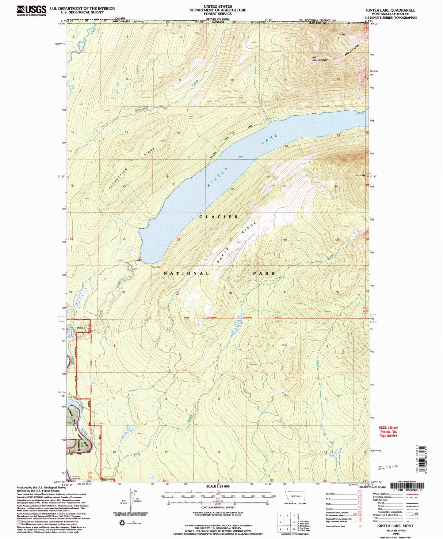
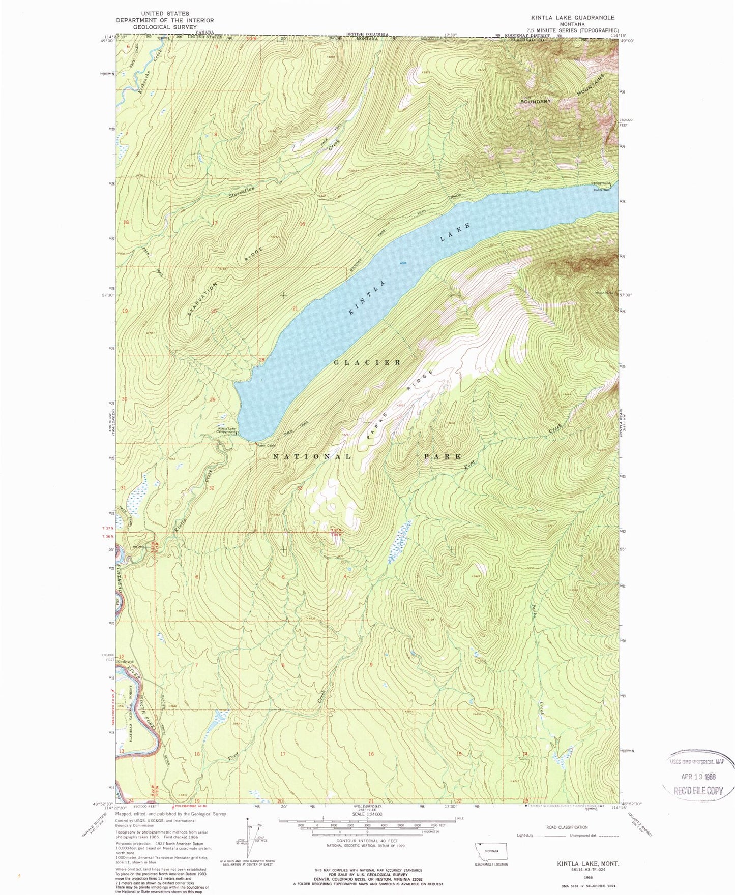
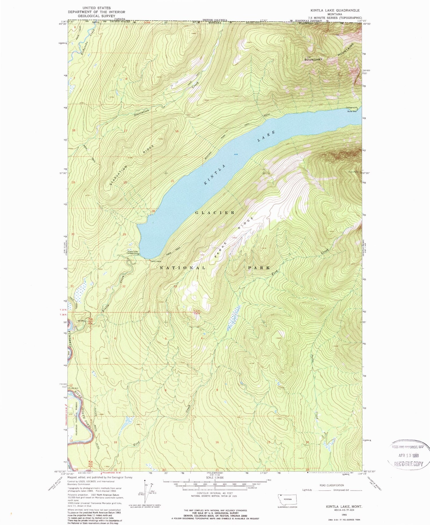
Classic USGS Kintla Lake Montana 7.5'x7.5' Topo Map
Regular price
$16.95
Regular price
Sale price
$16.95
Unit price
per
Couldn't load pickup availability
Historical USGS topographic quad map of Kintla Lake in the state of Montana. Map scale may vary for some years, but is generally around 1:24,000. Print size is approximately 24" x 27"
This quadrangle is in the following counties: Flathead.
The map contains contour lines, roads, rivers, towns, and lakes. Printed on high-quality waterproof paper with UV fade-resistant inks, and shipped rolled.
Contains the following named places: 37N21W29DDC_01 Well, Butte Well, Ford River Access, Kintla Creek, Kintla Lake, Kintla Lake Campground, Parke Ridge, Starvation Ridge, Tepee Creek