MyTopo
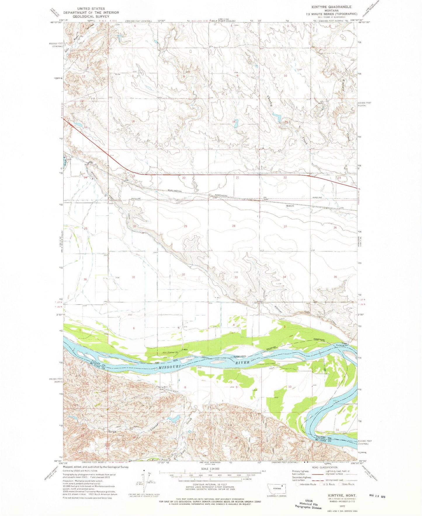
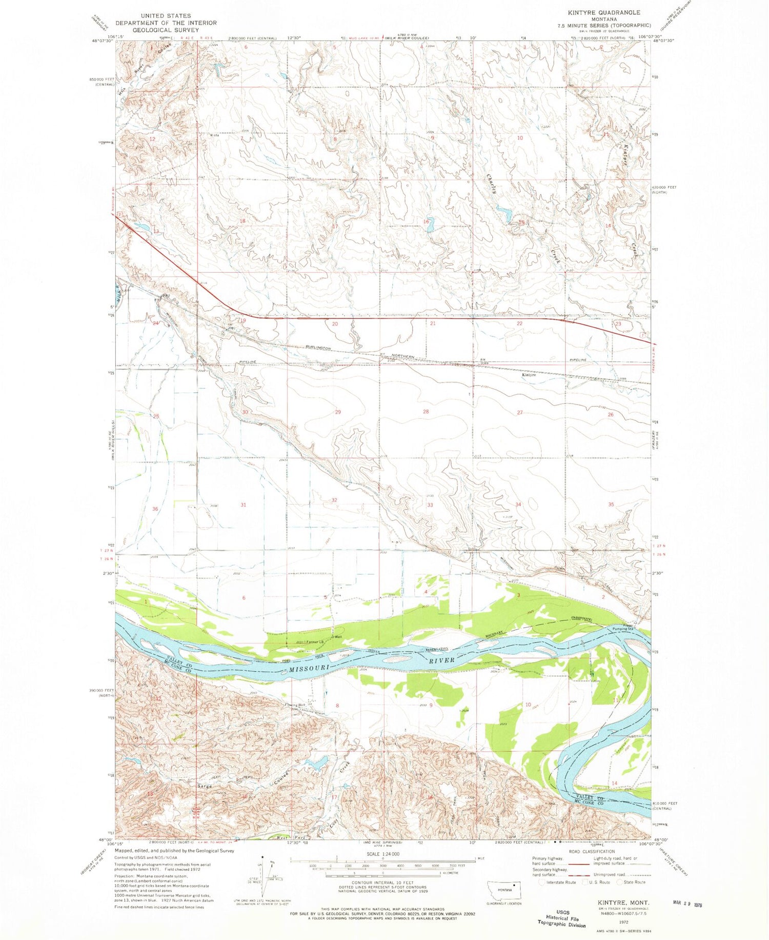
Classic USGS Kintyre Montana 7.5'x7.5' Topo Map
Couldn't load pickup availability
Historical USGS topographic quad map of Kintyre in the state of Montana. Map scale may vary for some years, but is generally around 1:24,000. Print size is approximately 24" x 27"
This quadrangle is in the following counties: McCone, Valley.
The map contains contour lines, roads, rivers, towns, and lakes. Printed on high-quality waterproof paper with UV fade-resistant inks, and shipped rolled.
Contains the following named places: 26N42E01AA__01 Well, 26N43E03BD__01 Well, 26N43E04AA__01 Well, 26N43E04AC__01 Well, 26N43E04AD__01 Well, 26N43E04AD__02 Well, 26N43E05AC__01 Well, 26N43E05CAAB01 Well, 26N43E05DB__01 Well, 26N43E06AC__01 Well, 26N43E06AC__02 Well, 26N43E06BD__01 Well, 26N43E08CBAB01 Well, 26N43E09BACD01 Well, 26N43E09BD__01 Well, 26N43E09CA__01 Well, 26N43E10BB__01 Well, 26N43E10CC__01 Well, 26N43E12BA__01 Well, 27N42E24CA__01 Well, 27N42E25AB__01 Well, 27N42E25BA__01 Well, 27N42E25CD__01 Well, 27N42E25DC__01 Well, 27N42E36BA__01 Well, 27N42E36CD__01 Well, 27N42E36DA__01 Well, 27N43E22BD__01 Well, 27N43E23CB__01 Well, 27N43E23DA__01 Well, 27N43E23DA__02 Well, 27N43E26BB__01 Well, 27N43E28AA__01 Well, 27N43E31BB__01 Well, 27N43E32BB__01 Well, 27N43E32CB__01 Well, 27N43E33CC__01 Well, 27N43E34AD__01 Well, 27N43E34BA__01 Well, Fort Dauphin, Frazer Pumping Station, Heifer Pen Dam, Kintyre, Lost Creek, Missouri Pump Canal, Sarge Coulee, West Fork Lost Creek