
MyTopo
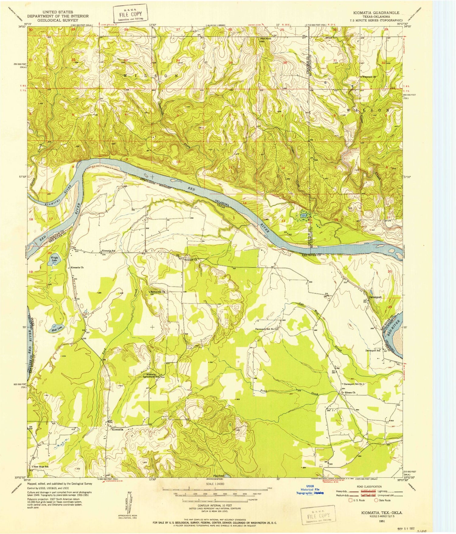
Classic USGS Kiomatia Texas 7.5'x7.5' Topo Map
Couldn't load pickup availability
Historical USGS topographic quad map of Kiomatia in the states of Texas, Oklahoma. Map scale may vary for some years, but is generally around 1:24,000. Print size is approximately 24" x 27"
This quadrangle is in the following counties: Choctaw, McCurtain, Red River.
The map contains contour lines, roads, rivers, towns, and lakes. Printed on high-quality waterproof paper with UV fade-resistant inks, and shipped rolled.
Contains the following named places: Bartonville Church, Cedar Creek, Davenport, Davenport School, Davenport School Number 1, Davenport School Number 2, Doaksville Creek, Ford Creek, Gates Creek, Kiamichi River, Kiomatia, Kiomatia Agricultural School, Kiomatia Church, Kiomatia School, Mud Lake, New Hope School, Pilot Knob, Riverside Church, Siloam Church, Watermill Church, Wright Lake


