MyTopo
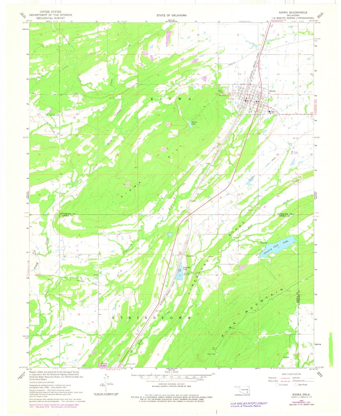
Classic USGS Kiowa Oklahoma 7.5'x7.5' Topo Map
Couldn't load pickup availability
Historical USGS topographic quad map of Kiowa in the state of Oklahoma. Map scale may vary for some years, but is generally around 1:24,000. Print size is approximately 24" x 27"
This quadrangle is in the following counties: Atoka, Pittsburg.
The map contains contour lines, roads, rivers, towns, and lakes. Printed on high-quality waterproof paper with UV fade-resistant inks, and shipped rolled.
Contains the following named places: Birch Creek, Country Club Lake, Country Club Lake Dam, Fivemile Creek, Harpers Valley Cemetery, Harpers Valley Church, Kiowa, Kiowa City Cemetery, Kiowa Elementary School, Kiowa High School, Kiowa Hill, Kiowa Lake, Kiowa Lake Dam, Kiowa Police Department, Kiowa Post Office, Kiowa Volunteer Fire Department, Kiowa-Pittsburg Division, Pine Mountain, Reynolds, Reynolds Lake, Rock Creek Site 14 Dam, Rock Creek Site 14 Reservoir, Sassafras Creek, Tanner Creek, Town of Kiowa, Township of Kiowa, Wards Cemetery, ZIP Code: 74553