MyTopo
Classic USGS Kipukapakekake Hawaii 7.5'x7.5' Topo Map
Regular price
$16.95
Regular price
Sale price
$16.95
Unit price
per
Couldn't load pickup availability
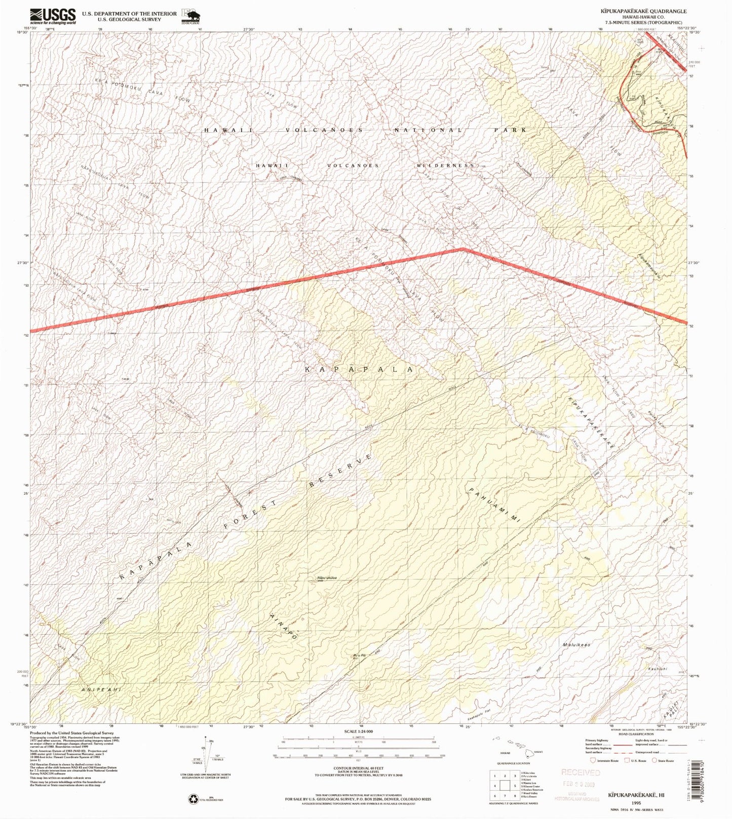
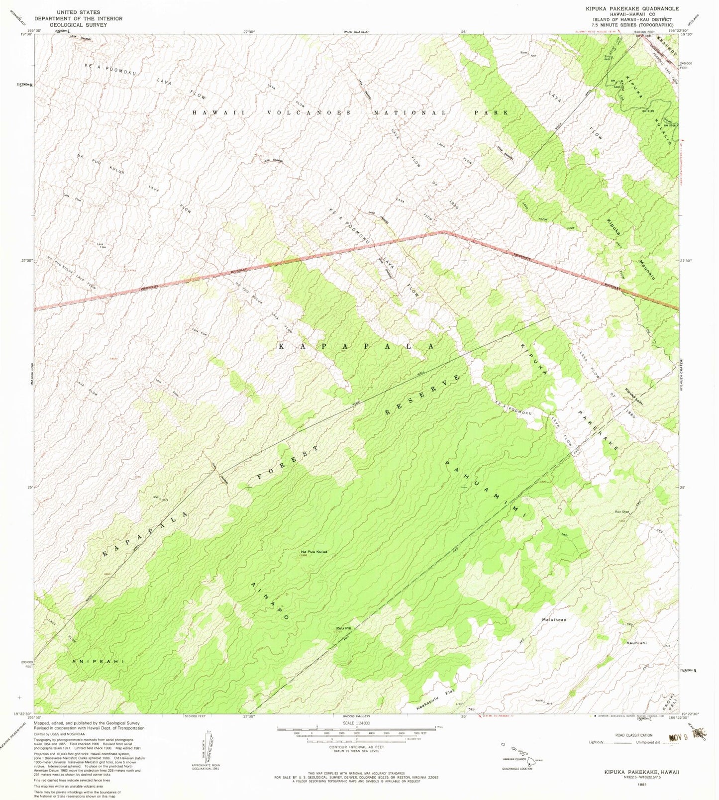
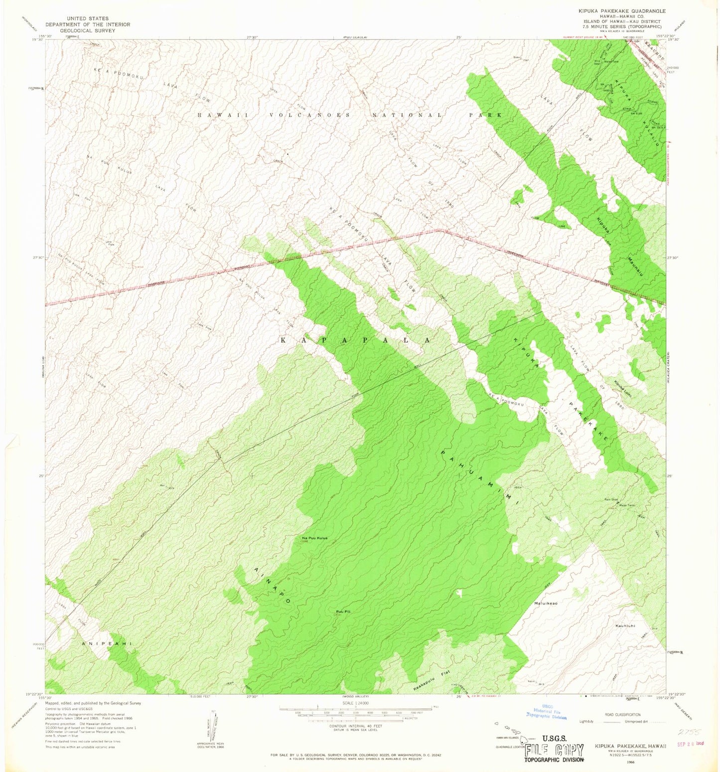
Historical USGS topographic quad map of Kipukapakekake in the state of Hawaii. Map scale may vary for some years, but is generally around 1:24,000. Print size is approximately 24" x 27"
This quadrangle is in the following counties: Hawaii.
The map contains contour lines, roads, rivers, towns, and lakes. Printed on high-quality waterproof paper with UV fade-resistant inks, and shipped rolled.
Contains the following named places: Ainapo, Kauhiuhi, Ke A Po'omuku Lava Flow, Kipukalo'ihi, Kipukamauna'iu, Kipukapakekake, Lava Flow of 1880, Maluikeao, Napu'ukulua, Napu'ukulua Lava Flow, Pahuamimi, Pu'upili, ZIP Code: 96785