
MyTopo
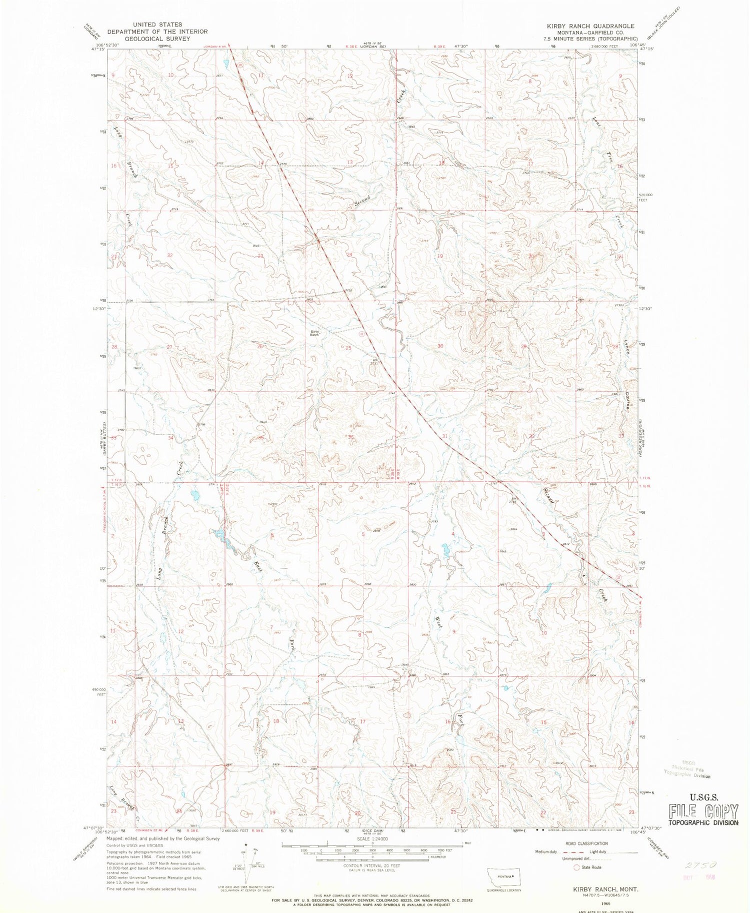
Classic USGS Kirby Ranch Montana 7.5'x7.5' Topo Map
Regular price
$16.95
Regular price
Sale price
$16.95
Unit price
per
Couldn't load pickup availability
Historical USGS topographic quad map of Kirby Ranch in the state of Montana. Map scale may vary for some years, but is generally around 1:24,000. Print size is approximately 24" x 27"
This quadrangle is in the following counties: Garfield.
The map contains contour lines, roads, rivers, towns, and lakes. Printed on high-quality waterproof paper with UV fade-resistant inks, and shipped rolled.
Contains the following named places: 16N38E24DBDA01 Well, 16N39E18BDBD01 Well, 17N38E25B___01 Well, 17N38E35BDAD01 Well, 17N39E18B___01 Well, Claribell Number 2 Dam, East Fork Long Branch Creek, Kirby Ranch, Lynch Coulee, Uthaug Livestock Dam, West Fork Second Creek


